There is an old saying in our country: “Sve planine na jednu, Prokletije na drugu stranu”. It means: “All mountains on one side, Prokletije on the other“.
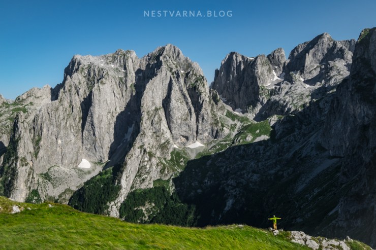
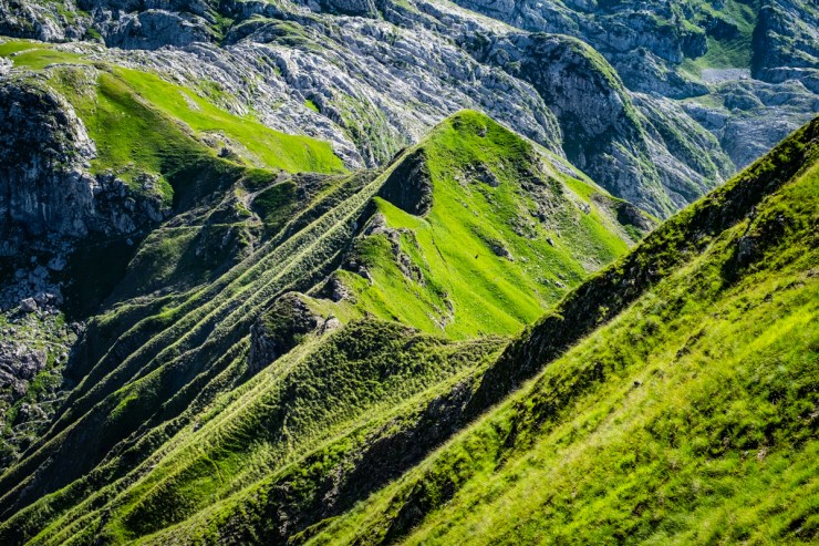
The saying is surprisingly true. Prokletije are special. They are vast and overwhelming. The legacy of the last ice age glaciers combined with unique geological structure made Prokletije extremely rich in dramatic forms of karst landscape: glacier valleys, rugged cliffs, huge vertical walls.
Prokletije in Serbian-Croatian or Bjeshket e Nemuna in Albanian: both mean the same, Accursed mountains.
Some say that only Julian Alps match Prokletije in size and beauty in the former country.
But unlike the Alps, there are no mountain huts within Prokletije. Number of visitors is still small. Prokletije is probably the last bastion of true intact wilderness on the continent.
Main reason for this lies in the recent past of the region. In the period after WWII (1945-2005) Prokletije made part of the well secured border between self-isolated Albania and more liberal, yet almost equally paranoid Socialist Federal Republic of Yugoslavia. it was a military restricted area on highest level, a zero tolerance guarded zone with armed outposts on both sides.
No civilians were allowed to enter this zone except local shepherds. Only a few mountaineers with special permits had a privilege to access the massif from the Yugoslavian (Montenegrin) side. One of them was Branko Kotlajić, a true pioneer explorer of Prokletije and a first person to officially climb some of its iconic peaks in the late 1950s.
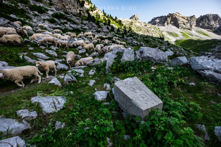
Finally, in the last two decades tensions lightened and bans on free movement over the green line were finally lifted. Nature lovers from all over Europe started to discover Prokletije. Tourist facilities in the valleys slowly started to develop but have remained low-key up-to-this-date. Up in the mountain, there are almost no signs of human presence. Several ruines at strategic spots are the only exception: these are old army barracks transformed into improvised shepherds refuges.
Preserved authentic character of the mountain is that key ingredient that brings true outdoor enthusiasts here. Prokletije are off the mainstream and will hopefully stay so.

But be aware, in Prokletije you are all alone and depending only on yourself.
It is still a remote border area. Terrain is very tough, weather conditions change very fast, fresh water is scarce in the karst landscape. Not all hiking trails of interest are marked: GPS device with confident tracks belongs to essential gear in Prokletije.
Instead of a potentially dangerous self-navigating challenge, less experienced hikers are advised to hire an experienced local guide and join organized groups.

Essential Prokletije “101” journey starts in valleys of Grbaja or Ropojana (Vusanje) in the north-eastern corner of Montenegro (municipality of Gusinje). Both valleys are at altitude of 1100m above sea level only, while surrounding peaks reach 2500m. This means that nothing comes for granted in Prokletije: to be on top of the mountain, a vertical kilometer is to be accomplished first, wherever you decide to go.
Here is the time-line for an epic-three-days-experience on the Montenegro side of the mountain range.
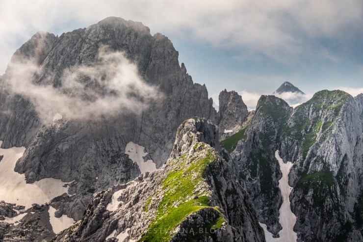
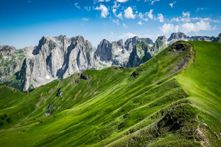
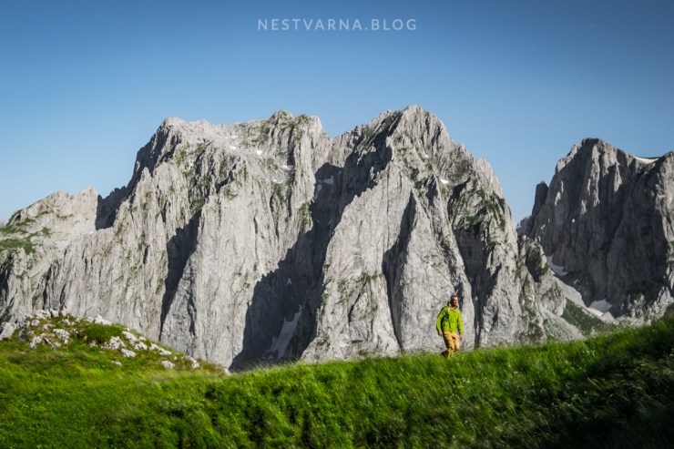
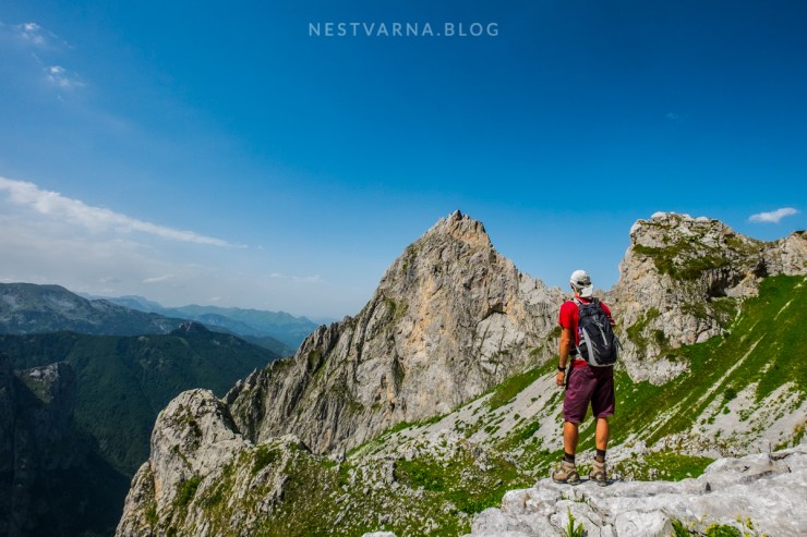
Day One: A divine combination of grey alpine peaks and green meadows of Montenegro: magnificient views over Karanfili from the ridge of Popadija and Valušnica.
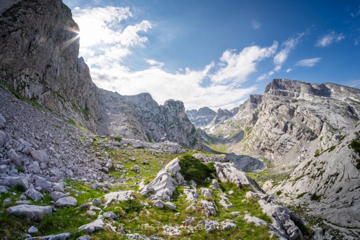
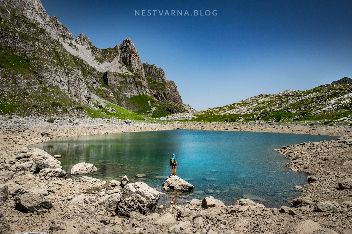
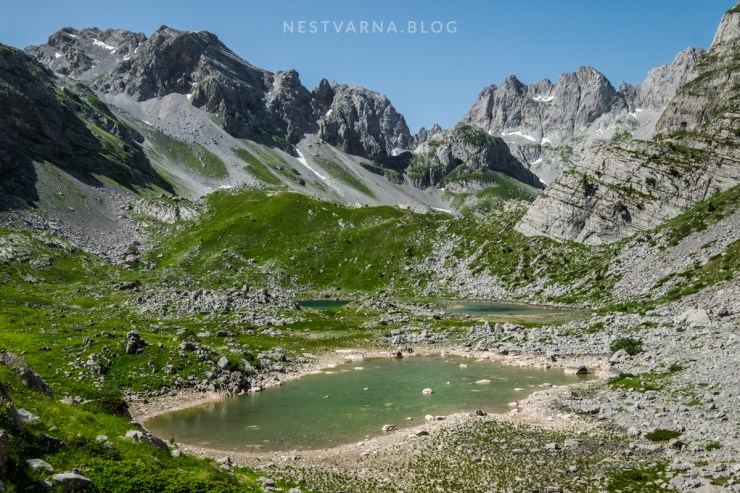
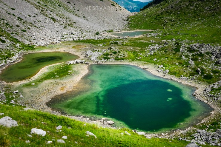
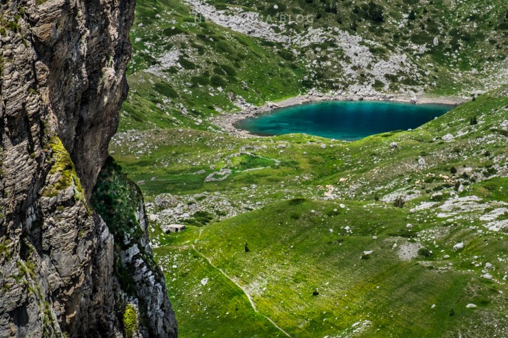
Day Two: Buni i Jezerces – The valley of the lakes: Glacier amphitheater of six periodical lakes below Prokletije’s highest peaks – Spectacular intact nature in the last backyard of Albania.
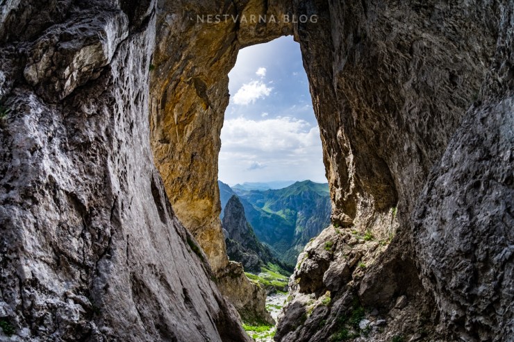
Day three: A Classic! Climb to Prokletije’s most iconic peak: Severni vrh (The north peak of Karanfili) and circular tour through Šuplja vrata

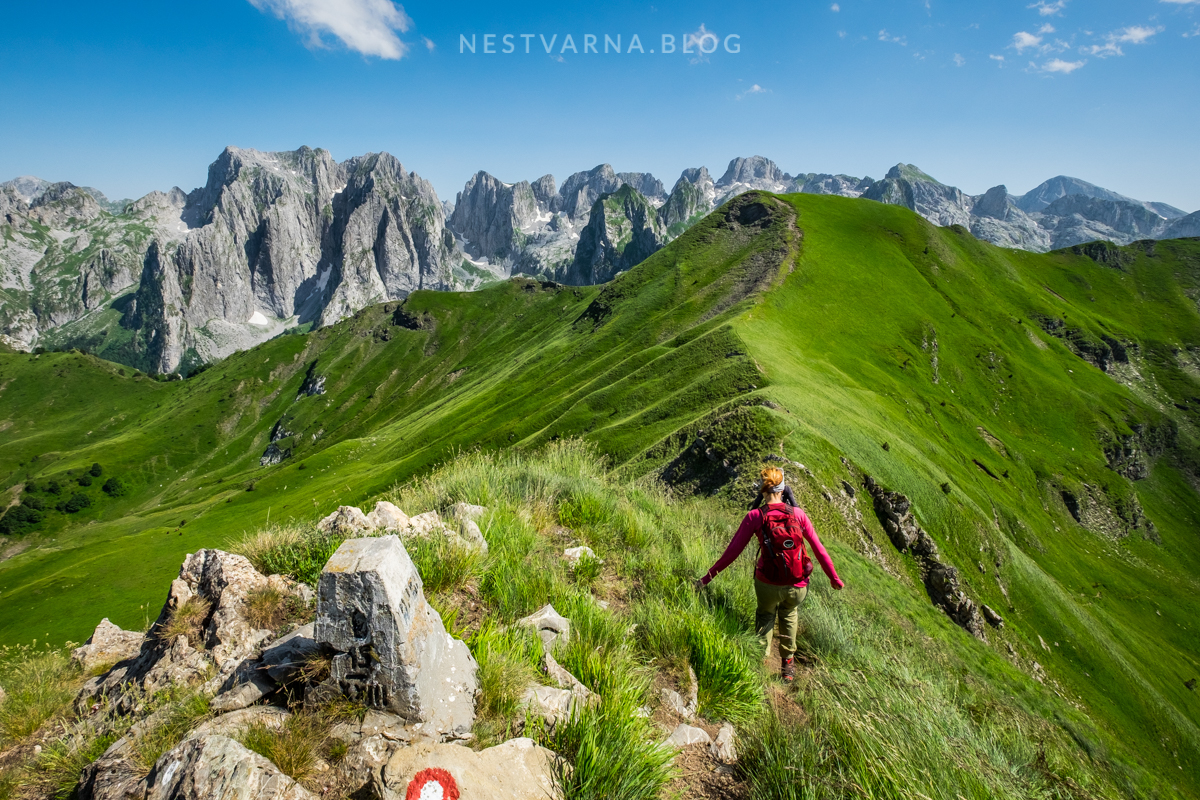
Day 1: Grbaja – Talijanka – Popadija – Volušnica (Maja Can) – Grbaja.
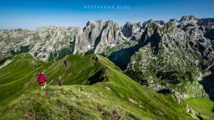
Even if you have no intention to climb Prokletije’s rough limestone peaks, just walking over the green carpet ridge of Popadija with its amazing views is a sight for sore eyes.
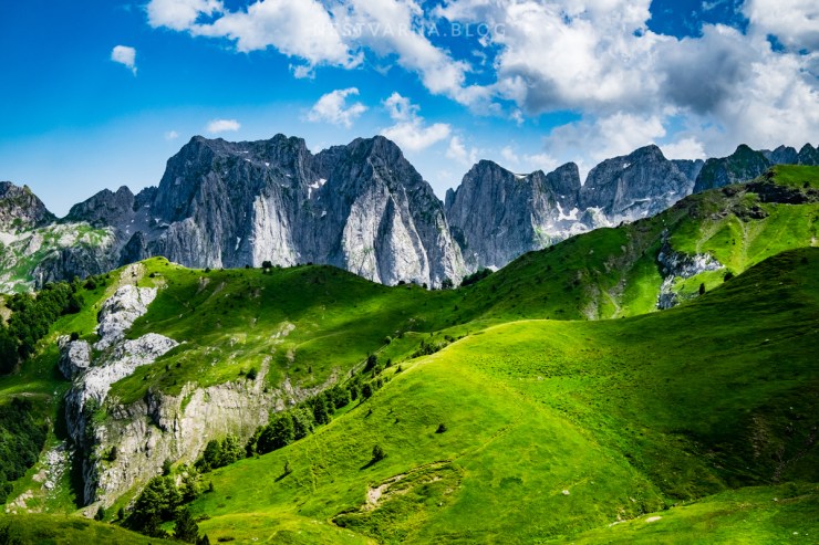
Alpine valleys are many, Grbaja is unique in one thing: It is extremely narrow and asymmetric. From one side stands the huge stone wall of Karanfili and from other side totally different scenario – lush green meadows of Popadija.
Best period for visit is end of June: springtime is blooming in the mountains. Best hour to be on top for perfect light is late afternoon.

The trail from Grbaja is marked, quite logical and circular (after the initial climb through the forest). I recommend to go counter-clockwise: first climb Talijanka and then continue along the ridge to Popadija and finally reach Volušnica (Albanian Maja Can). The whole track is 12km long with 1000m elevation gain.

Day 2: Ropojana – Karaula Zastan – Buni Jezerces – Qafa Jezerce and back.
If you are based in Grbaja a short transfer to valley of Ropojana is necessary (it takes around 30 minutes).
Old military road towards the valley departs from the last village in Montenegro Vusanje (Vutaj) – it is in bad condition especially after passing the beautiful river springs Oko skakavice (Savino oko).
The road goes all the way up to the former barracks Karaula Zastan (1340m) but its not passable by a vehicle. It is boring yet inevitable section to hike.
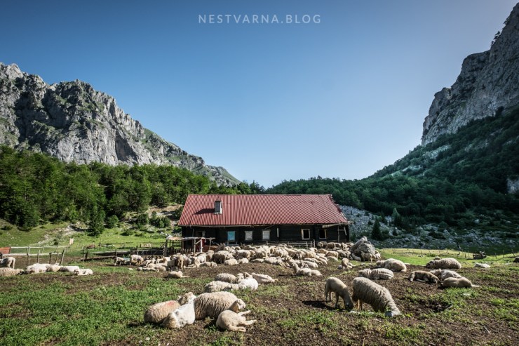
There is a fresh water spring near the barracks.
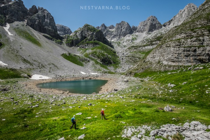
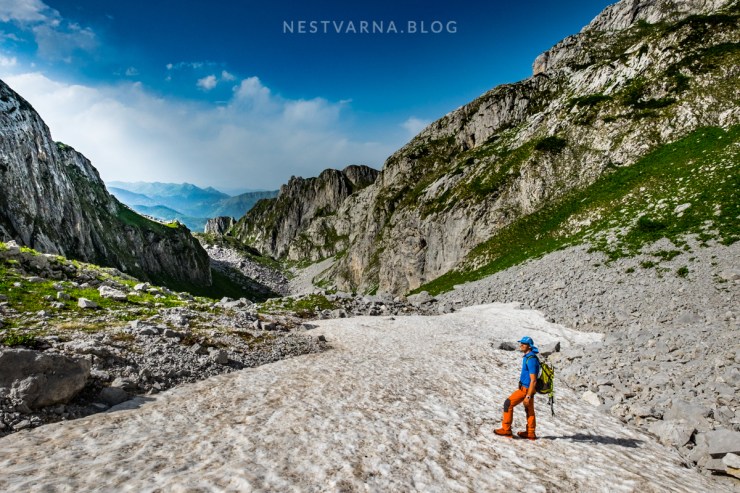
There is a visible marked trail from here that goes to the highest summit Maja Jezerce passing the “Valley of the lakes” (Buni Jezerces).
To reach the valley at 1800m, a steep climb through the forest is to be passed. As soon as you come out of the forest you enter Albania. Old border mark is still visible.
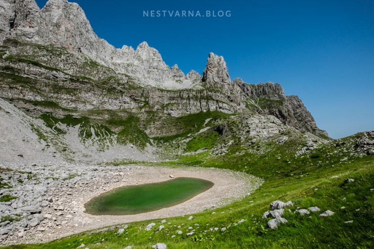
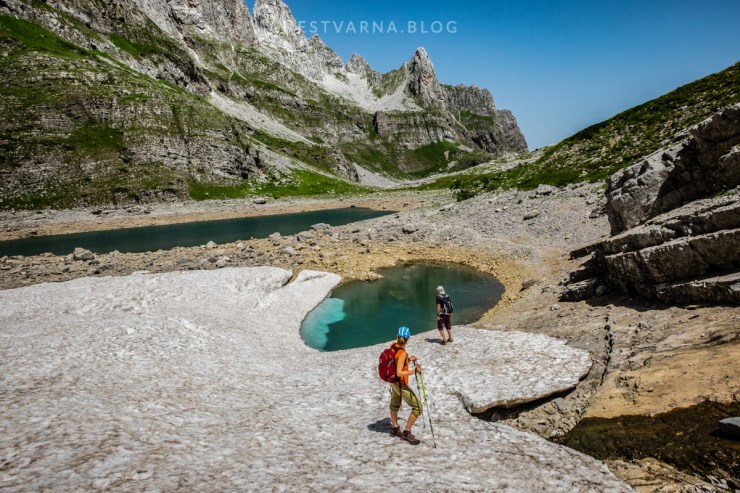
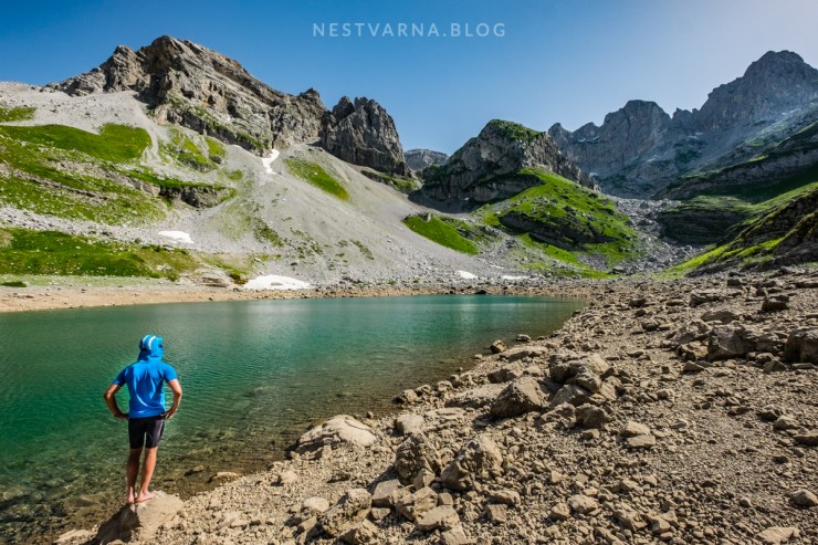
Seasonal lakes soon appear in the glacier valley. The water from the lakes will slowly disappear over the warm summer months.
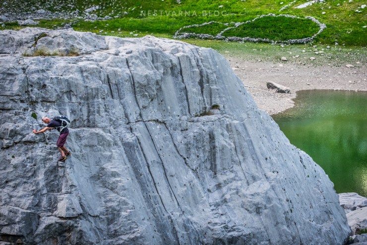
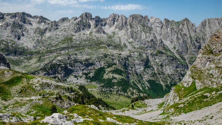
For a better perspective of Prokletije highest peaks, we followed the junction trail that goes toward the Jezerce pass (Qafa Jezerce) situated below Maja Bojs peak. This is actually the path connecting the highest summit to Maja Jazerce from the valley of Theth in Albania via Runica valley (Fushe Runice) and Pećki prevoj (Qafa Pejes).
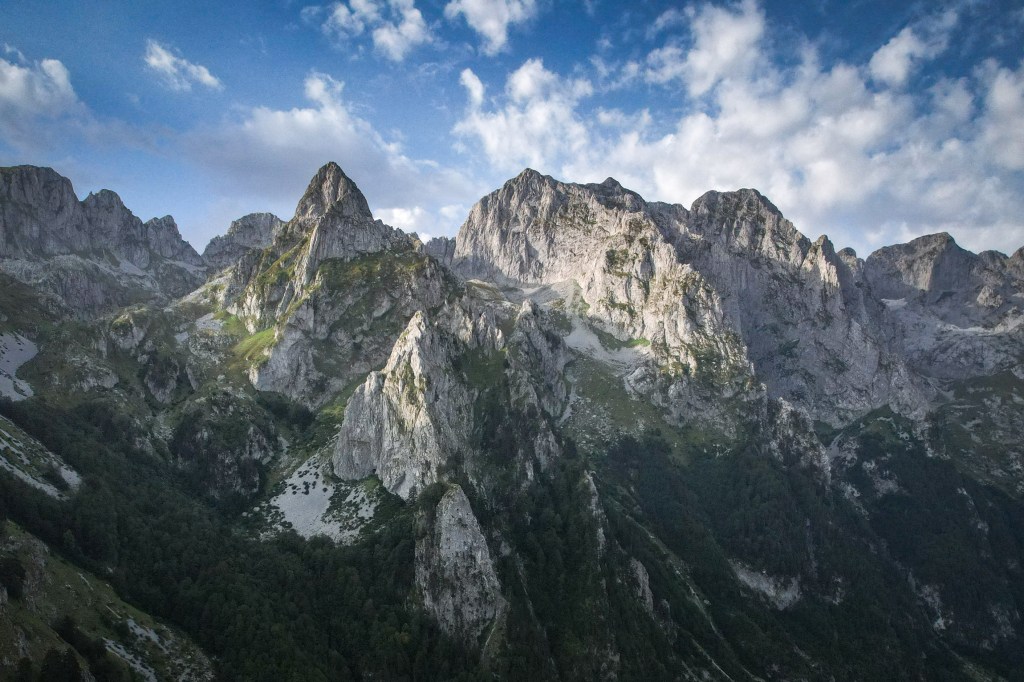
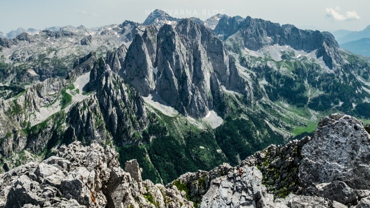
There is a huge mountain wall in sight on the other side of Runica: thats the same peaks we observed from Popadija the day before, only now seen “from the back”.
From Qafa Jezerce it is possible to climb the nearby Maja Bojs peak, access is however not marked and the last section is exposed, passing through a very steep chimney. We left this for some other occasion and went for a fresh swim in the big lake instead.
We descended to Ropojana the same way we came, covering 20 km with 1200m elevation gain in total.
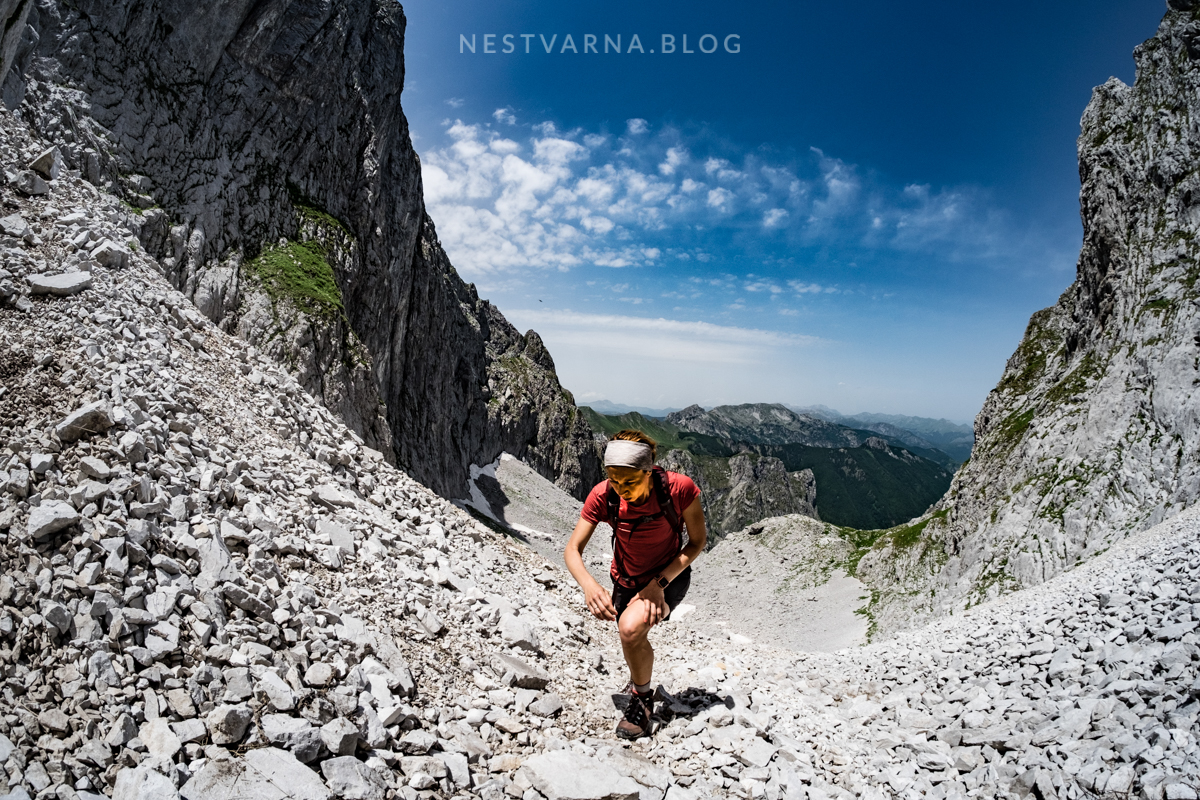
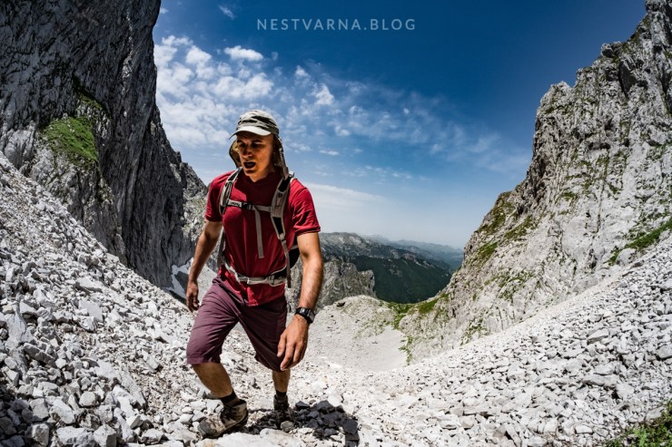
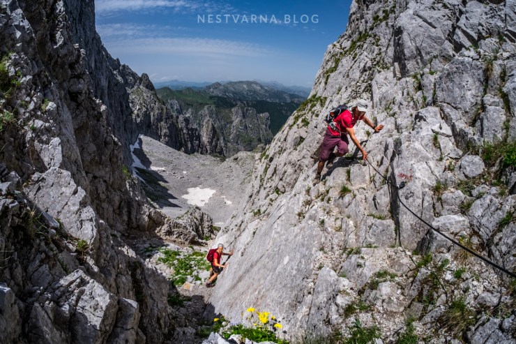
Day 3: Grbaja – Krošnjin prolaz – Severni Vrh – Krošnjin prolaz – Šuplja vrata – Grbaja.
If not the best, than the toughest climb we left for our last day in this first encounter with central Prokletije. Conquering Severni vrh – the north peak of Karanfili (Maja Bals) is a serious technical climb. Combined with a descent through Šuplja vrata it is a challenging route with 1500m elevation gain in just 12km (most of the climbing meters are in the first 7 kilometers). The more tired you become, terrain becomes steeper, slippery, and demands focus and the use of hands. The descending route is not marked at all (GPS self navigation required).
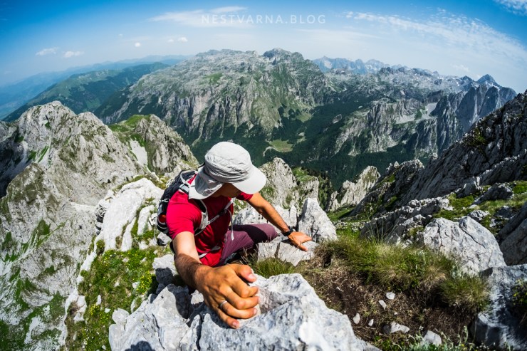
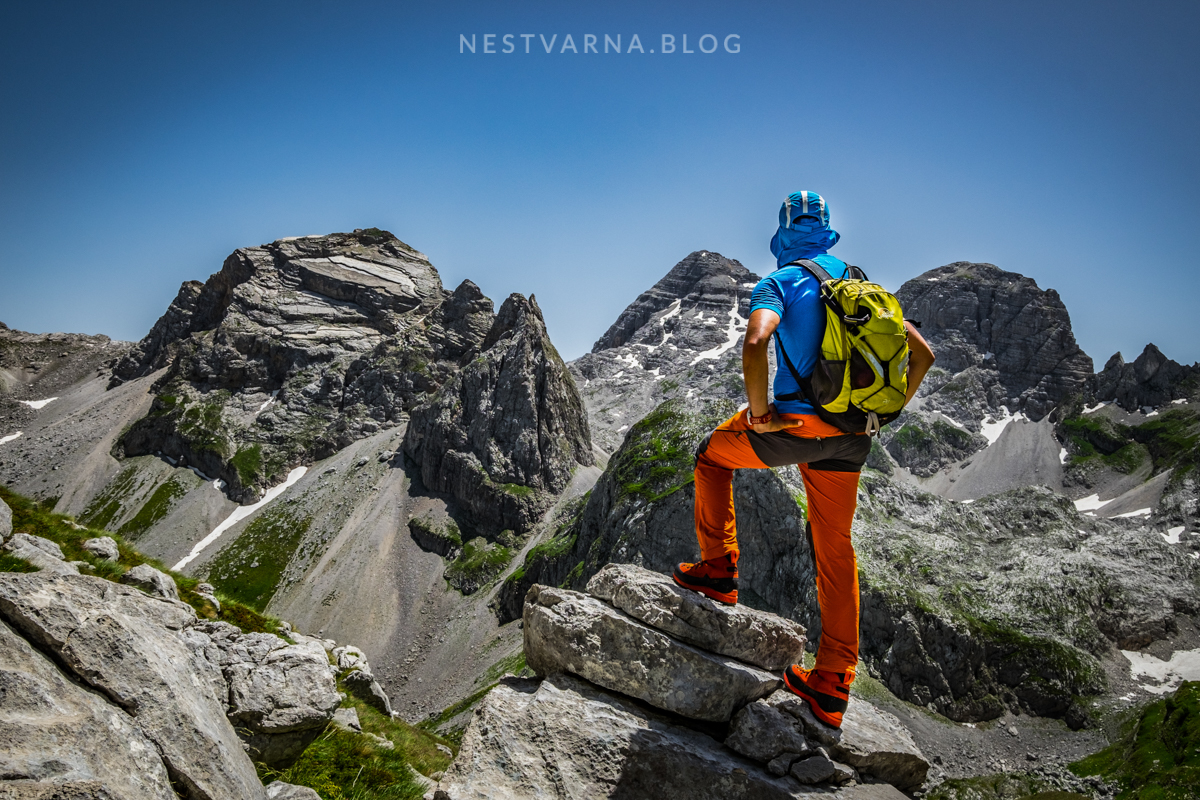
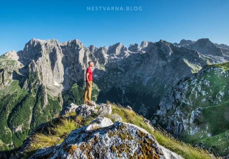
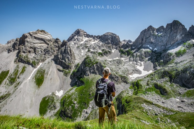
The view from the summit makes you to easily forget the sweat and suffer behind.
Three iconic peaks of Prokletije are in line: The North peak of Karanfili we stand on, Maja Bojs dominating the scene in the middle, and Maja Jezerce over the horizon.
On the other side lies the green ridge of Popadija (we passed on the first day). Behind is Trojan (“The three head mountain”) while the range of Komovi is in the very back on horizon.

Wikiloc:
Day 1: Volušnica, Popadija, Talijanka.
Day 3: Grbaje – Karanfili – Severni vrh (Šuplja vrata)
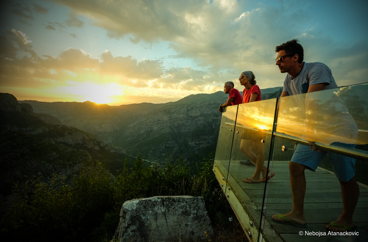
From Prokletije to the Adriatic sea in Montenegro is a 4 hour drive. The scenic road goes through north Albania along the canyon of river Cijevna, passing some beautiful old villages (Selce, Tamare) with great local food.

Svaka čast Nebojša.
Izvanredne i ture i fotografije.
Pozdrav,
Predrag Popović
LikeLiked by 1 person
Wonderful!
Did you know, is it allowed for foreigners to visit Buni Jezerces sinse you actually cross border between the states here? I understood there is no border control, but anyway is Albanian authorities is ok with it?
LikeLiked by 1 person
Dont worry there are no authorities, border guards or any other obstacles as long as you return to country you came from (Montenegro). What would be tricky is to descend to Albanian town and continue your journey further, but as long as you return to Montenegro (even the next day in case you camp) there is absolutely no problem. If you however do the Peaks of The Balkans circular trail make sure you register for a permit.
LikeLike
hola, quiero hacer la ruta del segundo día. Podrías indicarme que calzado lleváis para hacer esta ruta desde vusanje?
LikeLike
Hola voy a hacer la ruta desde vutaj en montenegro.
podrías indicarme que calzado llevas?
LikeLike