We arrived very late in Lepushe, in the very north of Albania, but still lucky to have that precious one hour of daylight to climb up a bit, and set up our first camp in the green meadows of Berezhdol.
It is where our 48 hours of adventure in the mighty Albanian Alps began…


Prokletije represent the most dramatic part of the Dinaric mountain system that stretches along the coast of the Adriatic sea. Scenery found here is alpine in every sense: colossal peaks rise from deep glacier valleys.

Most part of it belongs to Albania, where the mountain is similarly called: Bjeshket e Nemuna (“accursed mountains”). Access points from the south are valleys of Boge, Theth, Valbona and Cem (Cijevna) river canyon.

A majestic alpine road is recently built through the canyon of river Cijevna (or Cem in Albanian). The road departs from Hani Hotit, near the major border crossing between Podgorica and Shkoder. Road goes up to 1350m to the villages of Lepushe and Vermusha near the north border with Montenegro. A paved road that reaches 1350m altitude is a sort of “luxury” in Prokletije. Grbaja and Ropojana in Montenegro are at 1100m, while the valley of Thethe is only at 800m altitude.
The imposing massif of the “Albanian Alps” can be divided in several groups.
In its centre is the Popluks group. Name is derived from slavic Pop-Luka: it’s the name of the summit, which observed from the valley of Theth appears to be the highest (in fact it is not, but it hides Maja Jezerce, highest peak of Prokletije and all the Dinarids).
North of the Popluks lies the Bjelič mountain, that almost entirely belongs to Montenegro. Most prominent summits of Bjelič are Maja Rosit (Rosni vrh) and the famous Three Kolata: “The Good Kolata” (Maja Kolata), “The Evil Kolata” (Kolata e Keqe) and “The Flat Kolata” (Kolata e Podes).
South-west of Popluks lies the Radohines group.
To the west is the “Grbaja amphitheater” with its amazing chain of peaks: Karanfili, Fortit, Vukoces, Shkurt… It merges with Radohines group over the rocky peak of Maja Harapit right above the Thethe valley. South-face of Harapit is considered as one the highest vertical walls in Europe (1400m high).

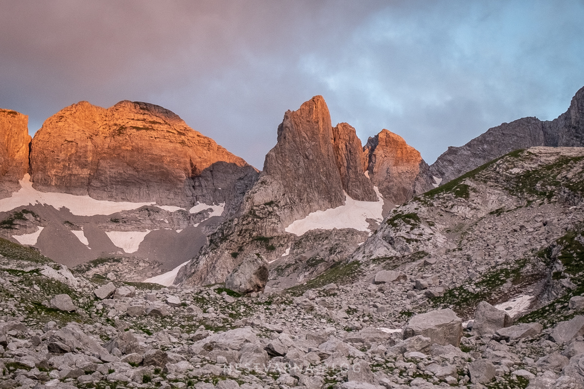
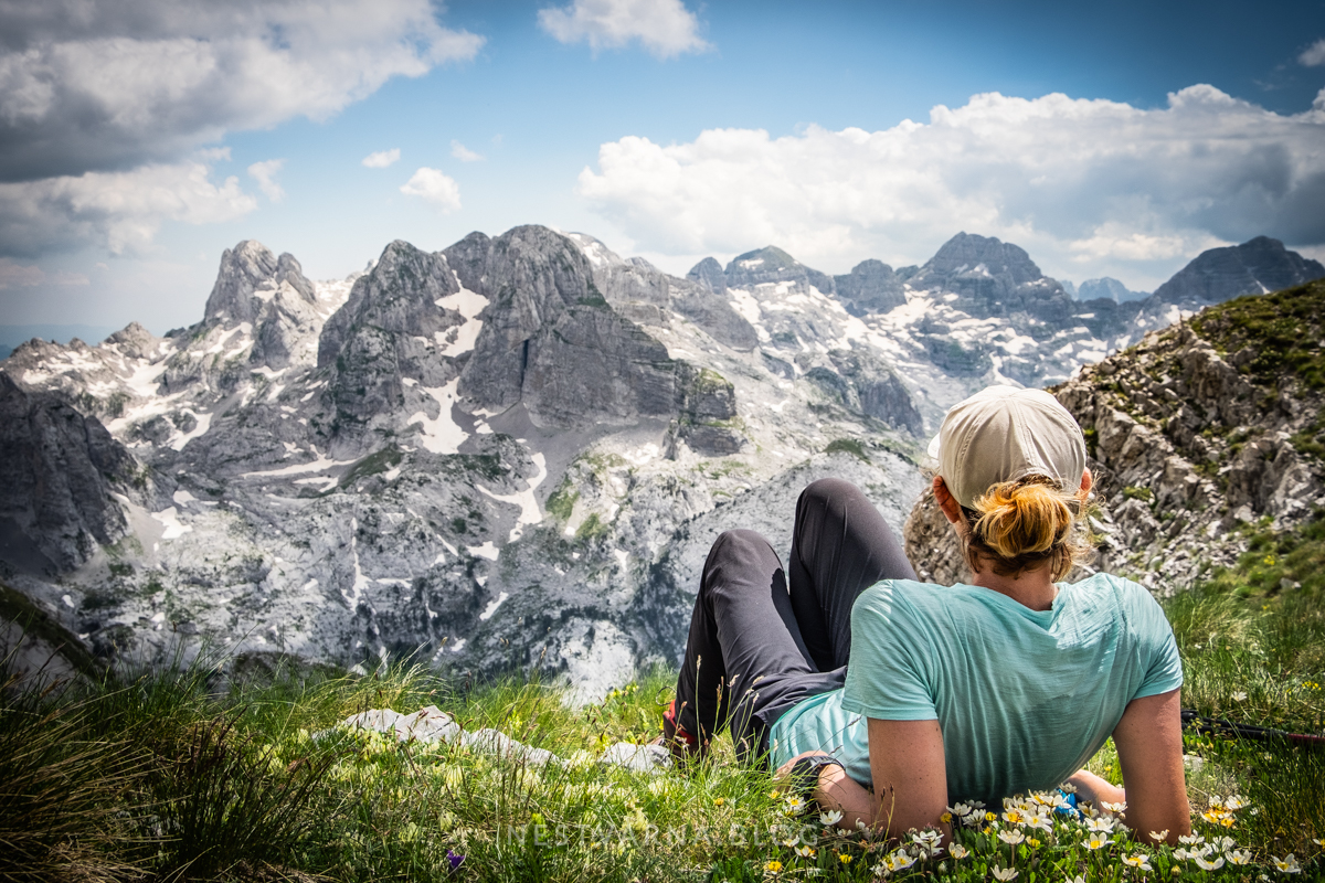
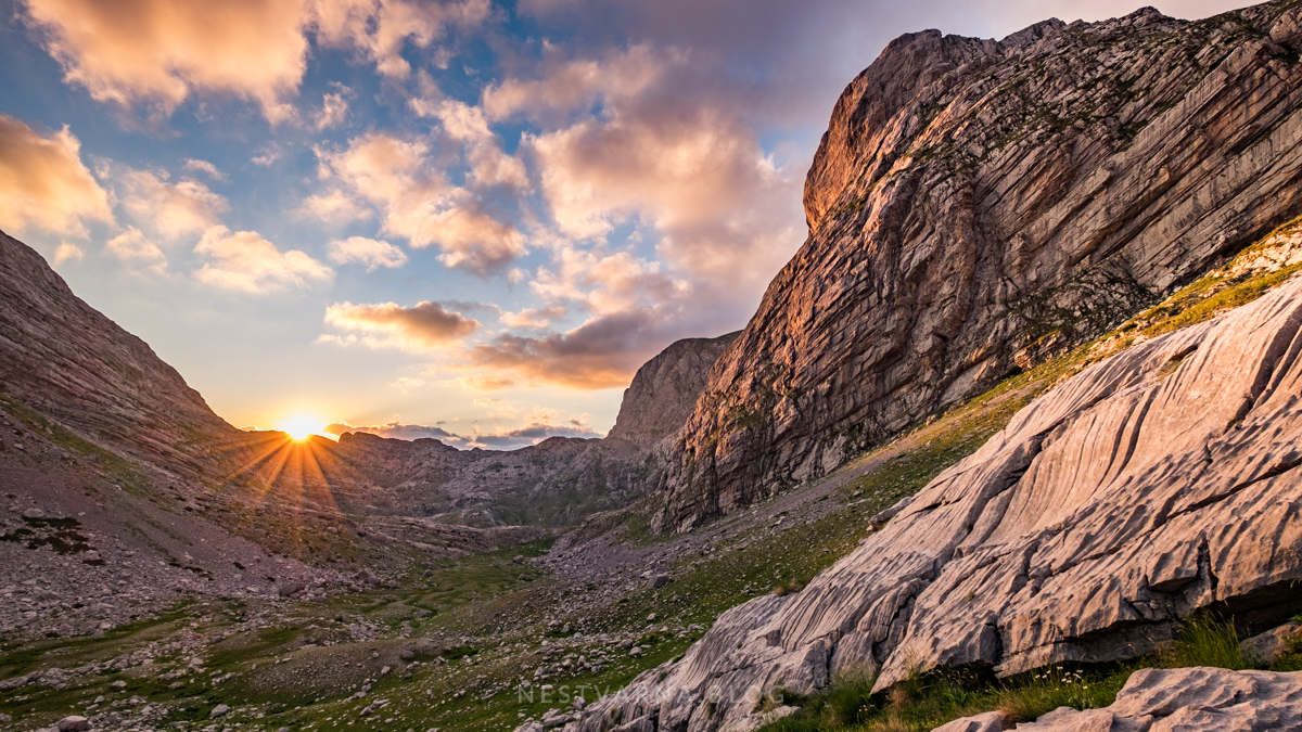
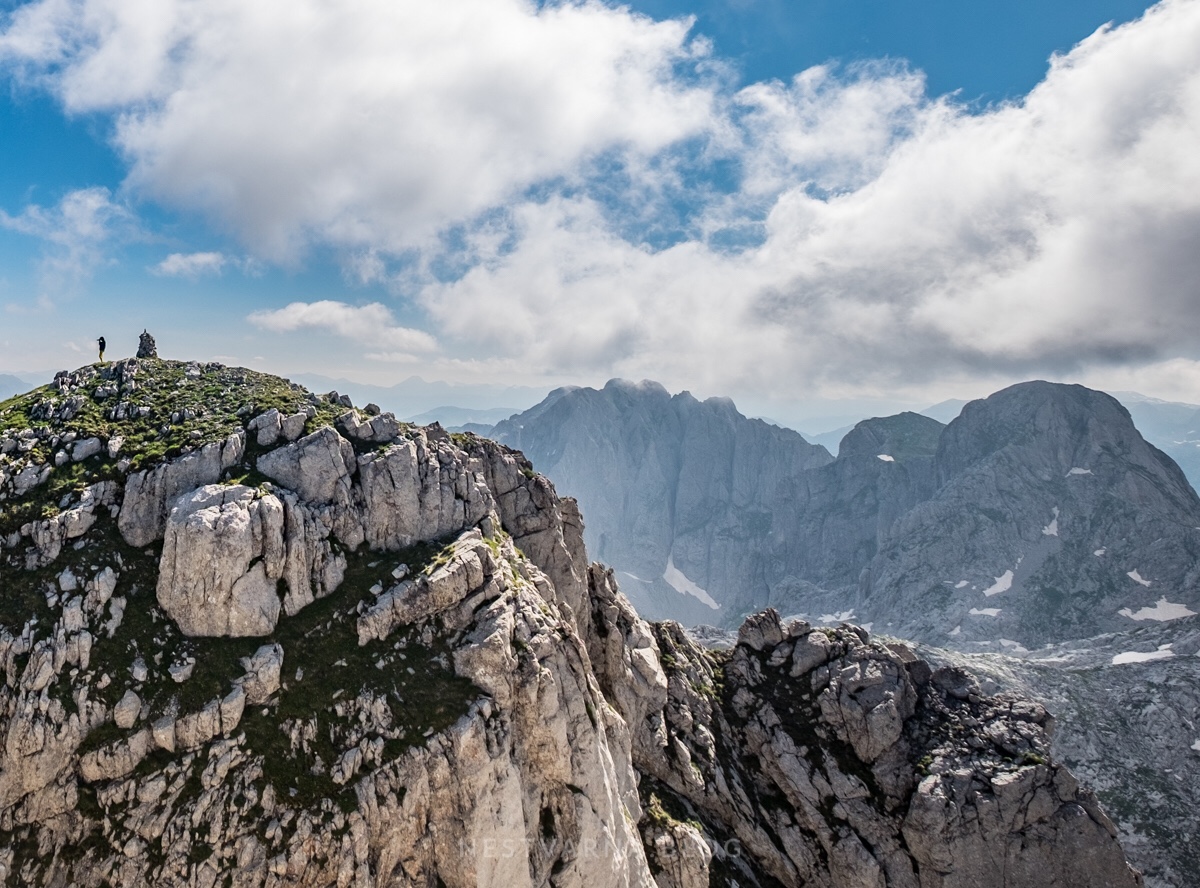
The Kingdom of Limestone opened its gates the next day, in the early morning, as we stepped upon the ridge of Maja Berezdolit. Maja Nigvacit (2412m) on the left and Mali Shnikut (2556m) to the right were the peaks that we conquered in the hours to come. Absolutely no one out there but us. We were completely alone in this part of Prokletije for 40 hours – a feeling hard to describe.

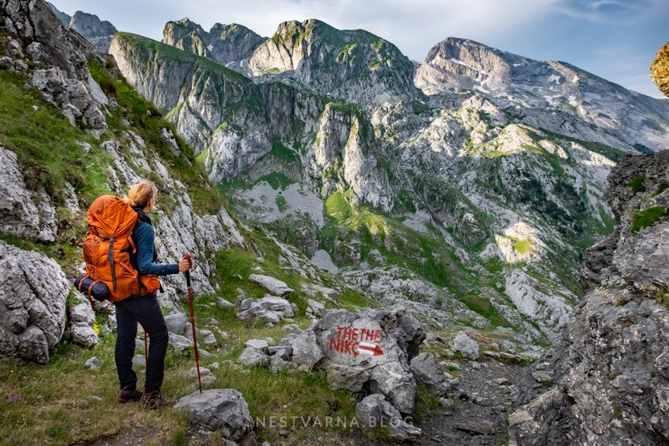
Lepushe – Thethe “Peaks of the Balkans” tracks separate on Berezdoll ridge: Upper trail (marked at the crossroad as Thethe ←) climbs constantly to the saddle below Nigvacit peak. Lower trail (marked at the crossroad as Thethe Nikc →) goes down a bit towards the valley of Jam, before going up again towards Thethe via magnificient glacier cirk of Koprishit. Trails join together below the steep pass, that goes further to the valley of Runice.
We followed the lower trail with an idea to set up a camp somewhere suitable, climb Mali Shnikut and then, on the following morning, walk the upper track back from Koprishit, climb Maja Nigvacit, and close the loop on Berezdoll ridge.


Camping possibility gave us ultimate freedom and a privilege to spend magic hours of the day deep in the wilderness. The unexpected loss of time upon arrival, due to the flight delay and border queue, forced us to quit our primary ambitious goals (to reach the Valley of the Lakes – Buni Jezerces from this side of the mountain).
But in the end, the loop we made in just two days, turned out to be a perfect plan! The less beaten paths of Prokletije proved themselves as extraordinary – crowned with majestic views from the peaks of Nigvacit and Shnikut (Maja e Madhe).
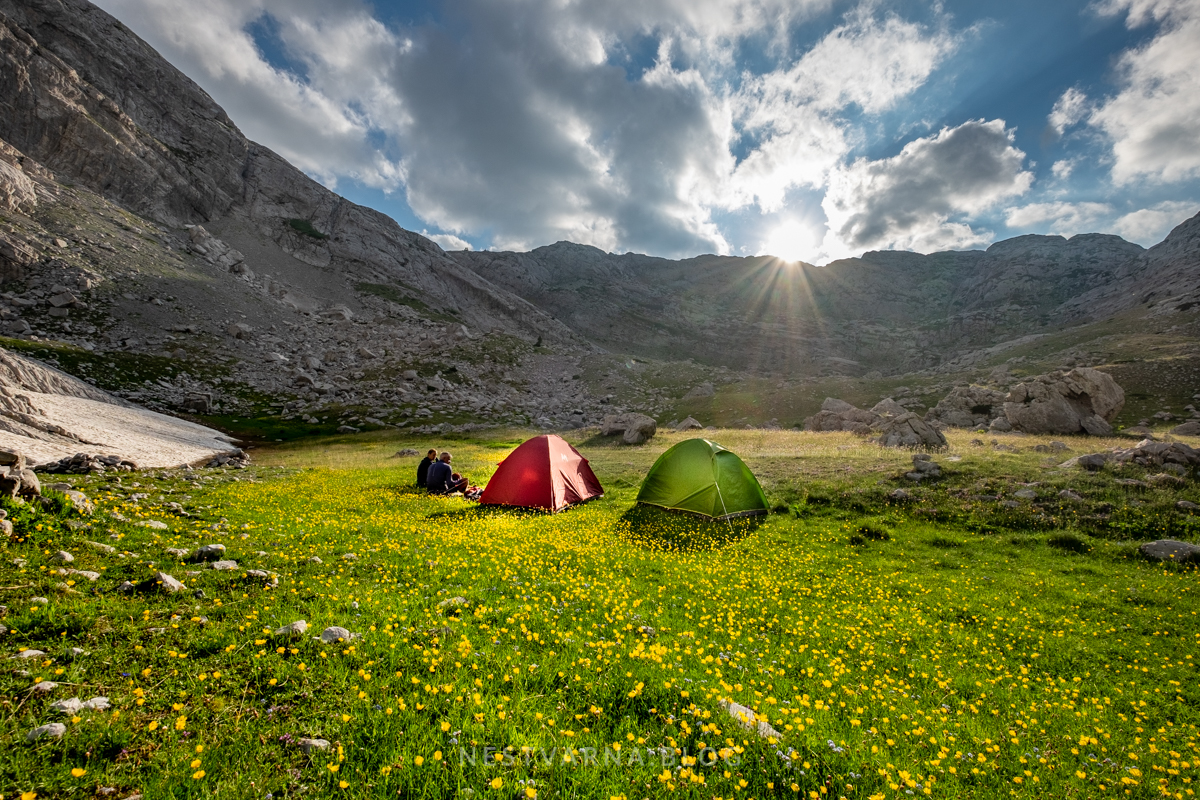
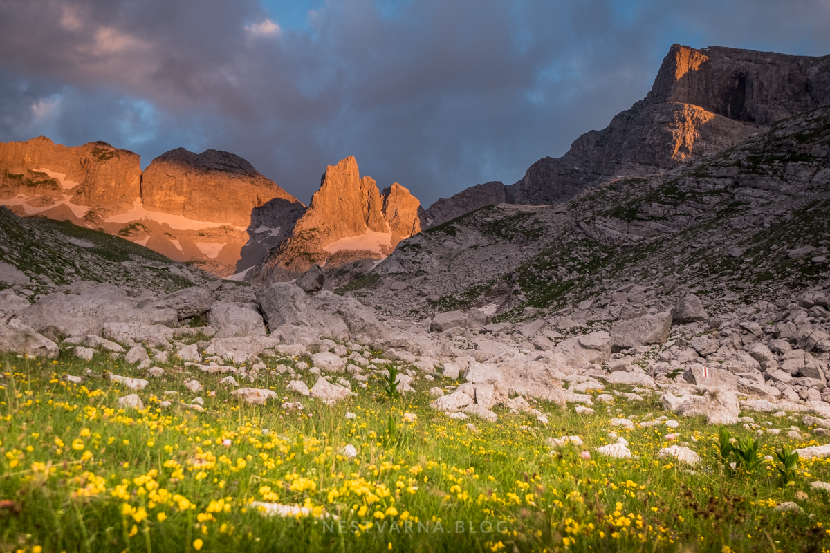
We set-up the camp att the very bottom of Korpishit valley, near the semi-deserted shepherds refuge.
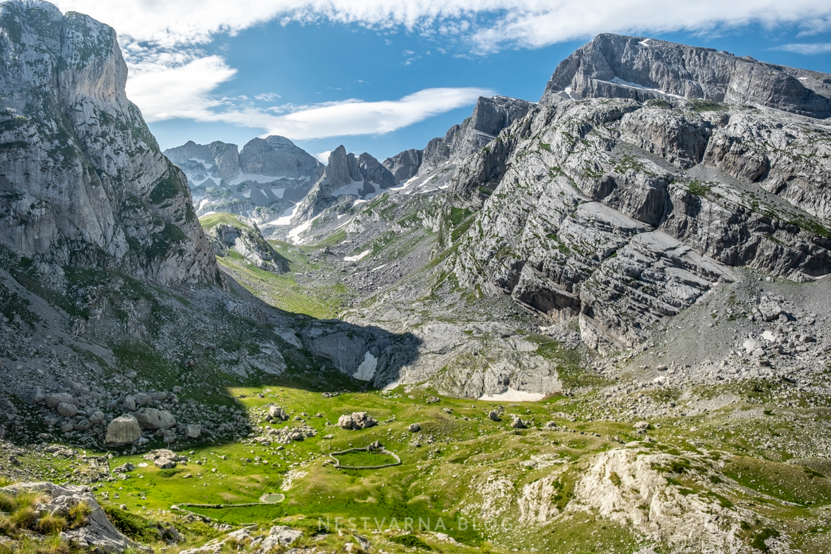
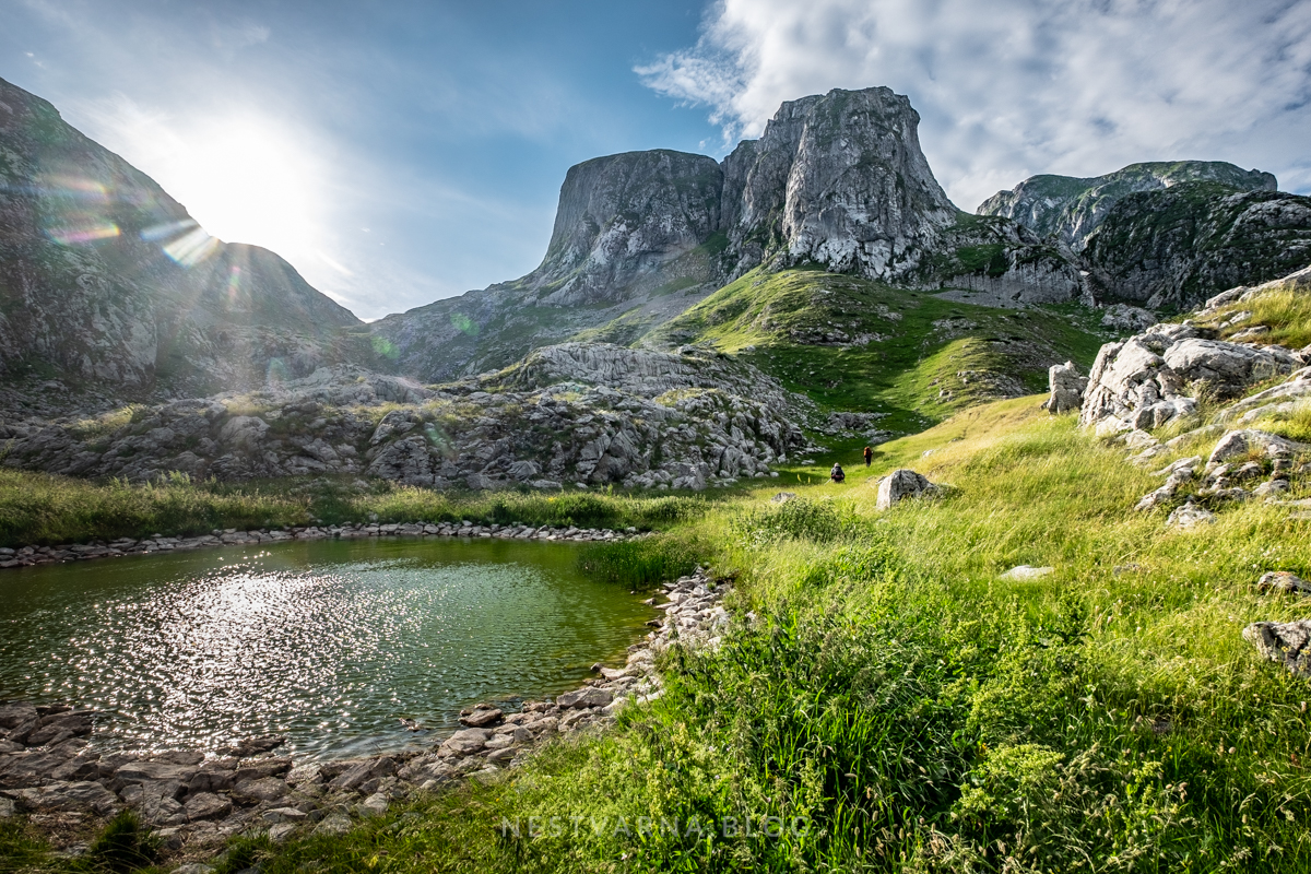
Key factor for camp location is the availability of a some water spring nearby. Snow can be used for hygiene and washing. The spring we found in the rock nearby (approach is marked) was almost drying out, falling only drop by drop. Luckily, close to the summit of Shnikut we later found another fountain with abundant water streaming down the rocks.

How to reach Mali Shnikut?
There are two possibilities to reach the summit. Harder one – we went on the ascent, and easier one – we went down to the camp. Both approaches are neither sign-posted nor marked (gpx track of our two-days loop is attached at the bottom of this story).
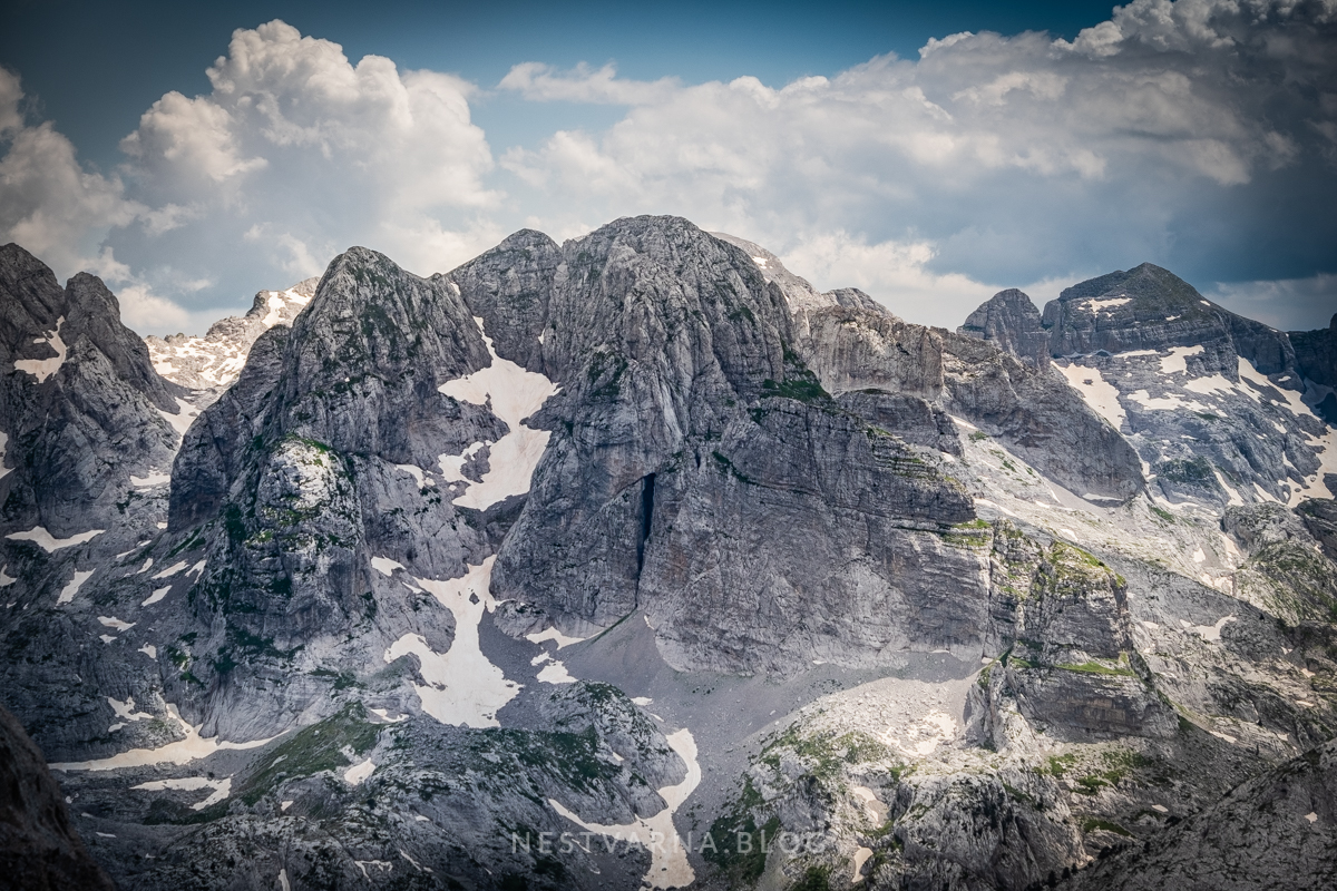
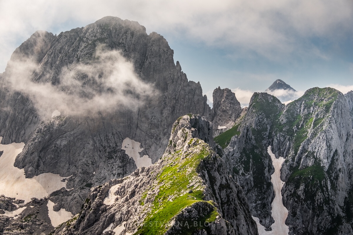
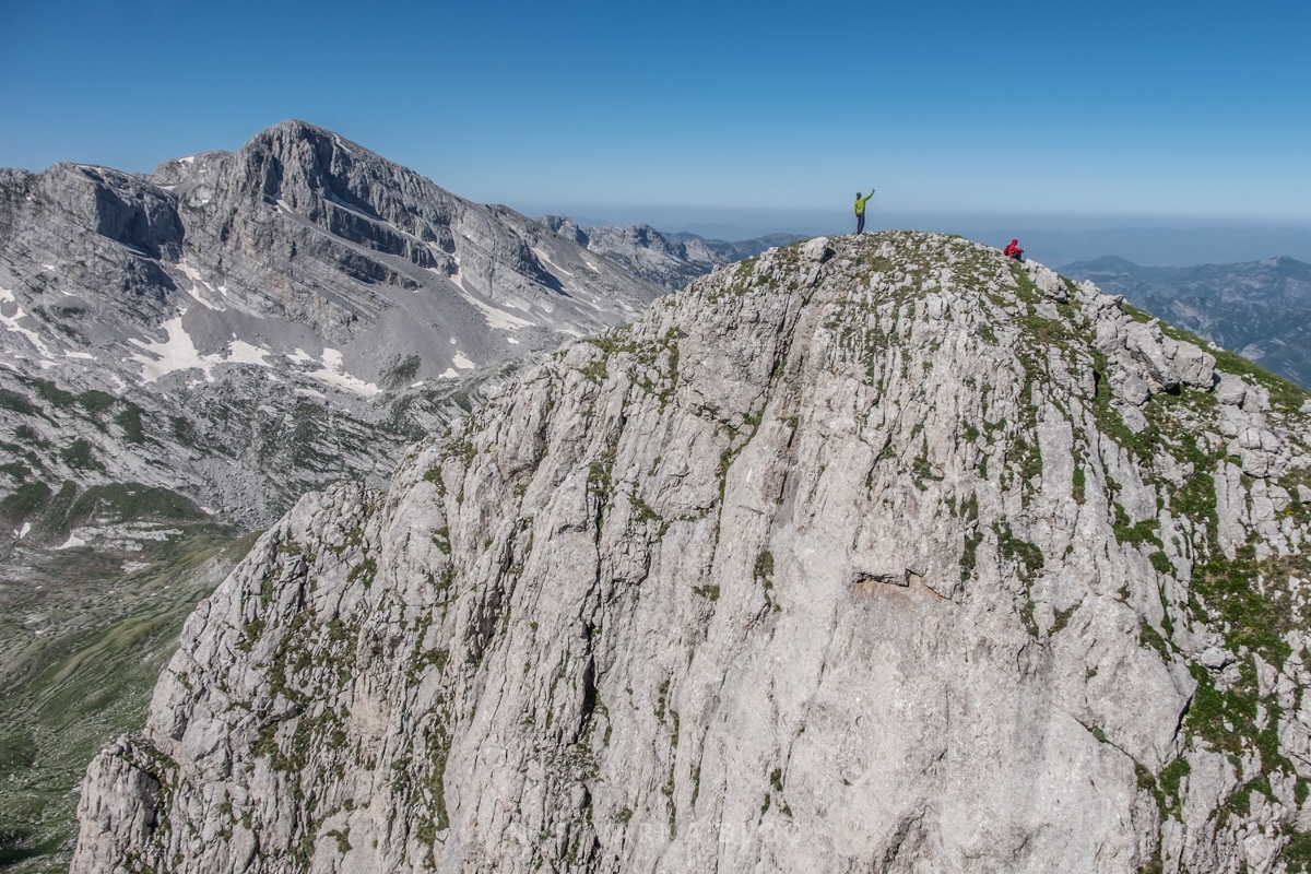
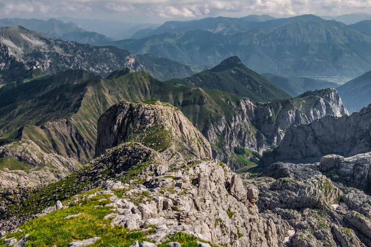
The view from Shnikut’s Maja e Madhe (2556m) belongs to most enchanting in whole Prokletije range. Popluks and Radohines groups can be beautifully observed, as well as half of Montenegro on the opposite side.
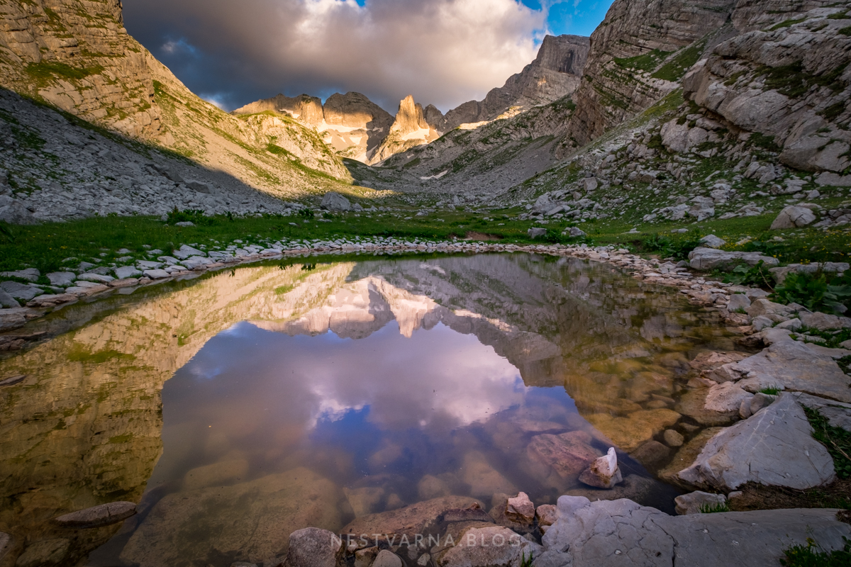
We reached our camp in the sunset. Light in the valley of Koprishit was incredible.
Following night and morning were quite cold and windy. We packed our gear and departed short after the dawn, and initially followed the marked path towards Thethe again.
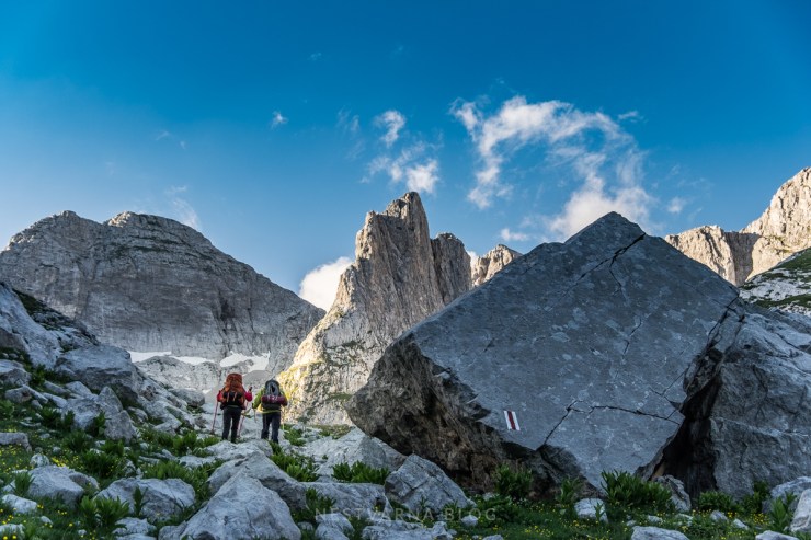
As we entered the big cirque we left the marked traverse path and turned left (in the western direction) towards Maja Nigvacit.
The Thethe traverse we just left, crosses the big mountain in front (going as high as 2200m at the Koprishit pass). After it, it goes down into the valley of Runice and intersects the major Peaks of the Balkans route Vusanje – Thethe. The Vusanje – Thethe section is actually ancient caravans haute-route from the south Adriatic to the central parts of Balkan peninsula, connecting Peć (Peja) and Skadar (Shkoder). The pass to the valley of Thethe is therefore called Qafa Pejes (Peja or Peć pass).

There was no need for us to follow the marked path all the way to Nigvacit, we shortened it over the meadows of the glacier cirque with a short final climb to the saddle where we finally merged on the upper trail (leading from Berezdoll ridge to here).
It took us 2 hours from the camp to reach the saddle. Summit access to Maja Nigvacit is not difficult, terrain is grassy, becoming rocky only at the top.
The view from the summit of Maja Nigvacit is simply gorgeous.

Nigvacit can be climbed in a single day from the valley, contrary to Shnikut. Total altitude gain from Predelec (Lepushe) to Maja Nigvacit is 1100m. to Maja Madhe (Shnikut) it is 1800m in elevation to be conquered.
From Podgorica airport to Lepushe village is a 2 hours drive through the beautiful canyon of Cijevna through nice villages of Tamare and Selce. Hiking starting point in Lepushe is called Predelec (Qafa Bordolecit) right at the entrance of the village.
There are a few restaurants along the road. Local specialties include wild trout from Cijevna river, corn bread in yogurt sauce, oven baked potato baked with fresh cheese dressing and the inevitable lamb meat.

North Albania is hikers paradise with a well preserved authentic character of the mountain and its people!
Prokletije or Bjehsket e Nemuna or simply Albanian Alps are off the mainstream and will hopefully stay so!
This journey was undertaken on June 28-30th 2019 by Gordana & Slaviša Mićanović, Nebojša Atanacković.
GPX:
Prokletije: Lepushe – Berezhdol – Maja e Madhe – Nigvacit
Flickr:

Fantastično !
Svaka čast Nebojša.
Pozdrav,
Predrag Popović
LikeLiked by 1 person