For most nature lovers based in Montenegro, Serbia or south Dalmatia, first contact with a “real mountain” happened most probably on Durmitor.
With its alpine peaks and valleys, mountain lakes, dense pine forests and a lunar-like landscape to the south, Durmitor is unique among the Dinarids.
It is surprisingly compact and easy to access. Its frontiers are marked with three deep canyons of rivers Sušica, Tara and Komarnica. The highest summit of Durmitor is Bobotov Kuk 2523m, but there are altogether more than 40 peaks higher than 2000m in the whole range.
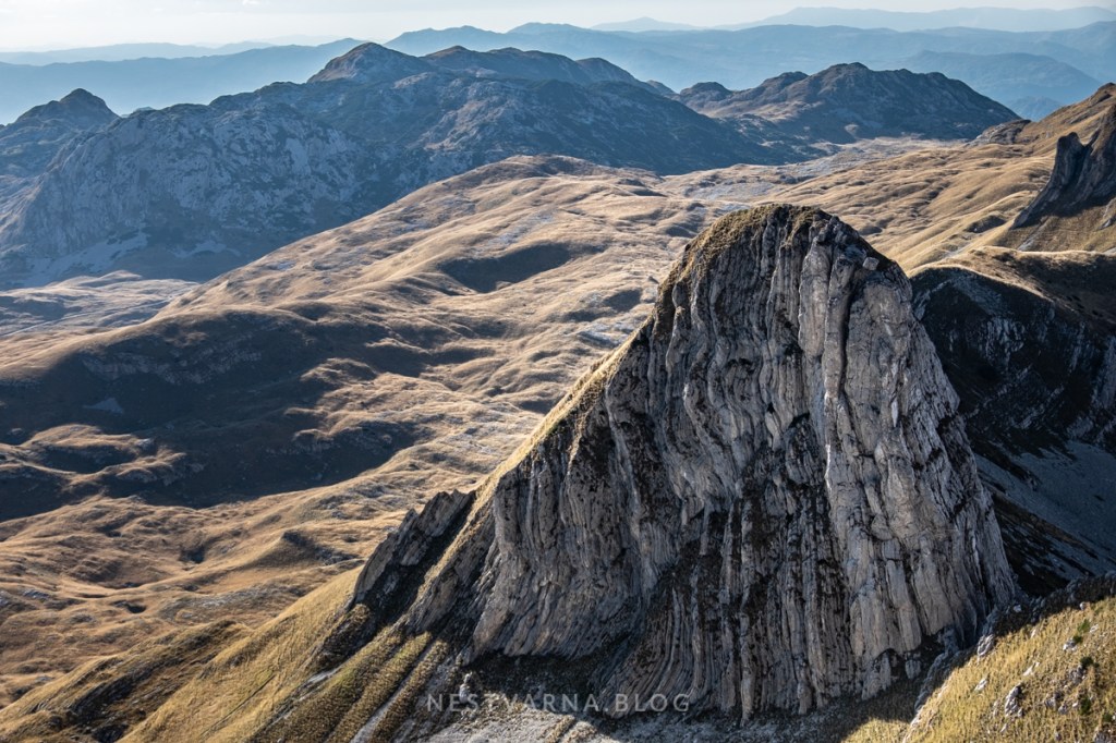
Close to the southern edge of the massif are located some of the most remarkable peaks of Durmitor: Prutaš, Šareni pasovi and Sedlena Greda. Their extraordinary form is the impressive legacy of the last ice age that shows the deep impact Pleistocene glaciers had on the Dinaric karst landscape.
To the east comes the wide plateau of Šljeme, third highest peak of Durmitor. In the central part are situated: Terzin and Minin Bogaz, Bandijerna and Zupci. Finally, Savin Kuk, Veliki and Mali Medjed and Crvena Greda spread around and above The Black Lake.
Across the valley of Žabljak, Durmitors neighbour to the east is vast Sinjajevina while on its western edge lies Piva region. Durmitor and Sinjajevina together build the widest high plateau in Montenegro, stretching around 60km from Tara river canyon on the east, to Piva canyon on the west.
Durmitor would not be the wonder of nature in its class, without its mountain lakes of mesmerizing beauty.
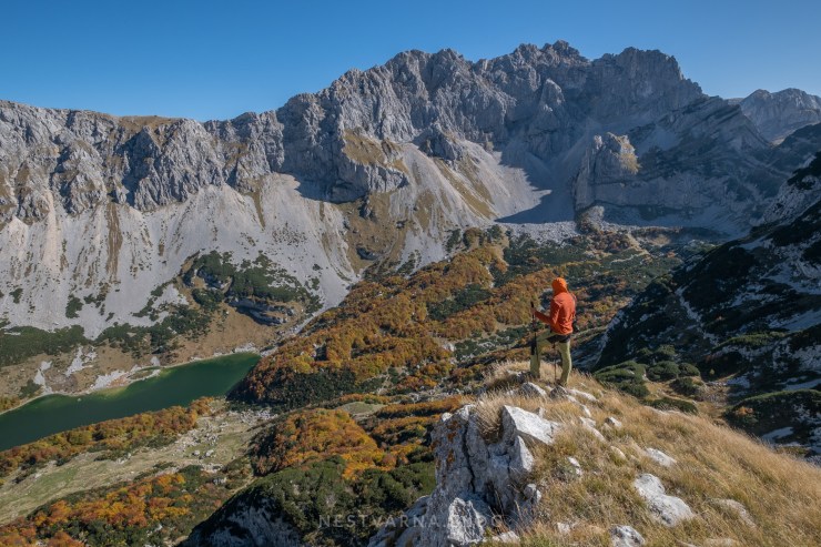
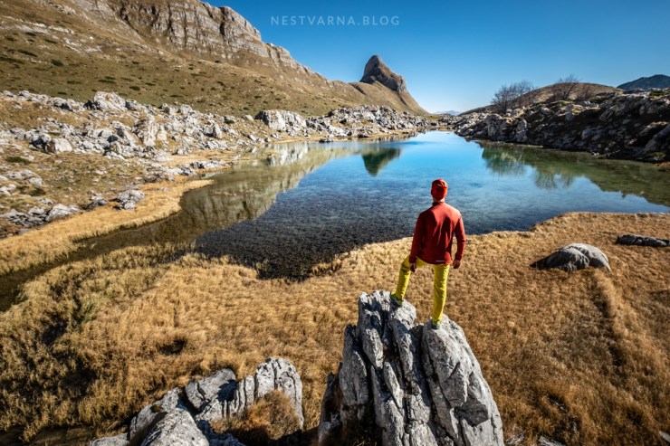
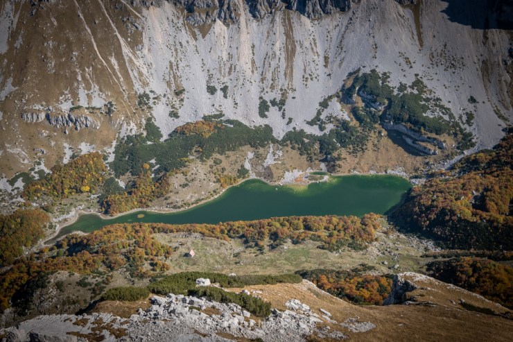
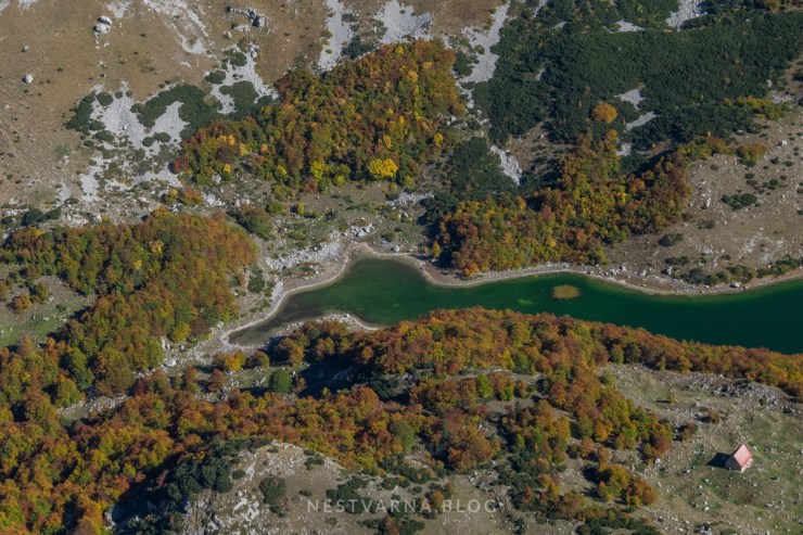
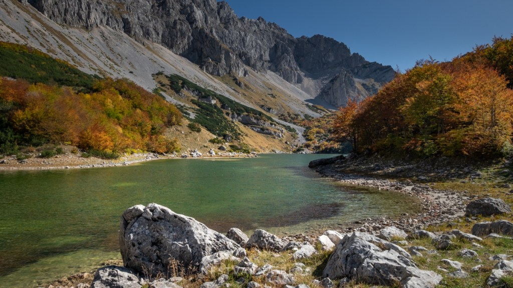
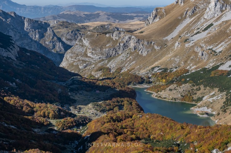
Apart from the main sight, The Black Lake, Durmitor has numerous “emerald eyes” spread around the massif. The largest of them is the Great Škrka lake situated in the deep alpine valley of the same name just below the highest summit of Durmitor.
Just as beautiful are the smaller yet seasonal lakes of Sušica and Zeleni Vir (they would eventually dry out during the summer) followed by Valovito, Jablan, Zminje, Vražje and Riblje jezero.
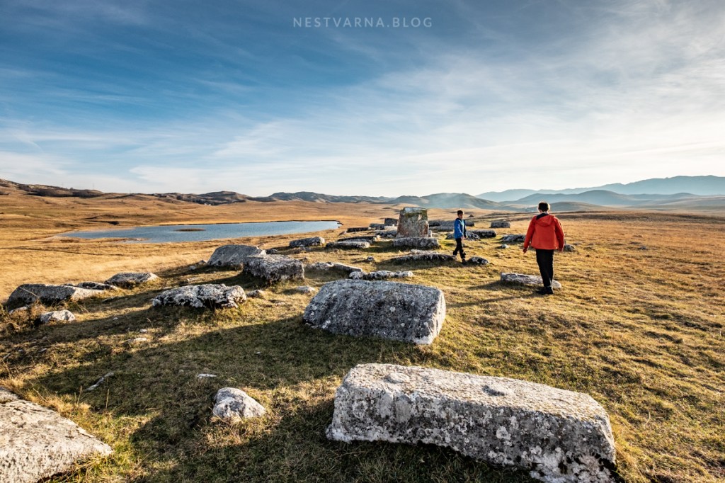
Every lake is special in its own way. Zminje and Jablan lake are located amidst the ancient pine forest, Valovito lake is in the beautiful karst valley of Katin Do just under the Stožina peak. Stožina means literally “the big straw pile” – it is one of Durmitor’s best-known landmarks. Finally, beside Riblje jezero (“The fish lake”) lies an ancient necropolis (“stećak”).
The hiking trail network in Durmitor is extraordinary for Balkans standards. It is possible to traverse from one side of the mountain to the other, or to create inspiring roundtrips.
I decided to dedicate the very golden weekend in mid-October of 2019 to one such “epic route” in Durmitor:
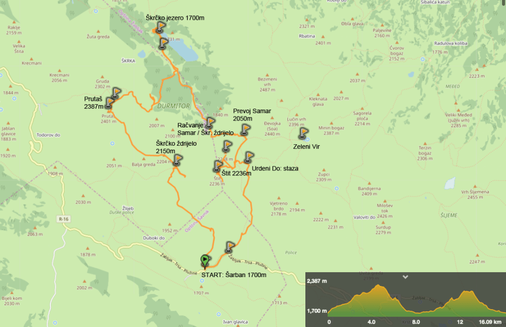
Šarban – Škrčko Ždrijelo – Prutaš – Škrka – Samar – Štit – Urdeni do – Šarban (the road).
Most foreigners visiting Durmitor aim for Bobotov Kuk summit as their final goal. In my humble opinion, even though the most popular, this is not the most beautiful route in Durmitor.
The circular route presented here will not take you to the highest summit of Durmitor but you will get the best views guaranteed! Across Prutaš, Škrka, Samar and Štit, the visitor passes three glacier valleys, stops to recharge at the magnificent Škrčko jezero, and goes three times up and down the 2000m altitude. It is a challenging route with 1200m total ascent in 16km, but your effort will be rewarded at each step along the way; astonishing sights change fast in time, there are no dull sections, and only a few people are met along the trail, if any at all.

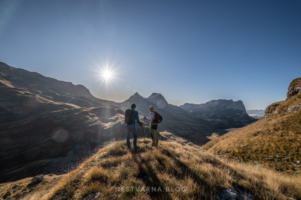

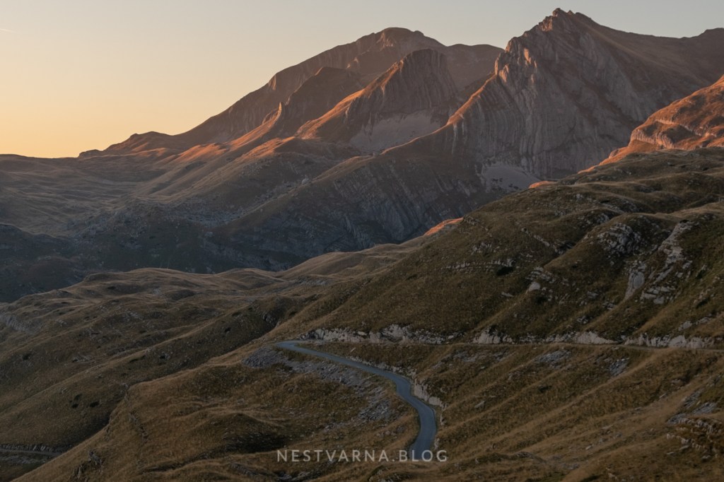
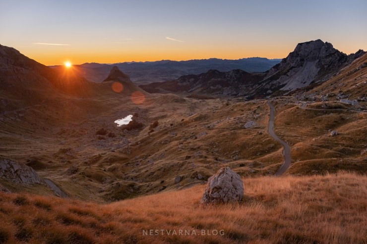
The excitement will begin even before the climb itself. Access to the starting point follows a fairy-tale alpine road that curves along the southern edge of the massif from Žabljak towards Trsa. It is the most scenic section of the famous Durmitor cycling ring. The magical Sedlo pass (“saddle”) is the highlight, at 1900m altitude.
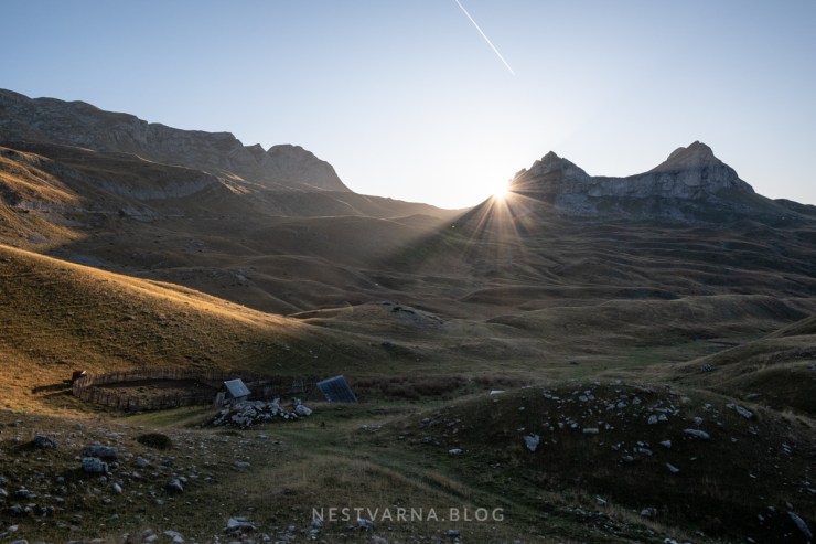
Getting up early is a must for hikers and photographers, especially in case of Durmitor. To witness the sunrise at the Saddle is a sight that will stick in one’s memory for a long time.
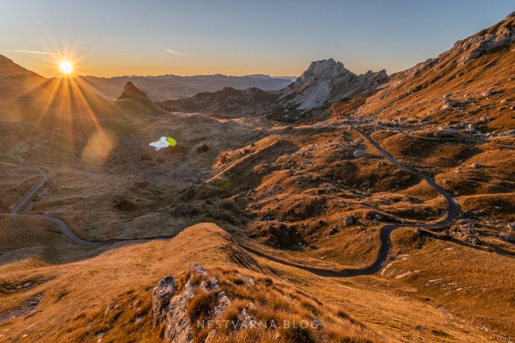
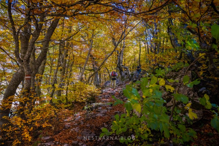
A few curves away, the sun will eventually wink one more time at the panoramic spot that looks towards Sedlo in the direction we just came from. Here we leave our car and start to walk uphill along the well-marked path towards Škrčko Ždrijelo and Prutaš.
It is mid-October 2019 – Indian summer is in full swing in Durmitor. Some clouds would make the scenery a bit more dramatic, but under the crystal-clear skies and with strong shadows down on earth, the outlines of the amazing mountain landscape are sharp and visibility is perfect.
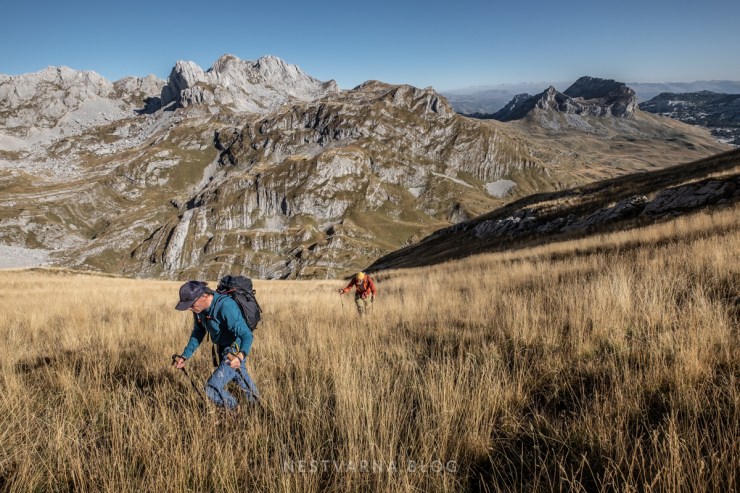
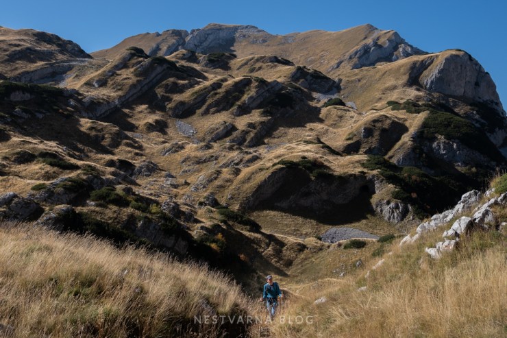
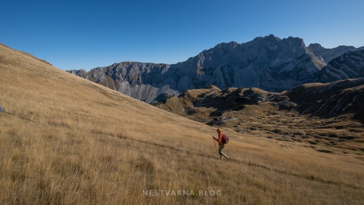
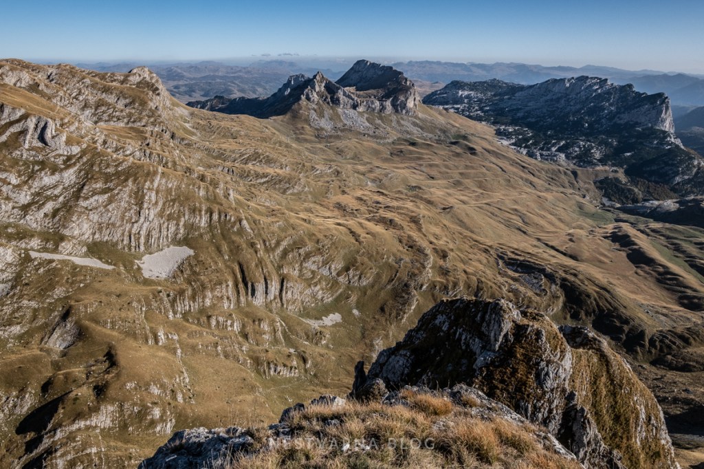
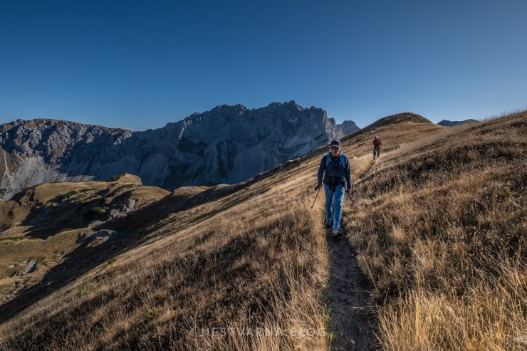
Via normale ascent to Prutaš starts at the main road close to the Šarban camp site, until it reaches the Škrčko ždrijelo pass, where the hiking trails divide. One path descends directly towards Škrčko jezero. The other trail follows the ridge uphill to the summit of Prutaš and from there it descends to the lake. The path is well beaten and marked all the way; elevation gain is slow and constant and the (Prutaš) summit (2393m) is reached in no more than 3h time from the starting point at the main road.
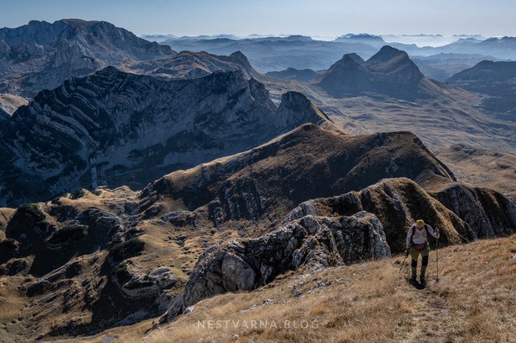

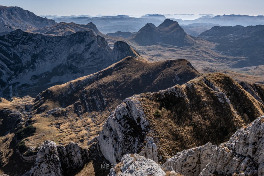
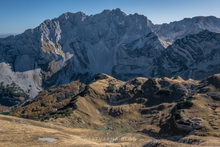
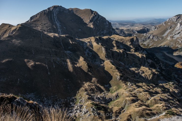
From the summit (2393m) view goes to the neighbour massif of Bioč, at the border with Bosnia Herzegovina across the plateau of Todorov Do and river Piva canyon.

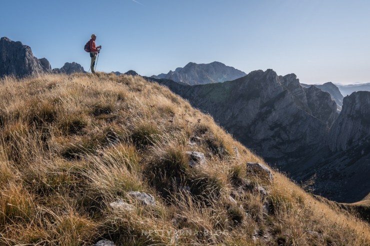
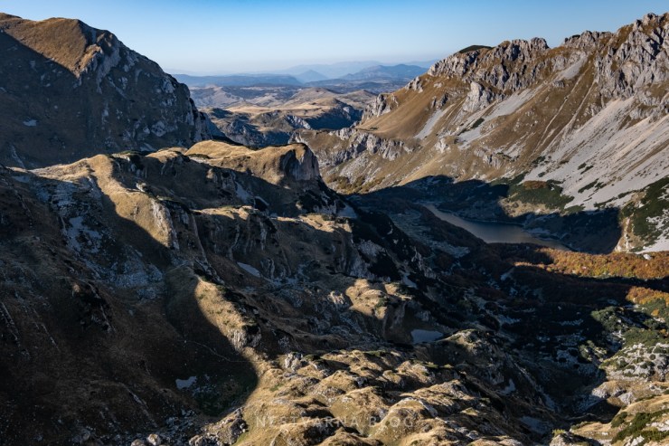
The real sight for sore eyes will come a few minutes later, following the path along the ridge, heading north. Its the remarkable view of the Škrka lake below the giant stonewall called “Nebeska Soa” – the highest summit of Durmitor Bobotov Kuk is the peak in the middle.
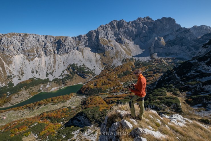
Descending towards Škrka we slowly enter the magical, “autumn zone” of the mountain. Surreal colours do not last long. In fact, it is just a matter of days, before they transfer into dark purple tones. With more frequent night time frosts, leaves will completely drop off the trees, announcing long and snowy winter in the mountains.
Autumn is most beautiful when observed from proximity.


We start to feel the first signs of fatigue, so we decide to make a break at the refuge, refilling our energy levels and water reserves for the second part of the track.

The demanding second half of the ascent was still awaiting us. Having descended to the lake, we practically lost all the elevation gain so far: the mountain hut at the lake is at 1750m altitude: same as our starting point in the valley.
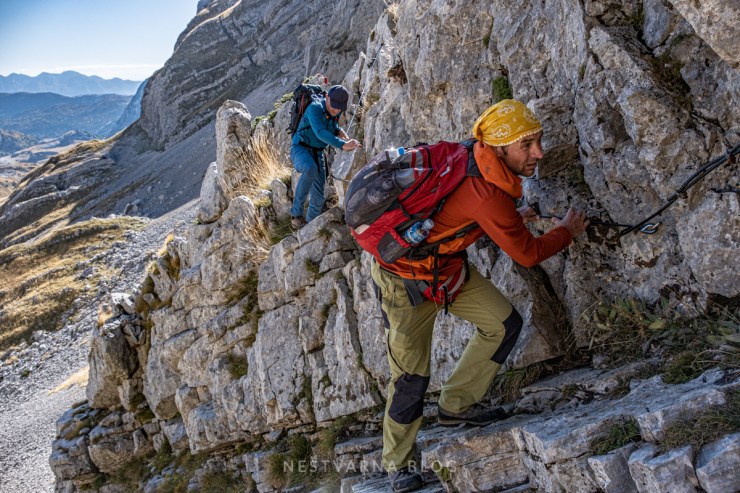
On top of that, crossing from Škrka valley to Urdeni do is via Samar – the highest pass of Durmitor (2050m). This is the only technical section along todays route.
What makes Samar tricky and potentially dangerous in late autumn is its north face that prevents sun rays falling in from March till October. It can be very slippery between the rocks in the short but steep passage.
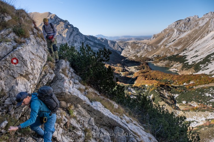
With all measures of caution, we successfully traversed to the other side.
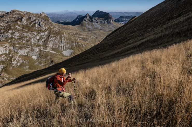
The views from Samar are equally appealing – yet there is little room for rest, it is 2 o’clock already, and we have to move on – the last 2 hours of remaining daylight are dedicated for the second summit today – Štit.
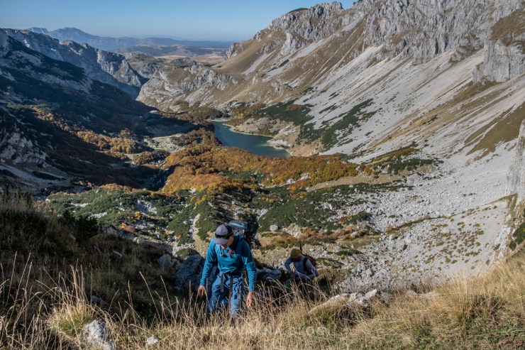
Descending from Samar is not easy, but this time we luckily move down the slope exposed to the sun. Potential critical places are well secured with ropes on this side.
Right below the unpleasant stone scales of Samar, we must leave the marked path (for the first and last time along the whole route). Barely visible shepherd path on the right-hand side is to follow.
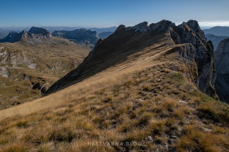
The path does not lose much on altitude, ending below the small chimney. After a short and technically easy climb upwards, a wide meadow opens at top. Ascending the meadow in free direction we finally reach the ridge. The southernmost point of this ridge is its highest point called Štit (meaning literally “shield”).
The north side is the peak of Šareni pasovi. Climbing the very summit of Šareni pasovi is dangerous and should be avoided without proper alpinism gear and experience.
Views from the the “top of the shield” are equally sublime, describing again the intense impact of the last ice age in Durmitor south side landscape.
Having conquered Štit (2248m), the short final descend was left. From the chimney we descend directly onto the marked path in Urdeni Do that will later on take us to the main road in less than hour.
Epic circular route in Durmitor was successfully accomplished in a short autumn day.
There was not much time for chilling, October is an extraordinary month with its vivid colours, yet gives little space for fixing potential errors. This trail is therefore to be approached with caution especially in the later period of the year.
Đorđe Lašić (BSK Mountaineering section) and Aleksandar Bzdušok (Aquaplan) were great partners in action!
Big thanks to Igor Konatar for useful advices and fresh updates from Durmitor!
Time-line of our tour (sunrise around 7:00, sunset around 18:00)
8:00 START: Šarban, 1750m
9:15 Škrčko ždrijelo, 2050m
10:30 Prutaš summit, 2393m
12:15 Škrka refuge by the lake, 1700m
14:00 Samar pass, 2050m
15:30 Štit (Šareni pasovi) 2248m
16:30 Urdeni do, 1900m
17:30 FINISH: Šarban, 1750m
If you encounter lack of time and not reach Samar until 15:00, skip the Štit summit and go straight to Urdeni do.
Wikiloc: Šarban – Škrčko ždrijelo – Prutaš – Škrčko jezero – Samar – Štit – Urdeni Do
Flickr: Prutaš – Škrčko jezero – Štit i Šareni pasovi
Durmitor lodging recommendation: Family Farm, Virak.
