Putovanje je organizovano kroz projekat “Turizam, Adrenalin i Rafting Avantura (T.A.R.A.)” koji zajednički sprovode opštine Plužine i Foča a finansira EU.
Following the invitation by T.A.R.A. (cross-border project of municipalities of Foča, Plužine supported by EU) we spent a “golden october weekend” in the glorious “Mountain Liberland” between Foča (Bosnia Herzegovina) and Plužine, Montenegro: in National Park “Sutjeska” and Nature Park “Piva”.
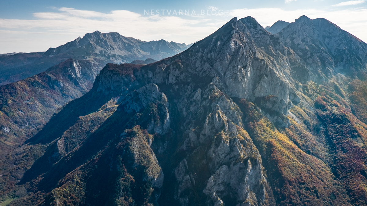
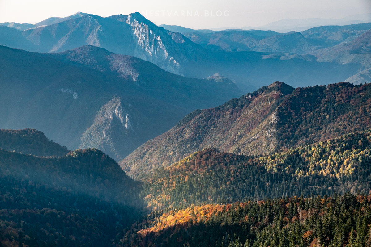
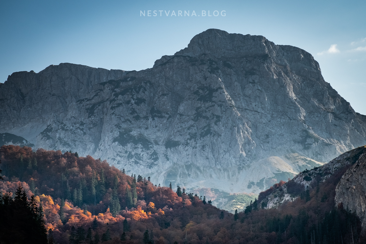
Mountain range that lies west of Durmitor, and stretches between deep river canyons of Piva and Sutjeska does not have a distinct name. In the mountaineering circles it is in the recent years often tagged as “BMV” – capital letters stand for Bioč, Maglić and Volujak. Bioč belongs entirely to Montenegro, while Volujak is almost entirely in todays Herzegovina.
The historical land of Herzegovina is de facto divided in 1878 in two entities. Eastern parts became part of the new country of Montenegro, finally liberated from the Ottoman rule. The other parts of Herzegovina went together with Bosnia to Austro-Hungarian rule. Many families from Piva and Nikšić found their summer pastures now across the border in another country. According to historian Miloš Vojinović, the border between the Danube Monarchy and Montenegro was very tough especially in the period 1906-1914. Ridge of Volujak was a military outpost of the Austro-Hungarian army (ruins of many artillery nests are visible to this date). The cavalry was situated in the small border town of Gacko. In order to solve the water supply issues for large number of military units in dry-karst-land of Herzegovina, Austrians constructed the dam with artificial lake of Klinje that exists until today.
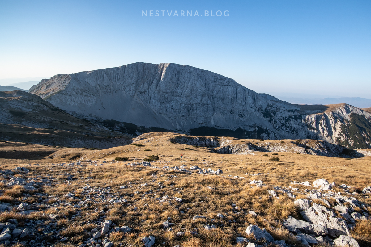
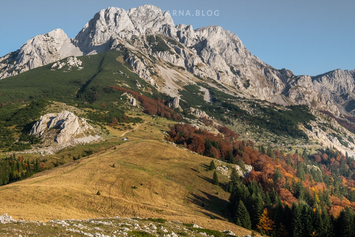
A closer look on the map says that biggest portion of the “BMV” range belongs to Bioč mountain. Its highest peak Veliki Vitao (2388m), is the highest within the whole mountain range. Other peaks of Bioč include Vrste, Nož, Bubreg.
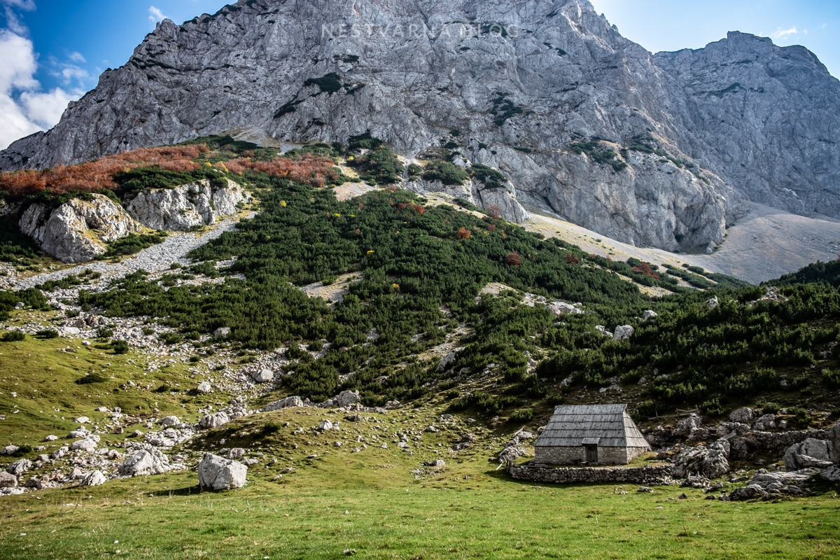
Bioč belongs to less visited parts of the Balkans. In order to reach its remote peaks, usually a long summer day is required. It is easier to come here from Bosnia Herzegovina than from Montenegro itself. Possible access points are valley of Papin Do near Čemerno, or the plateau of Prijevor just below Maglić.
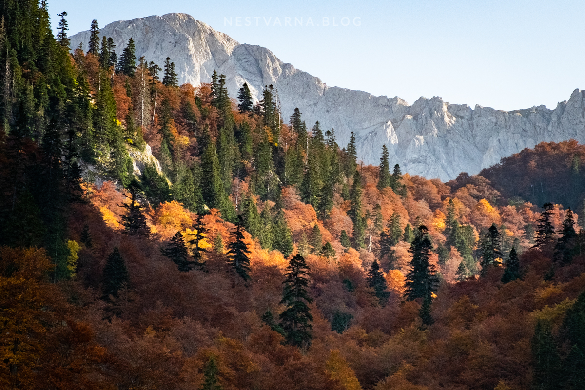
Bioč merges on Maglić (2386m) to the north – the highest peak of todays Bosnia and Hercegovina. Westernmost end of Bioč is the impressive ridge of Trzivka above the incredible Trnovačko lake. The glacier circus of the lake divides mountains of Bioč and Volujak.
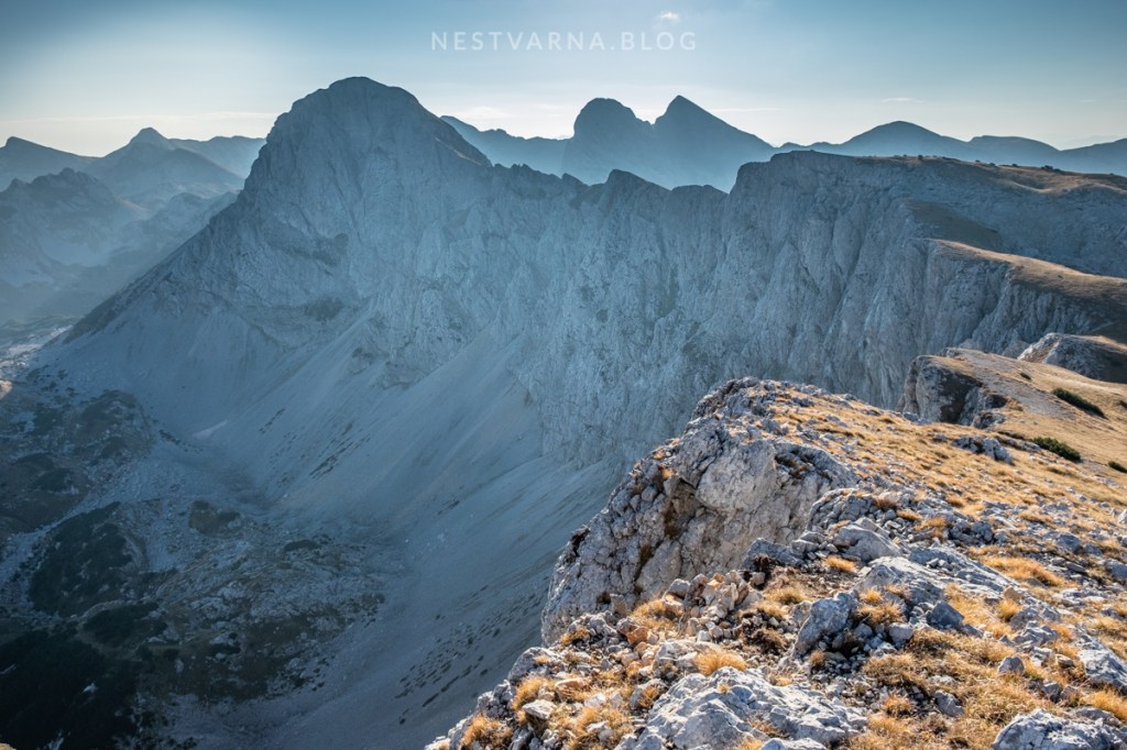
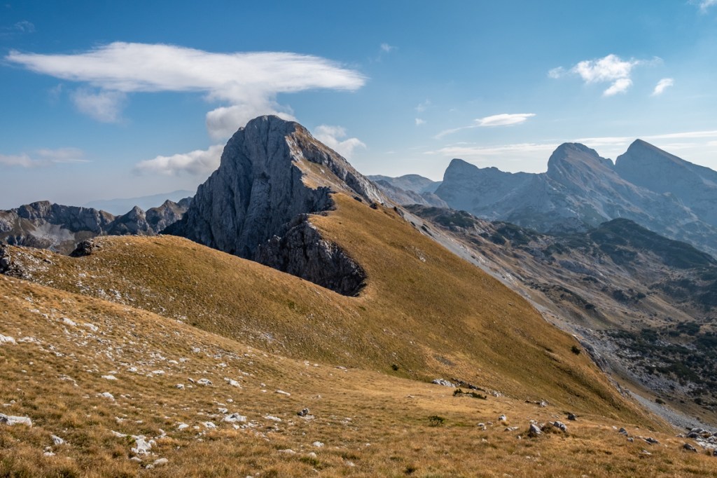
Volujak has a form of a greek letter Г. Its highest peak lies on its eastern edge – Velika Vlasulja (2336m).
Northern end of Volujak (Badnjine 2243m, Lica 2111m) divides deep river canyons of Suha and Sutjeska.
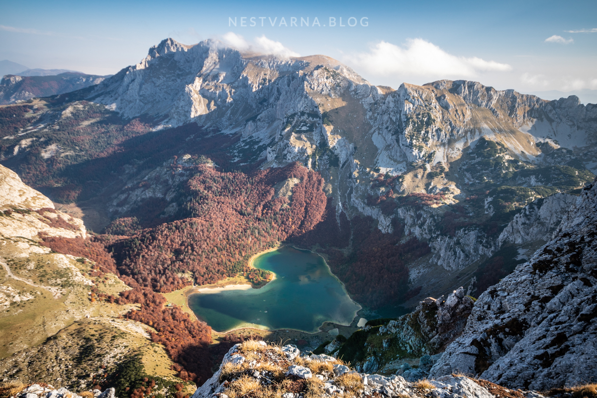
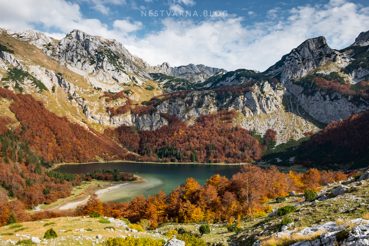
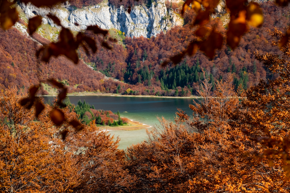
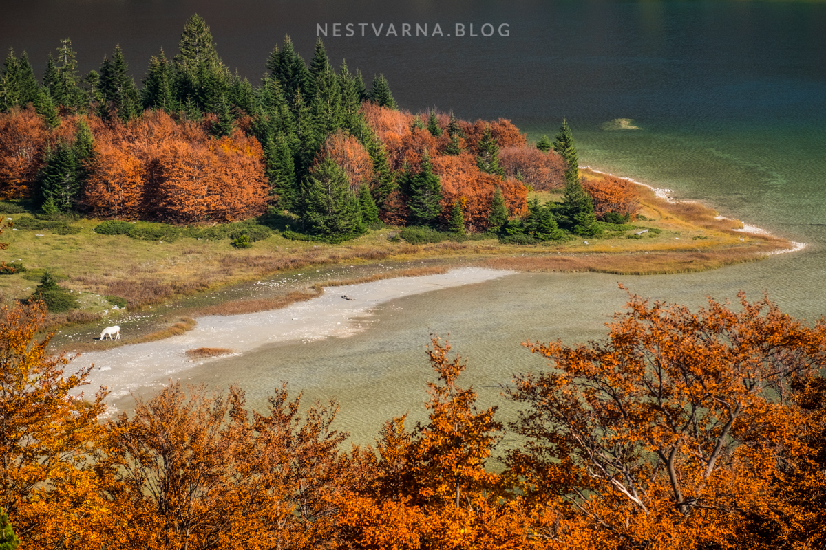
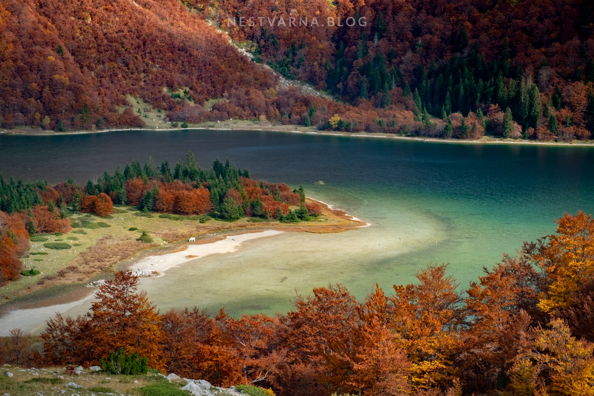
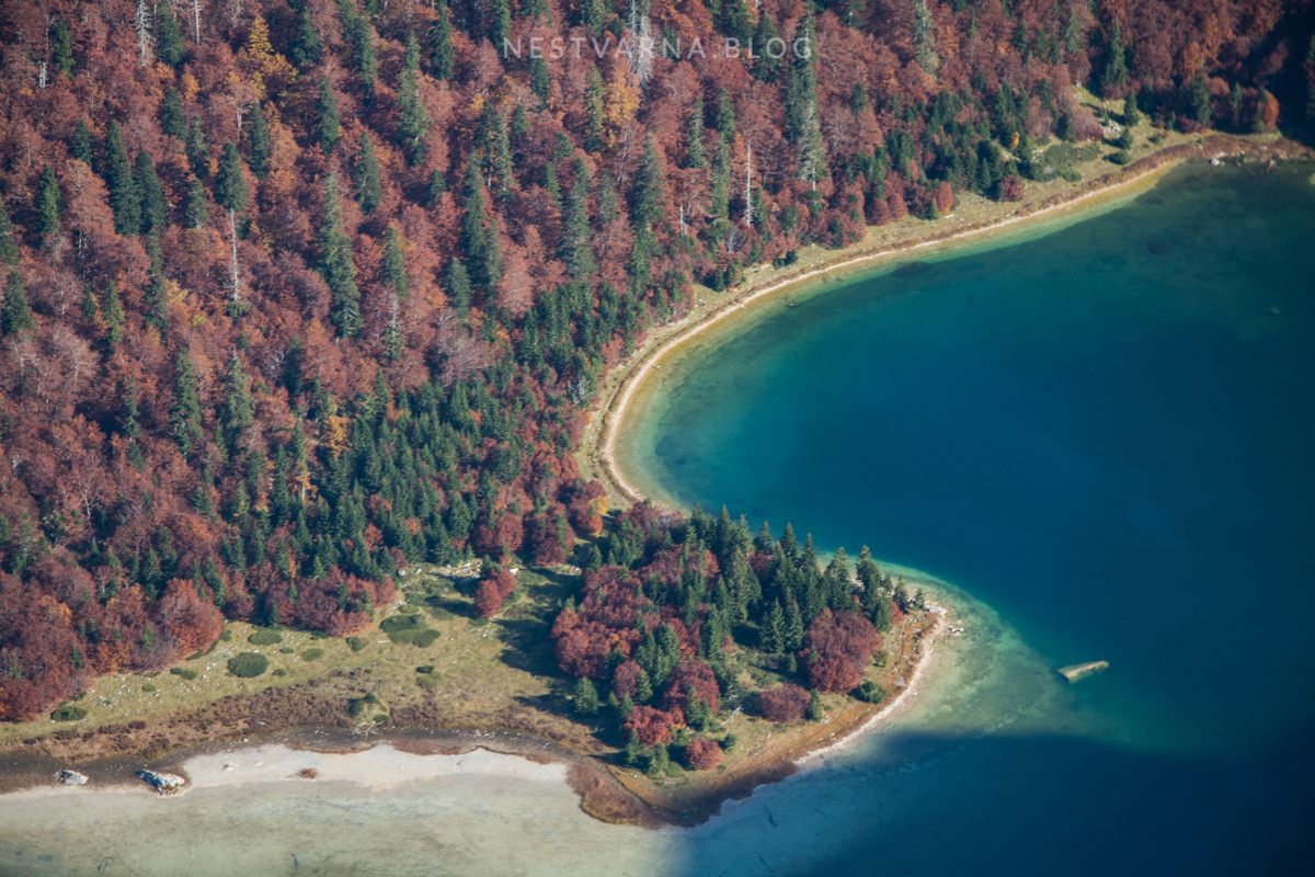
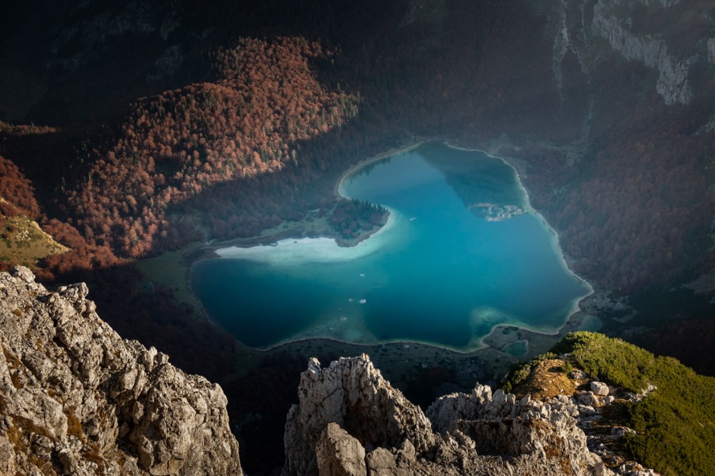
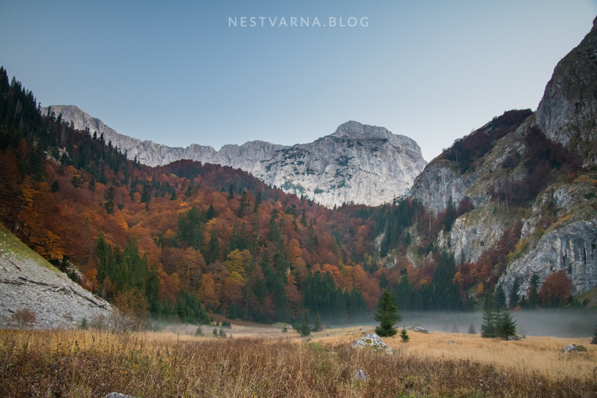
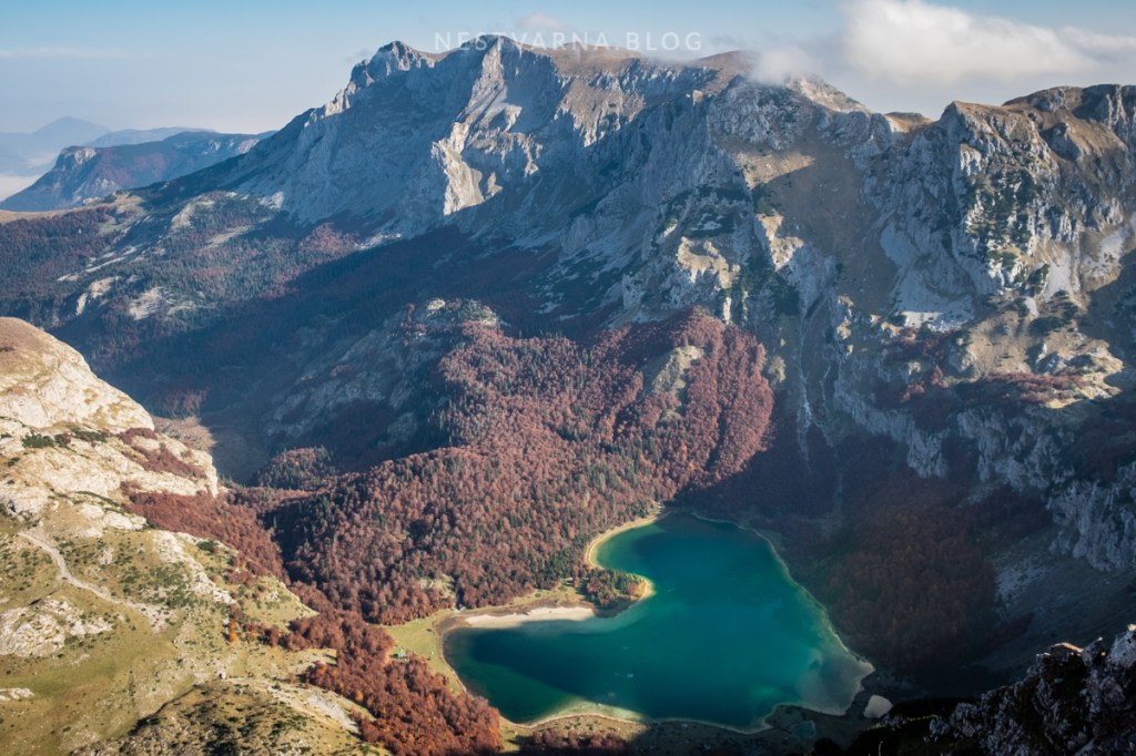
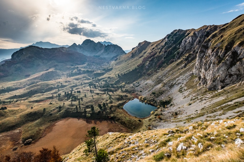
In the centre of the mountains of Maglić, Bioč and Volujak lies the incredible Trnovačko lake.
Thanks to its heart-shaped form, or maybe due to its emerald colour, Trnovačko jezero is truly unique. We were blessed to see it within the almost surreal scenery of the firing autumn colours.
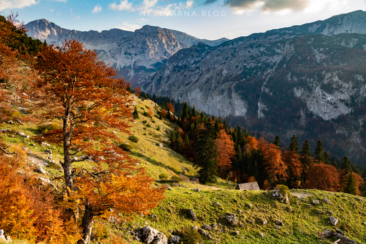
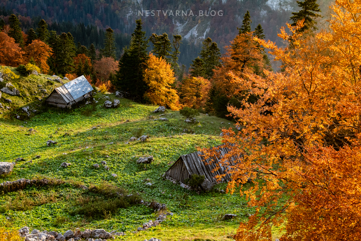
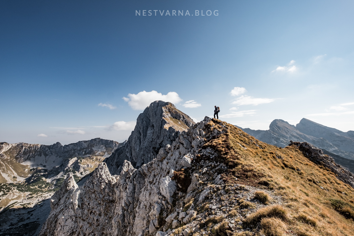
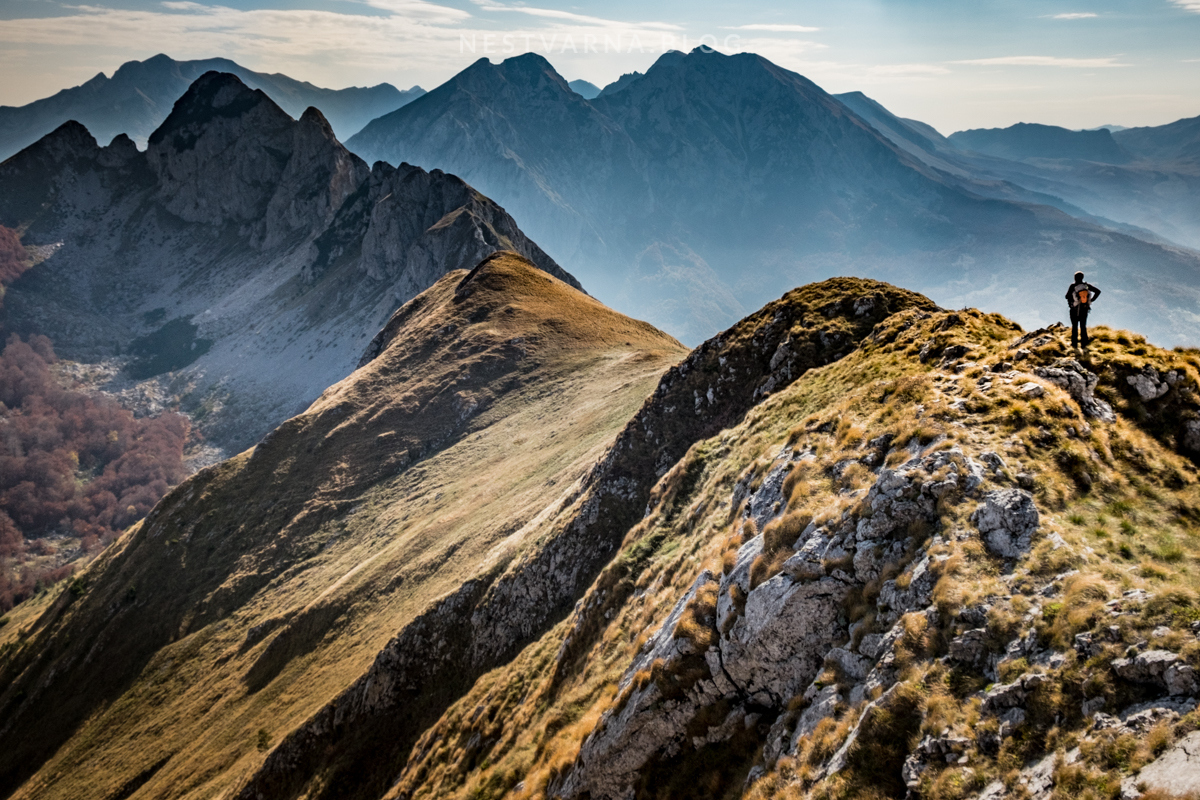
Our action plan was to reach the Trnovačko lake from Prijevor and to camp at the lake the following night. Next morning, before the sunrise, we hit the track to Trnovački Durmitor over Rudinske kolibe shepherd settlement. From Trnovački Durmitor (2242m) we continued along the ridge to Trzivka peak (2333m).
The road from Tjentište to Prijevor has dramatically improved in the last years. It encompasses Prerućica, one of last intact forests on the continent.

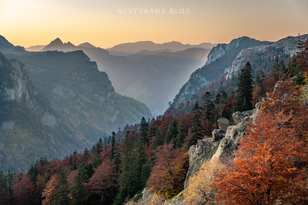
Walking path from Prijevor to Trnovačko jezero (total length 5 kilometars) starts in Bosnia and Herzegovina in the Sutjeska National Park and ends in Montenegro – in the Nature park of Piva. The paths goes above another incredible canyon in the Sutjeska national park – Suha river.
The hiking trail goes down to the moody dry-lake of Suva jezerina. Afte a short climb through the breech forest – Trnovačko lake finally appears.
It is a strenuous 2 hours hike from the lake to the iconic bird-eye view of the lake itself (the peak of Trnovački Durmitor). This path is barely marked.
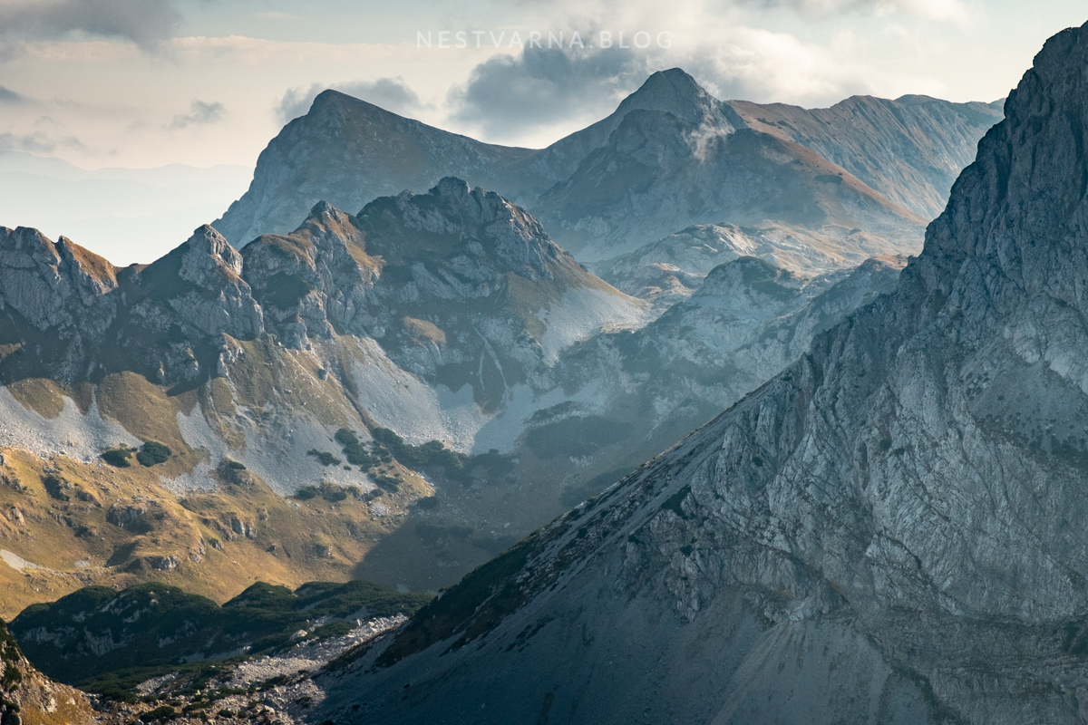
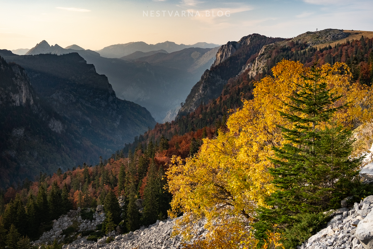
The ridge of Trzivka is quite attractive too. Views over the lake open at several spots but none matches that from Trnovački Durmitor.
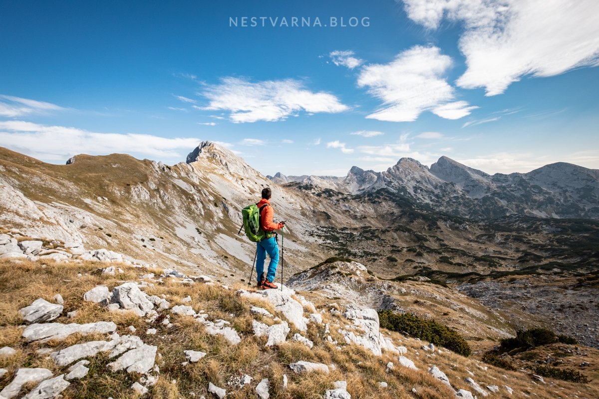
Back from Trzivka we went through Bojanska vrata pass that connects Bioč and Volujak. From Trnovačko lake back to Prijevor it took us another 2 hours. We saluted the sunset over the canyon of Suha and descended to Tjentište. The next morning we moved onto another side of the National park, to the mountain of Zelengora.
On the eastern slopes of Zelengora, in the heart of Sutjeska National park, lies the magical spot of Gornje bare.
What today looks like a tranquil peace of heaven on earth was place of a bloody battlefield in 1943. It is where the partisan forces of the new Yugoslavia managed to break the ring of German and Italian occupying divisons, however with huge losses.
The nearby grassy peak of Uglješin vrh is worth a short hike. Tremendous views open over Tovarnica and Planinica ridge, with Maglić and Volujak in the background.
Foča in Herzegovina and Plužine in Montenegro are two neighbour cities that are slowly being recognized as excellent bases for outdoor activities in this part of the Balkans.
Foča is the “capital of rafting” – with numerous camps located on just below famous Tara river (to be more precise, on the river Drina, that Tara and Piva are forming at their confluence in Šćepan polje).
Contrary to its wild and free sister Tara, a hydro-power plant was built decades ago on river Piva. The original settlement of Plužine was submerged due to construction of the plant, and transformation of river Piva into artifical lake. New town of Plužine was built on higher level, next to the new accumulation lake.
Plužine and its area is however becoming increasingly popular in the biking and touring communities. Inspiring panoramic roads depart from Plužine to nearby mountains and canyons.
Driving one of these roads was a perfect way to finish off this glorious journey in this part of Balkans. Route Plužine – Etno selo Izlazak – Đatlo bridge – Dubljevići – Boričje – Plužine combines some beatiful viewpoints over the Piva canyon with lonely mountain landscape of Pivska planina. Unique medieval necropolis of “stećci” are also to be found en route.

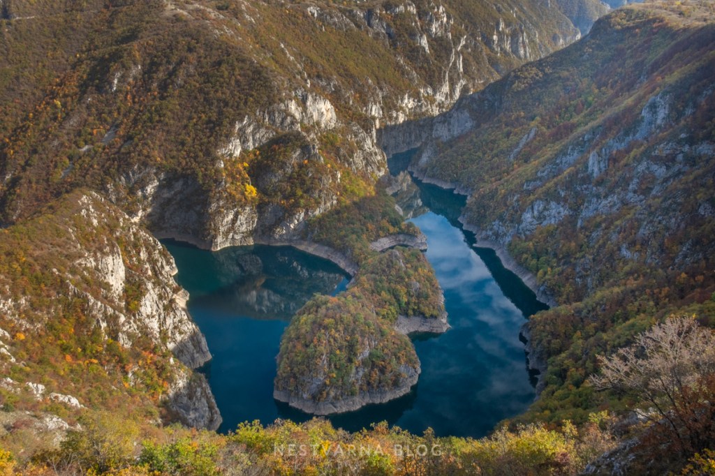
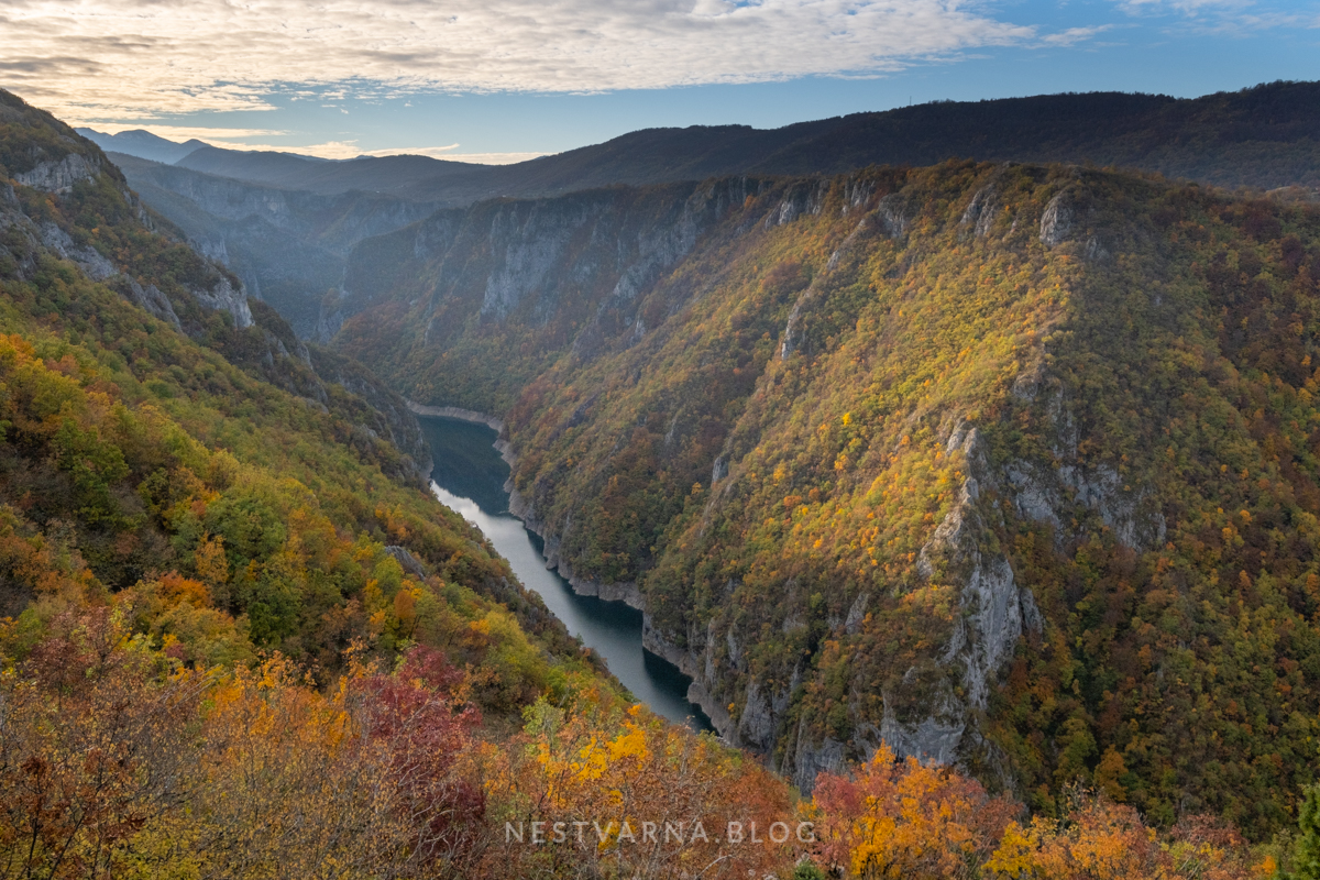
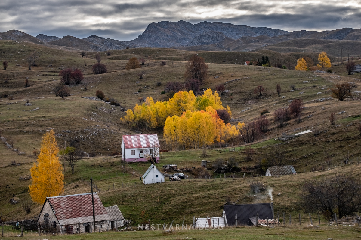
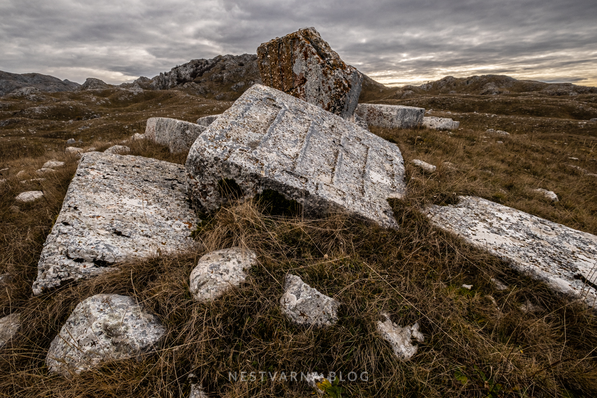
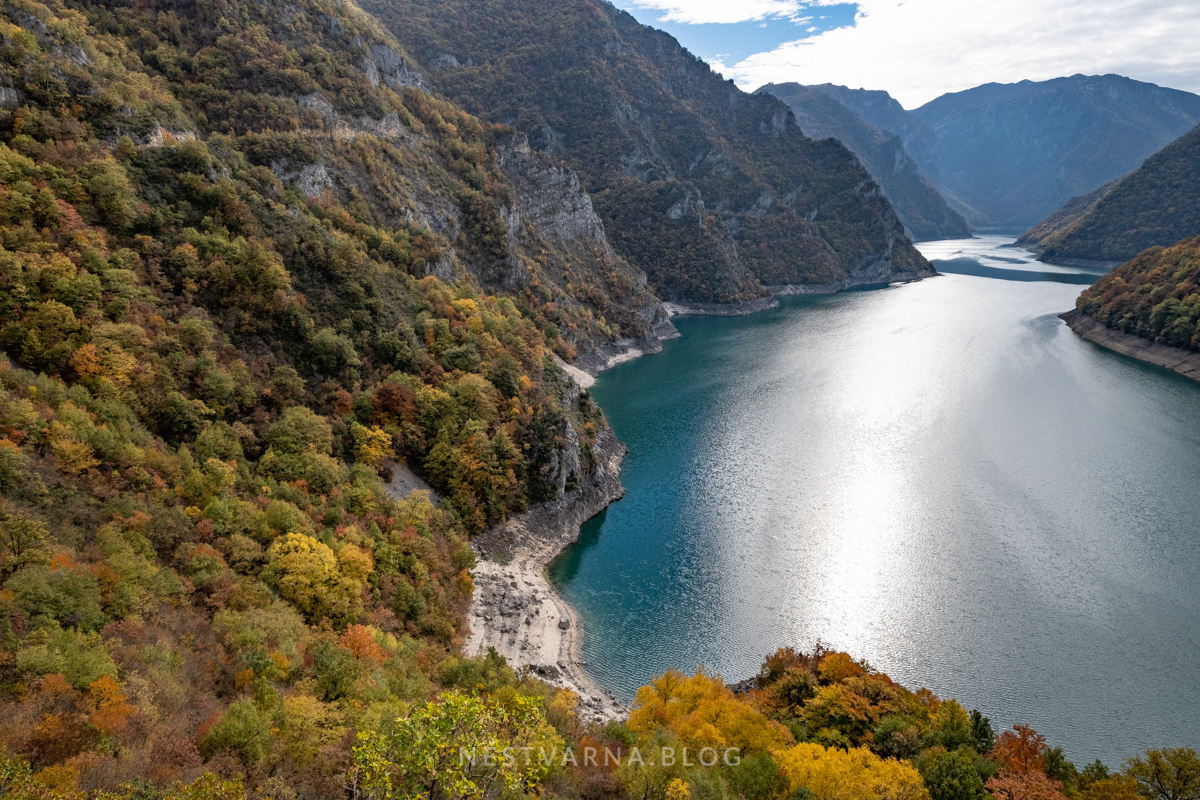
Photo Credits: Nebojša Atanacković and Goran Stamenković.
Wikiloc:
Gornje Bare – Uglješin Vrh – Tovarnica – Planinica – Gornje Bare.
