
Troca se uma libra de canela por uma libra de ouro. O cravo, especiaria e medicamento contra a dor de dentes, chega a ser ainda mais caro. As outras embarcações, vindas de Antuérpia, de Génova, das terras hanseáticas e sabe-se lá mais donde, levarão as mercadorias compradas em Lisboa ate portos longínquos para se revender a retalho ainda mas caras…
Dejan Tiago Stanković – Contos de Lisboa.
In early June 2026, I found myself in the Azores, following the winds that once shaped the course of global trade. Today, this remote archipelago of nine volcanic islands lies far from the world’s busiest shipping lanes, yet for centuries it occupied a pivotal position on the great maritime routes since the Age of Discovery and well into the nineteenth century.
The name Azores comes from the Portuguese word açor, meaning “goshawk.” These islands, known in Portuguese as Os Açores, became an indispensable stop for vessels returning from South America, Africa and India, even though they were not always the most direct point on the map.
In the age of sailing ships, sea routes were dictated not by distance but by the wind. So influential were these prevailing air currents that they eventually lent their name to one of the most familiar terms in maritime history: the trade winds.
Early navigators learned that north of the Equator the prevailing westerlies carried ships eastward before gradually bending towards Europe. On outward voyages from Europe to the Caribbean or India, captains steered south, hugging the African coast and calling at strategic ports such as Madeira, the Canary Islands and Cape Verde. The return journey followed a very different pattern. Ships ventured far into the open Atlantic before allowing the westerlies to sweep them back towards Europe via the Azores.
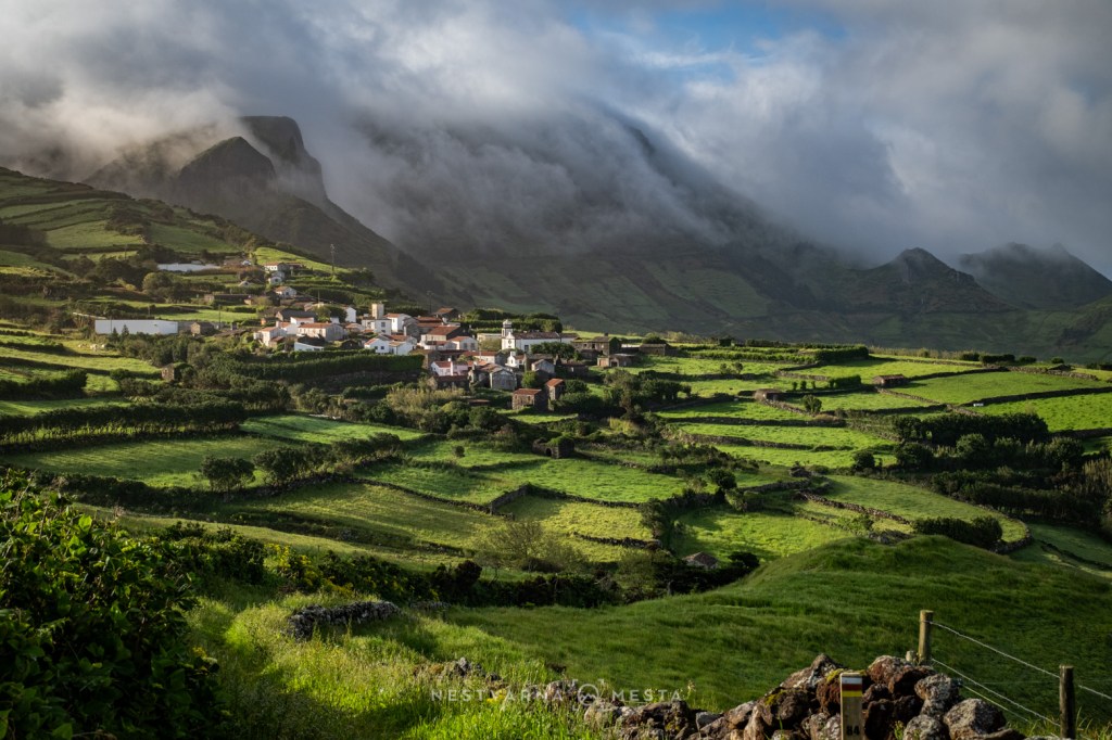
This is how a scattering of seemingly insignificant islands in the middle of the Atlantic became one of the world’s great maritime crossroads. At the very least, ships needed somewhere to replenish their supplies of fresh water before continuing the long voyage between the Old World and the New. The Azores offered that in abundance. Freshwater springs emerge from volcanic rock across the islands, nourished by a climate where spring seems to last forever.
The Azores are anything but compact. Instead, the islands are scattered across a vast stretch of the Atlantic Ocean. Today they are linked by small turboprop aircraft whose operations remain highly dependent on the weather. Atlantic conditions are notoriously unpredictable, while many island runways lie beneath hills that are frequently wrapped in cloud and mist. Flying for SATA Air Açores is clearly a profession that demands exceptional skill. After every landing, the applause from passengers feels entirely justified.
The archipelago is traditionally divided into three island groups. Closest to Europe—and also the largest and most populous—is São Miguel, accompanied by its smaller neighbour, Santa Maria.
About an hour’s flight farther west lies the Triângulo (“Triangle”), formed by the neighbouring islands of Pico, Faial, and São Jorge, all connected by regular ferry services. Slightly farther north stands Terceira, the “third island,” now second only to São Miguel in both size and historical importance.
Far beyond them, on the extreme western edge of the archipelago — o extremo occidente— lie the tiny islands of Flores and Corvo. Resting on the North American tectonic plate, they are geographically closer to another continent than to mainland Europe.
The Azores owe their existence to the meeting of tectonic plates, one of the most active volcanic regions in the Atlantic. Every island in the archipelago was born of fire. Even today, volcanic caldeiras—many transformed into tranquil lakes known as lagoas—remain among the defining features of the landscape.
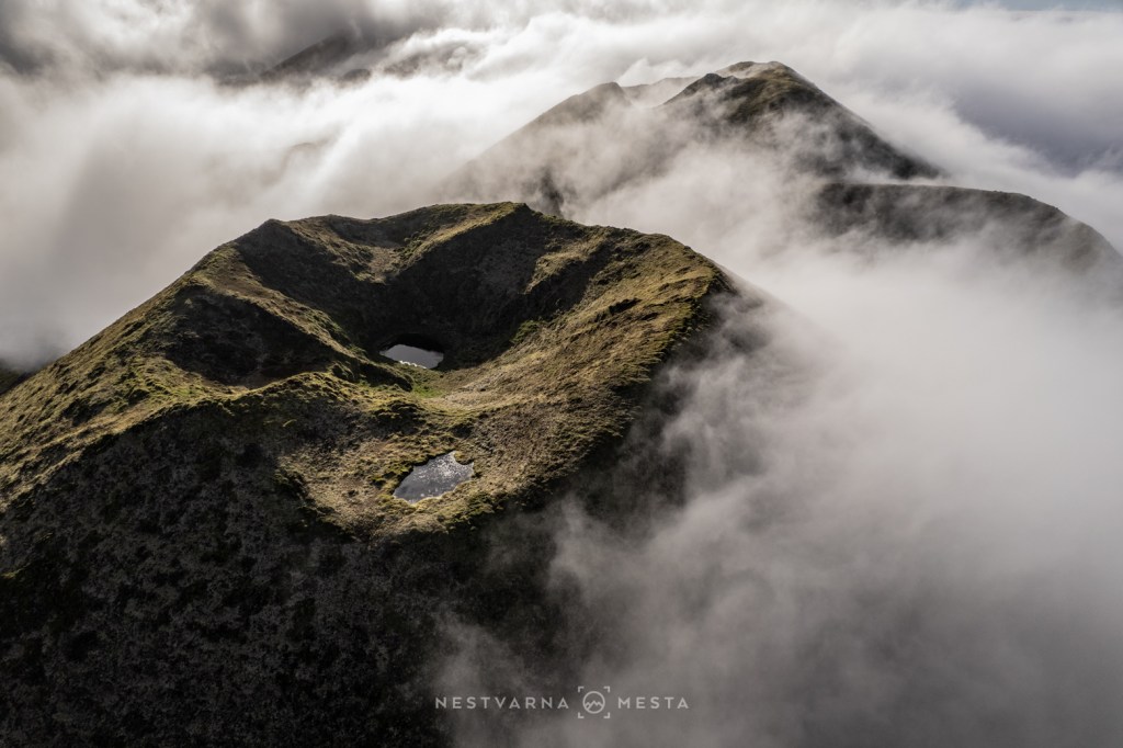
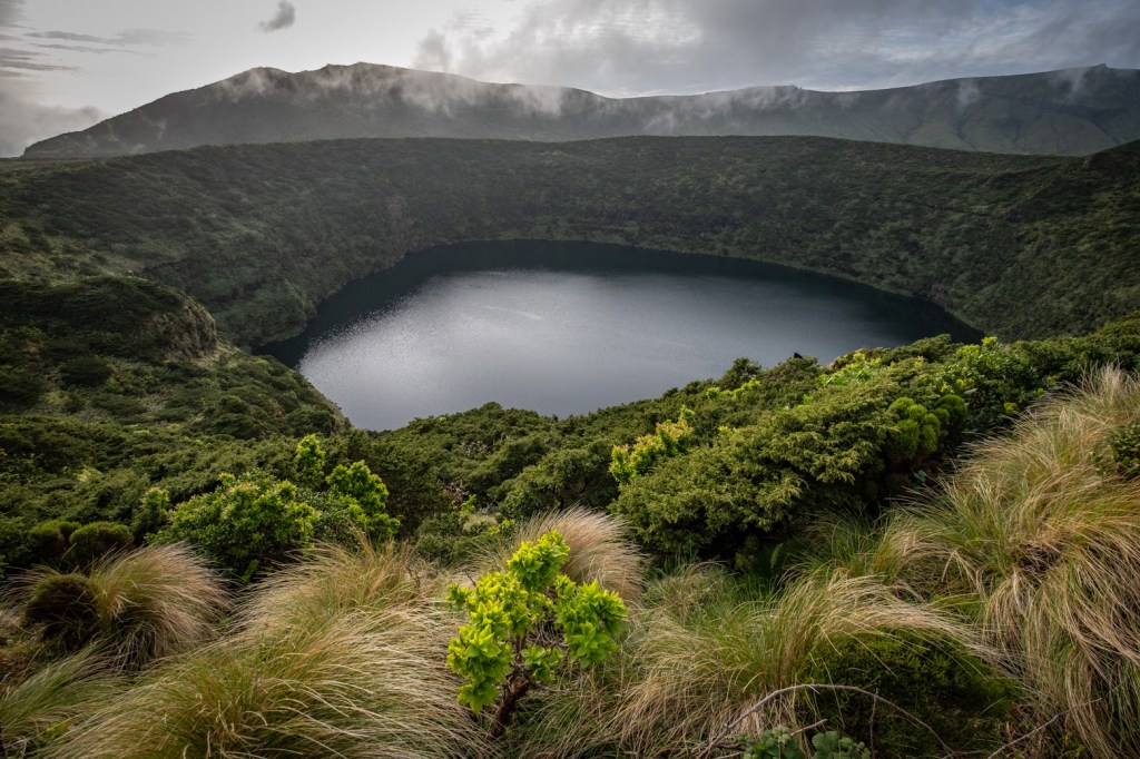
Learning to Travel at the Atlantic’s Pace.
The Portuguese sometimes call the Azores Ilhas de Bruma — the Islands of Mist — and with good reason. I wrote the opening lines of this journey on the remotest island of them all, Corvo, where persistent Atlantic weather stranded me for three unexpected days as cancelled flights grounded all plans. And this was only the beginning of June.
Travelling through the Azores demands careful planning. My itinerary included eight flights, three ferry crossings and four rental cars. Yet all it takes is the cancellation of a single flight for the entire schedule to unravel. Here, even the best-prepared itinerary can quickly become an exercise in patience, adaptability and improvisation.
With the exception of São Miguel, the “real” Azores deserve at least two weeks. These are not islands to be rushed. The secret is to embrace their slower rhythm and accept that plans are often rewritten by the weather. Even when everything runs smoothly, the Atlantic usually offers far more cloud than sunshine. A volcanic crater or a spectacular waterfall may remain hidden behind dense mist for an entire day.
Weather forecasts are of limited value here. What proves far more useful are the live webcams and weather radar, which often provide the only chance of catching a brief window of sunshine.
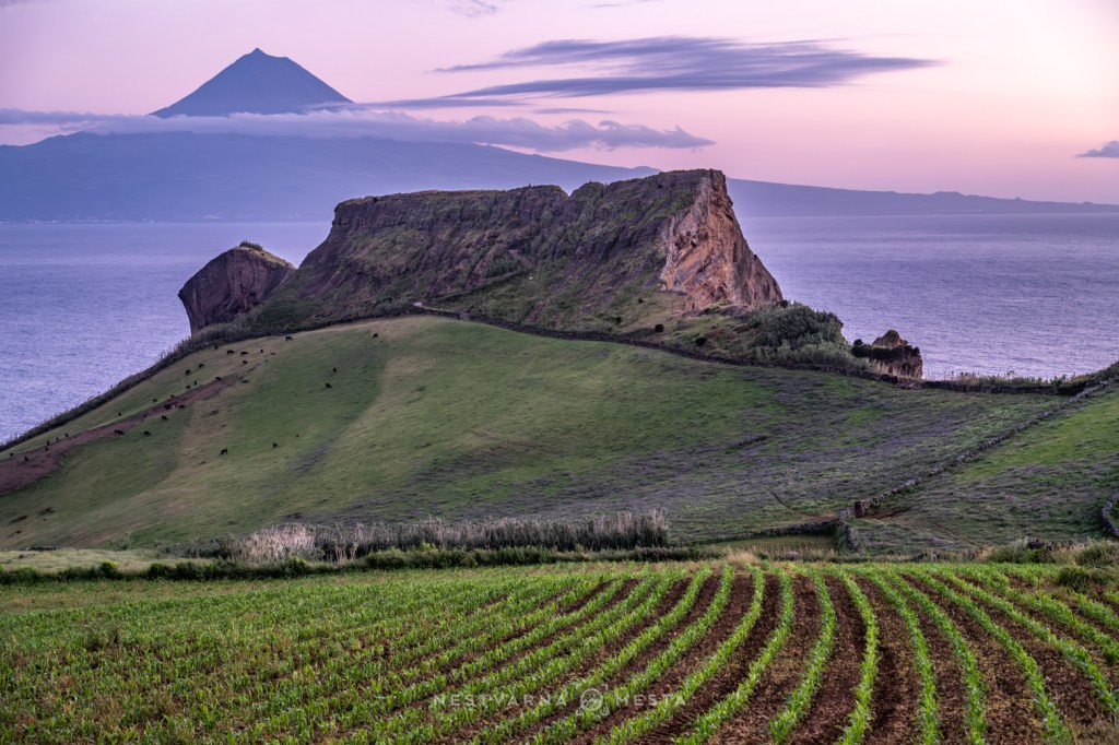
The landscape follows a familiar pattern from one island to another. Broad volcanic plateaus, punctuated by calderas and crater lakes, suddenly give way to towering cliffs that plunge into the Atlantic.
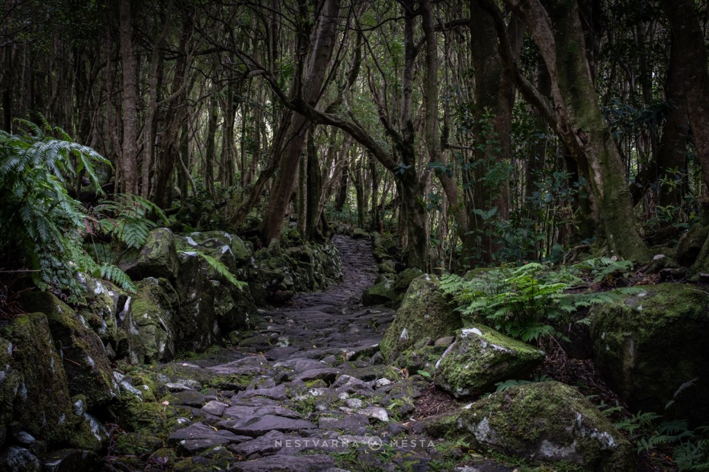
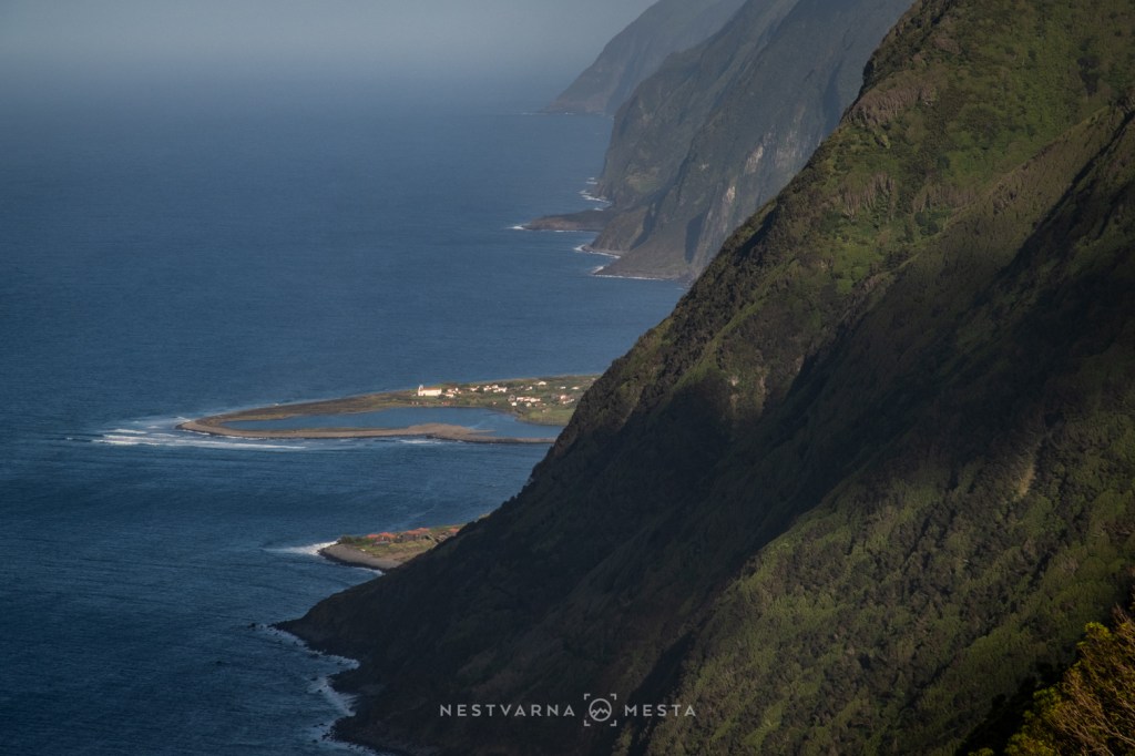
The remarkably humid climate has created lush subtropical vegetation unlike anywhere else in Europe. The islands seem to exist in a perpetual spring: cool rather than warm, damp rather than dry, and astonishingly green throughout the year.
One side of an island may disappear beneath heavy cloud while the opposite coast basks in brilliant sunshine. More often than not, it is only late in the afternoon that the skies finally begin to clear.
Despite the logistical challenges and unpredictable weather, the outer Azores are a paradise for patient photographers, hikers and anyone seeking solitude far from crowded tourist destinations.
Over twelve days I explored five islands, concentrating on the central group — the Triângulo — and the remote western islands known as the Extremo Occidente. I spent most of my time on Flores and the least on Faial.
Each island revealed a different face of the Azores.
Ilha das Flores.
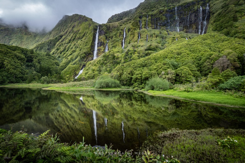
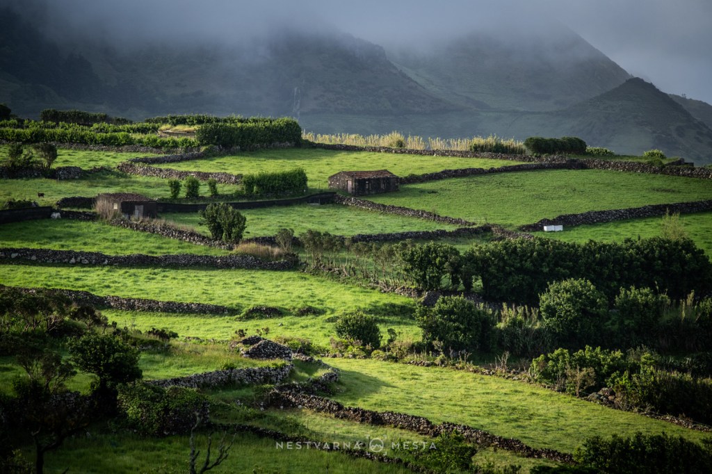
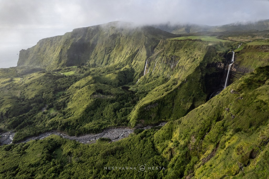
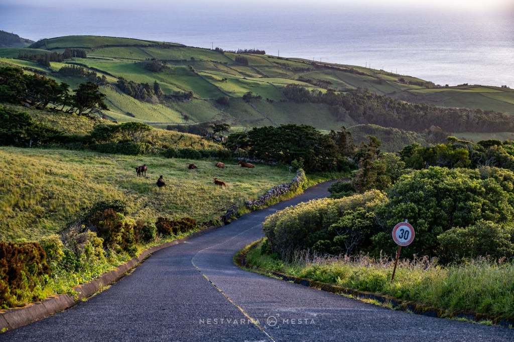
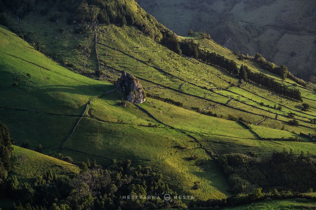
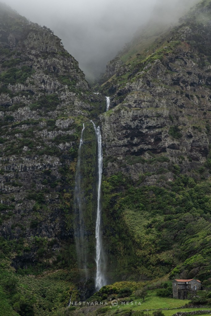
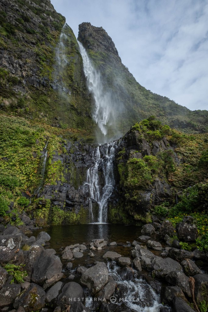
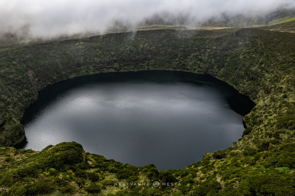
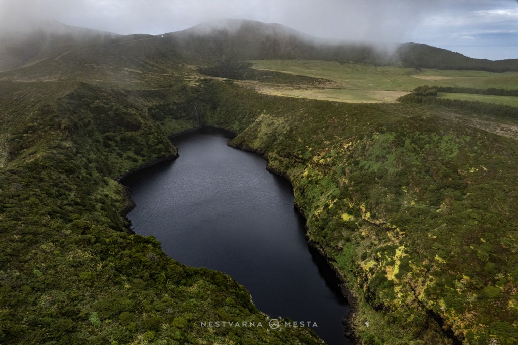
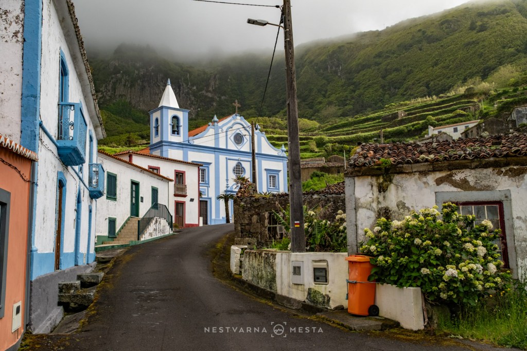
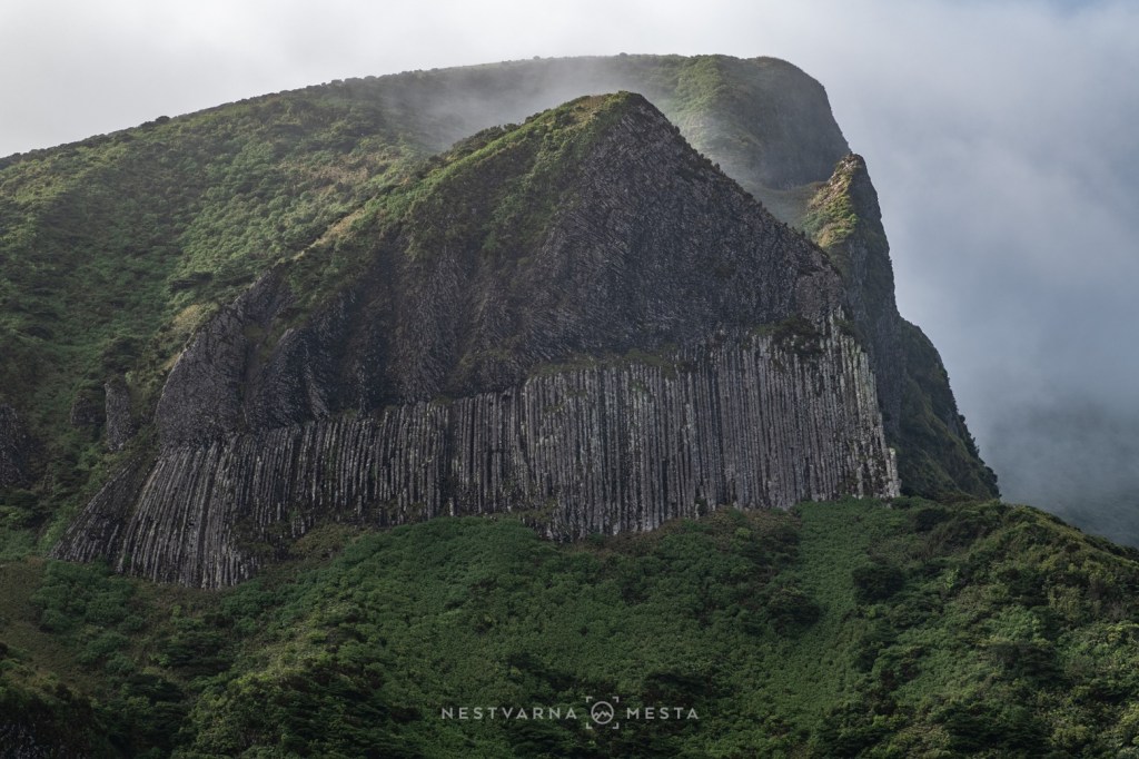
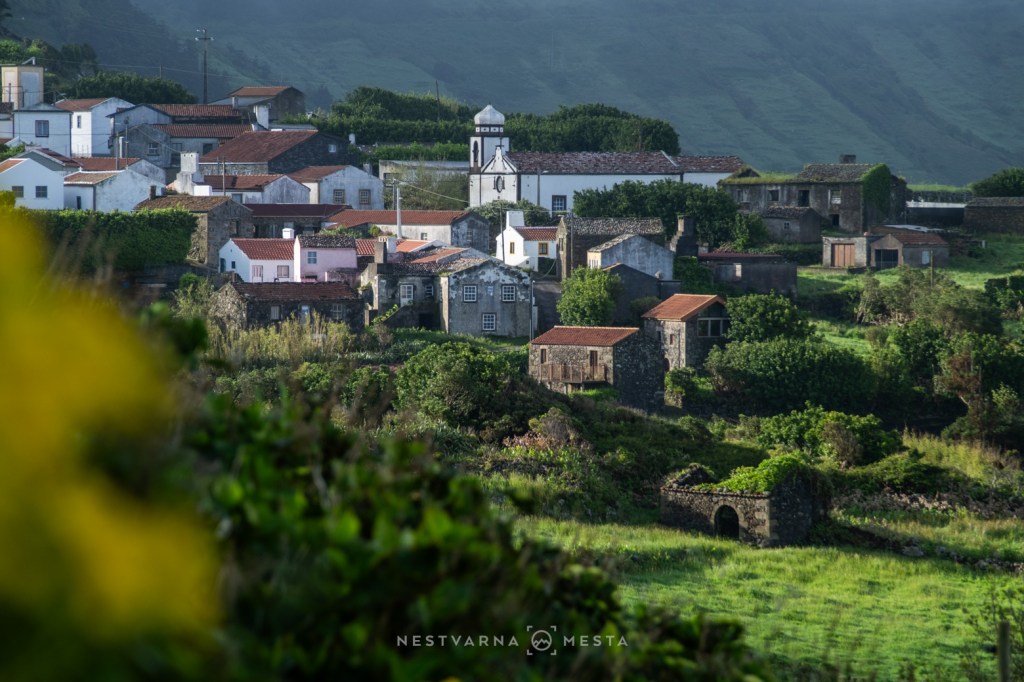
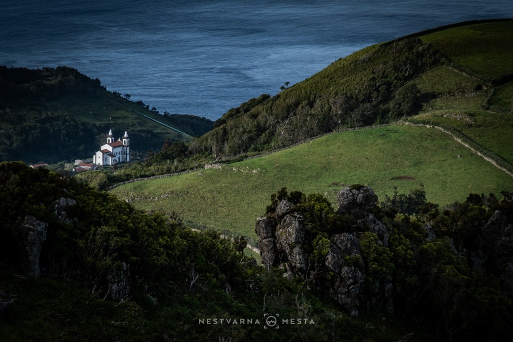
Flores — quite literally the “Island of Flowers” — is the Azores in miniature. Waterfalls tumble from towering cliffs, volcanic lakes shimmer beneath drifting clouds, emerald pastures stretch across the hillsides, and every shade of green imaginable seems to exist here.
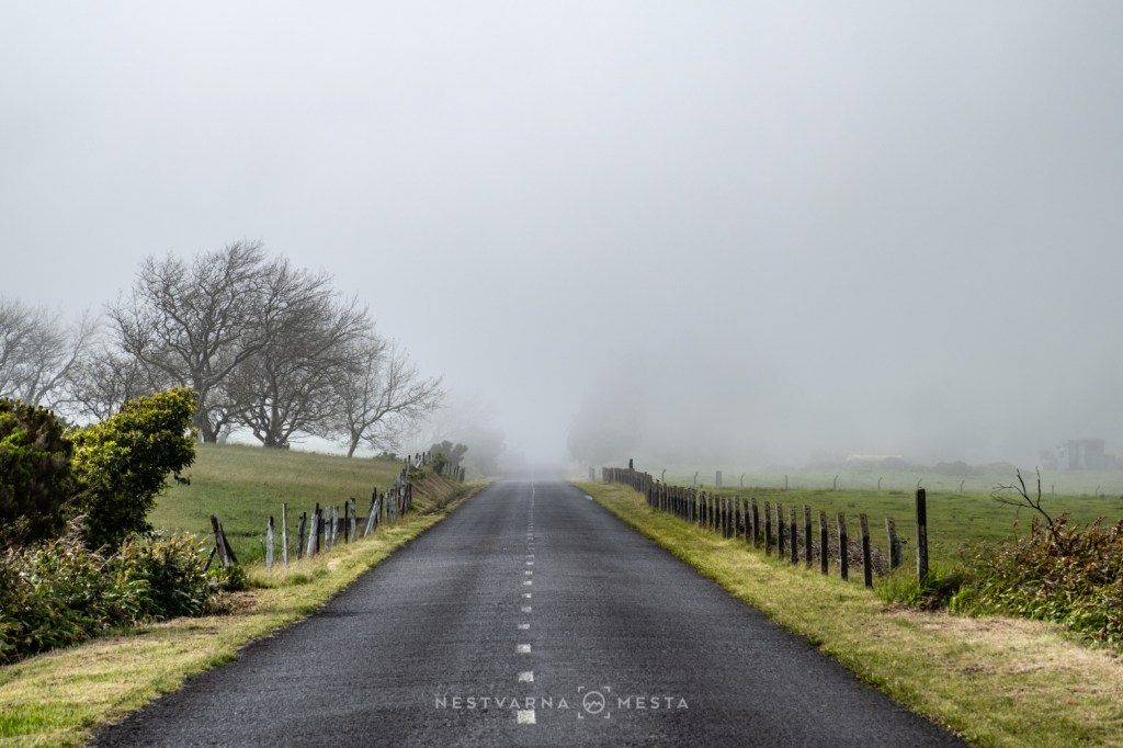
For four days I found myself engaged in a quiet battle with low cloud and persistent fog (nevoeiro), waiting for the landscape to reveal itself. Capturing photographs on Flores requires patience above all else. Reaching the island had already been an adventure. It involved three separate flights, all completed within a single day from Belgrade — something that still feels slightly unbelievable.
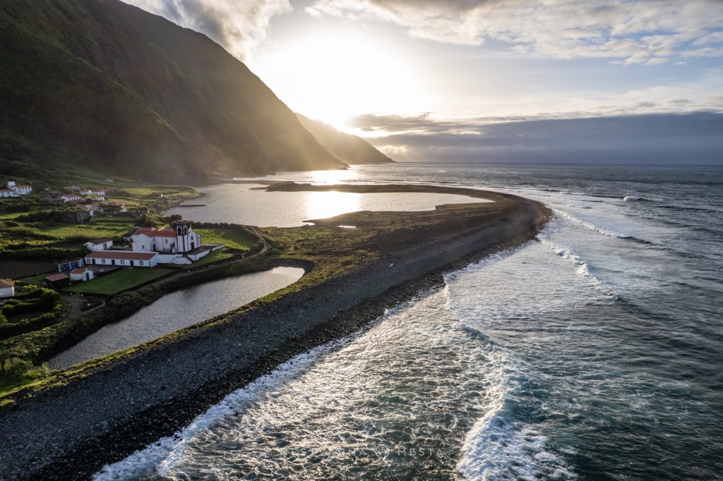
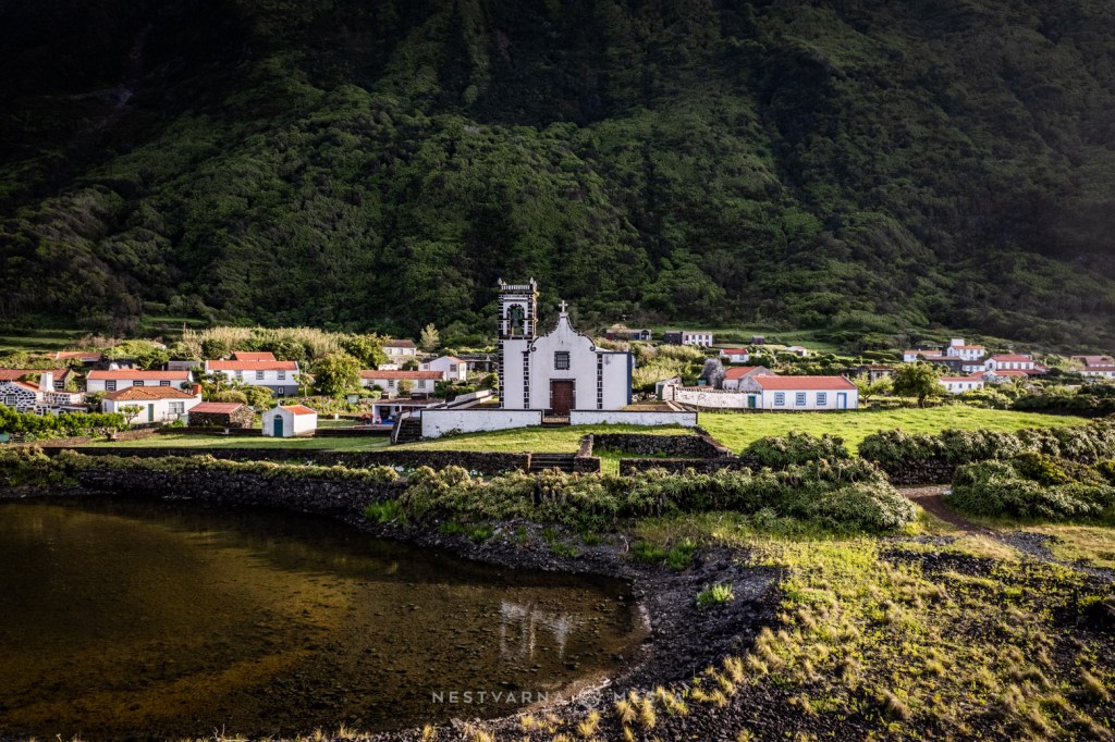
Thousands of years ago, lava and volcanic ash poured into the Atlantic, creating unexpectedly flat coastal platforms enclosed by dramatic cliffs. Locally these formations are known as fajãs vulcânicas. Similar platforms formed by landslides rather than lava flows are called fajãs detríticas.
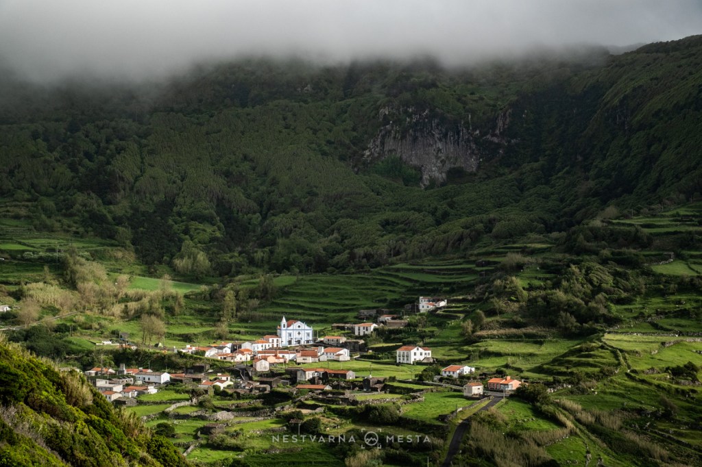
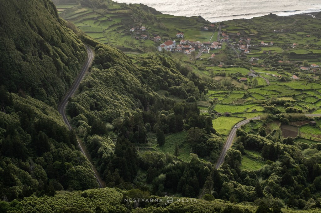
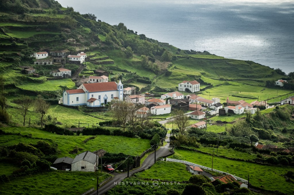
While São Jorge is renowned for its spectacular fajãs detríticas, Flores possesses two equally remarkable examples: the volcanic Fajã Grande and the erosional Fajãzinha, both framed by towering cliffs that seem to belong to another geological era. Completing the scene are some of the most impressive waterfalls in the Azores, led by the magnificent Cascata da Ribeira Grande.
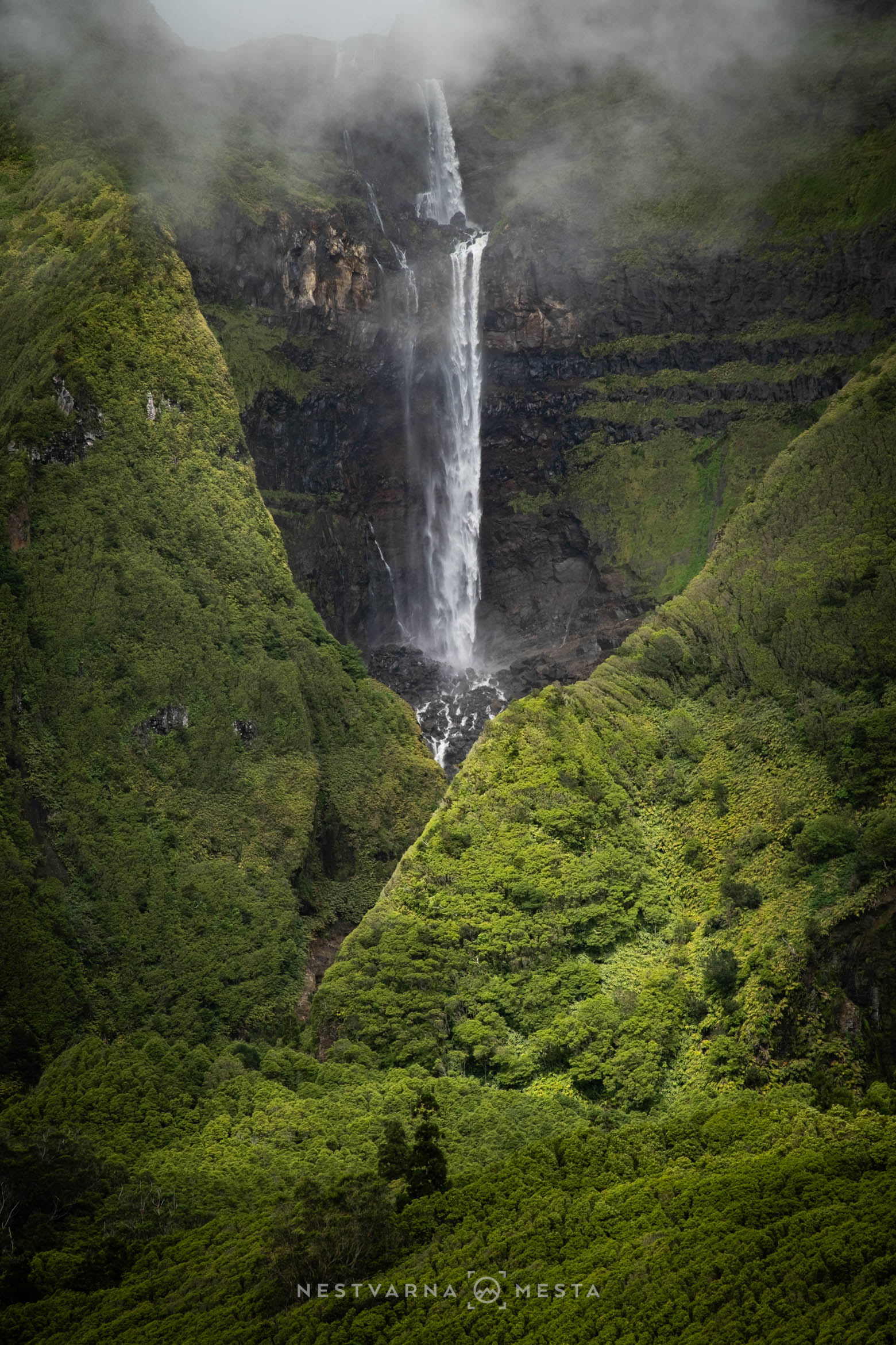
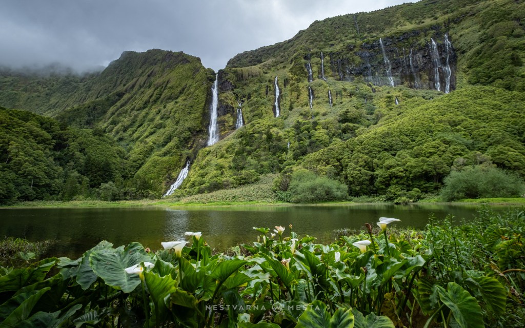
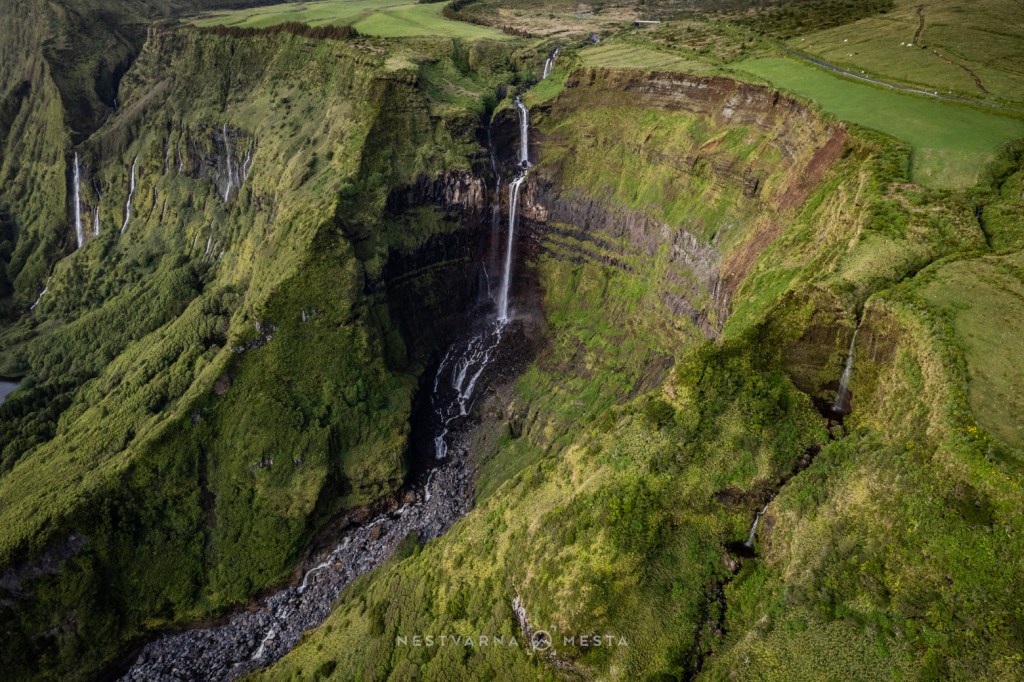
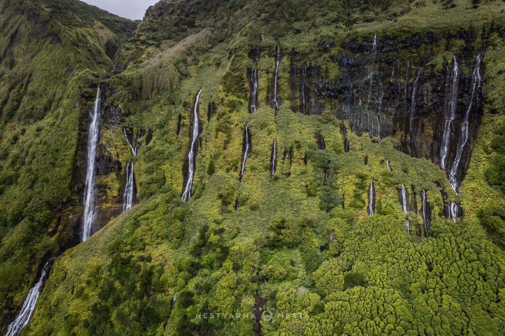
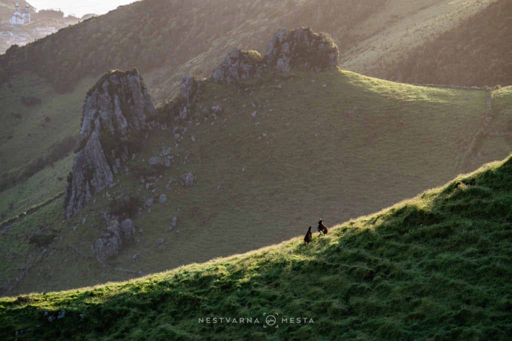
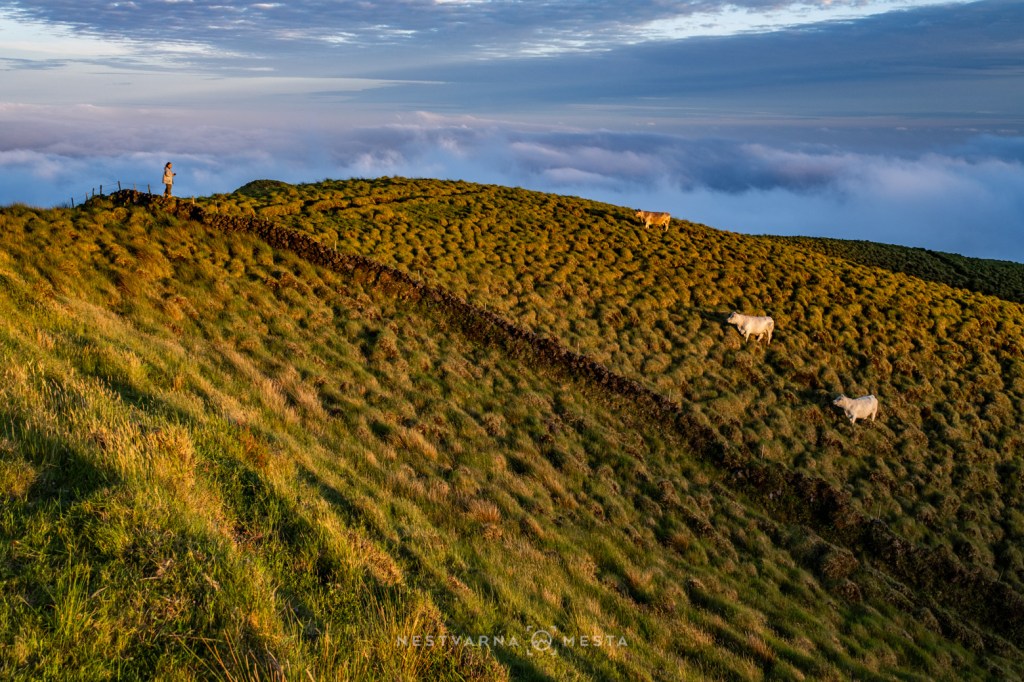
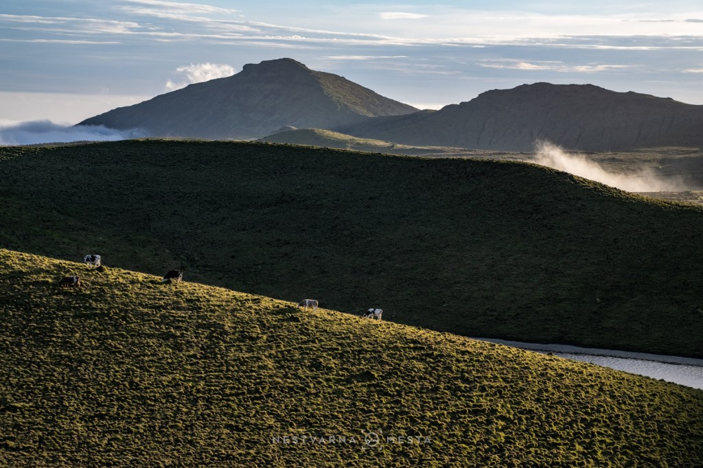
The heart of Flores is a vast volcanic plateau (planalto) that spends much of both day and night hidden beneath a blanket of cloud. Conditions are too harsh for permanent settlements, yet ideal for grazing cattle.
Several ancient calderas now hold peaceful crater lakes. Caldeira Funda and Caldeira Rasa lie in the south, while Caldeira Negra, Caldeira Comprida and Caldeira Seca occupy the northern part of the plateau.
From these highlands, the valley of Além da Fazenda descends towards the sea. It was carved by immense rivers of molten lava that once flowed across the island, gradually sculpting the dramatic landscape visible today. Elsewhere, the plateau ends abruptly in sheer cliffs dropping hundreds of metres into the Atlantic.

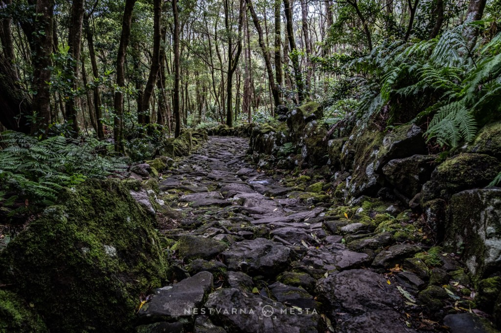
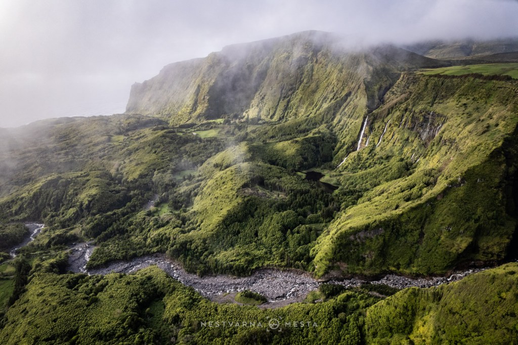
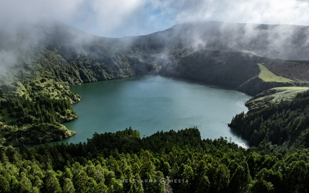
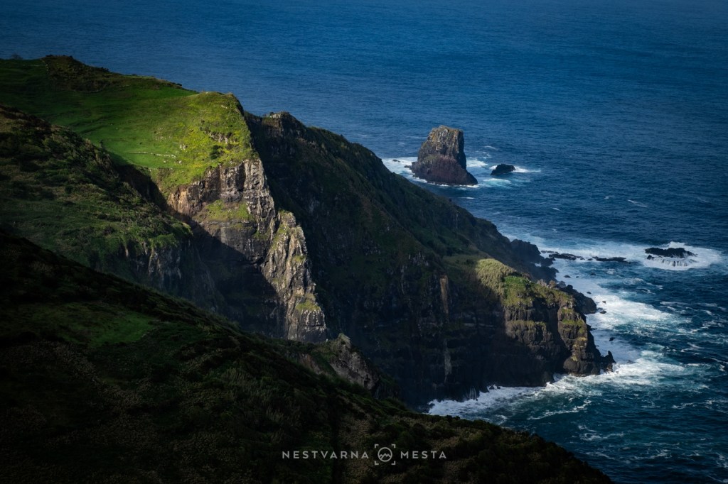
From Flores I boarded a small aircraft bound for Corvo. With a flight time of barely twenty minutes, it is said to be one of the shortest scheduled flights anywhere in Europe.
Corvo – Where the Atlantic Takes Over
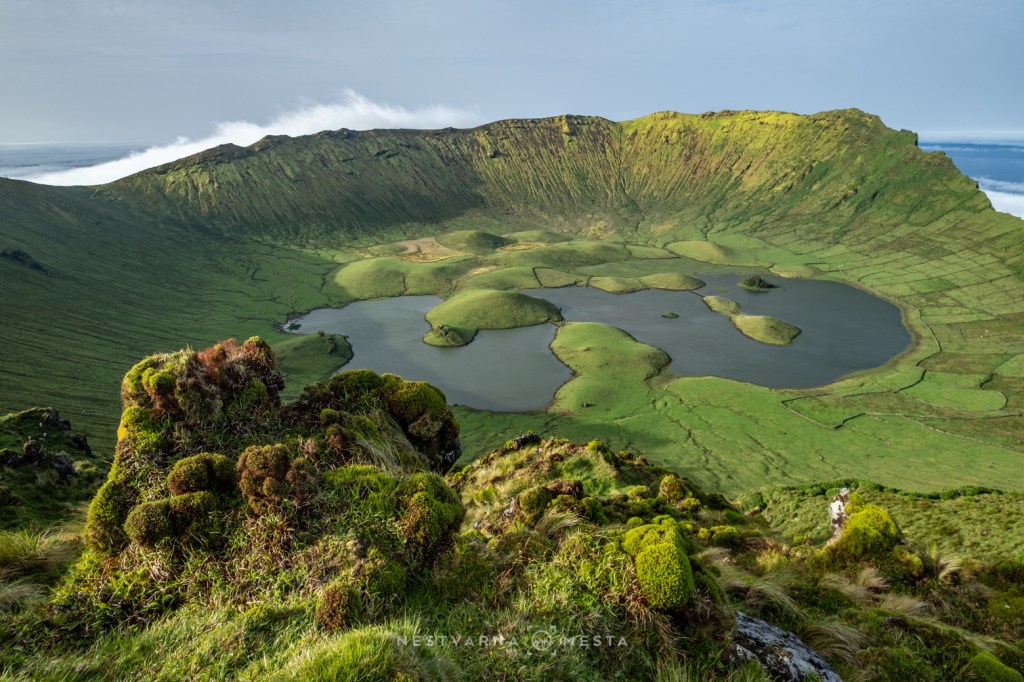
Corvo is little more than a speck in the vastness of the Atlantic Ocean. Exposed to weather systems rolling in from the west, the island seems perpetually wrapped in low cloud, drizzle and mist. Seeing the sun on Corvo gradually began to feel less like a possibility and more like wishful thinking.
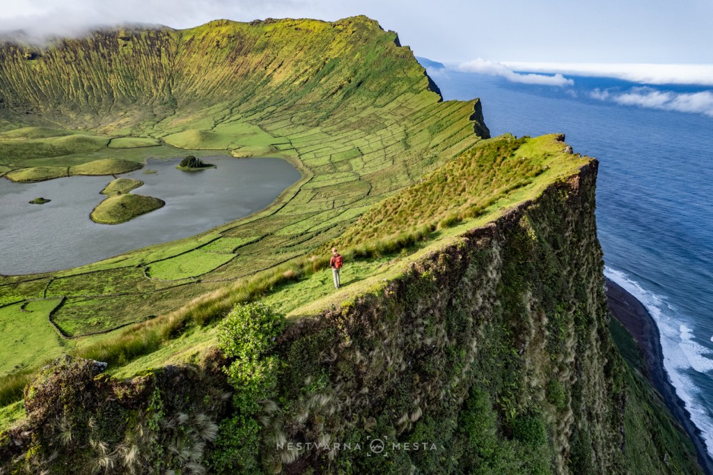
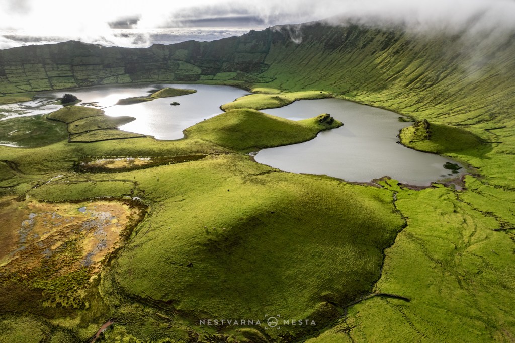
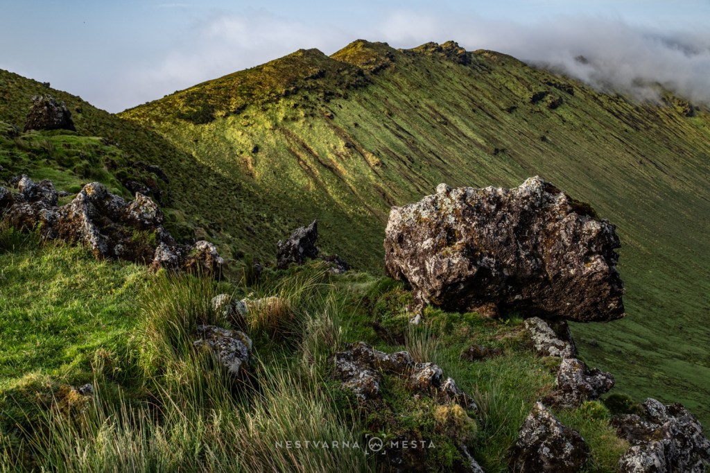
In reality, the island is nothing more than the summit of a colossal stratovolcano. Rising abruptly from the ocean floor, Caldeirão—literally “the Great Cauldron” — dominates every aspect of the landscape. The only place where a settlement could ever take root is a narrow volcanic platform along the southern coast. There, pressed between the sea and the cliffs, lies Vila do Corvo, a compact fishing village that is still home to barely four hundred people.
There is something deeply moving about staying on Corvo. Its extraordinary beauty is matched only by its profound sense of isolation. When flights are cancelled day after day because the runway remains hidden beneath low cloud, the island begins to feel less like a destination and more like a world of its own.
For three days I remained stranded on an island barely six kilometres long, watching the sky, waiting for the fog to lift.
Only on the evening of the third day did Caldeirão finally reveal itself. I struggle to remember another moment in my travels that brought me such uncomplicated happiness.
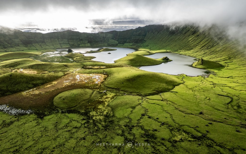
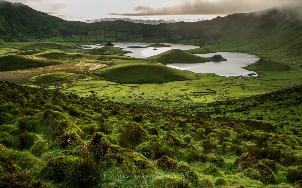
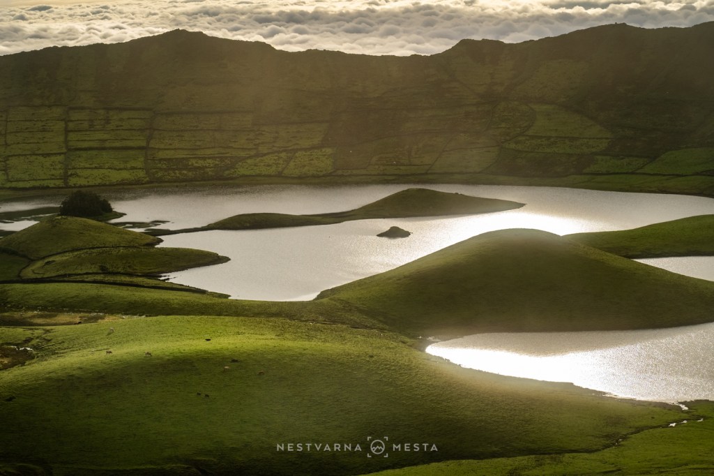
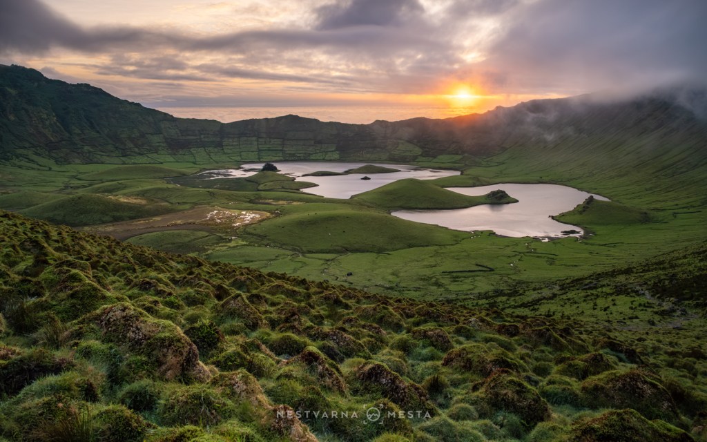
The following morning I walked the narrow rim separating the immense volcanic crater from the Atlantic Ocean below. It was, without question, the defining moment of the entire journey.
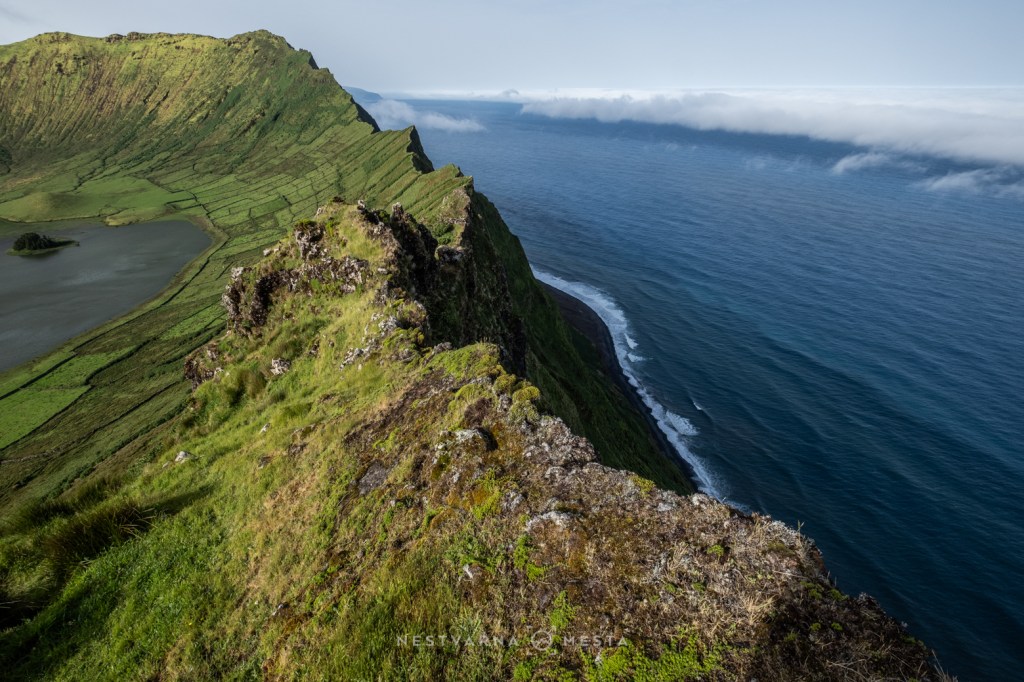
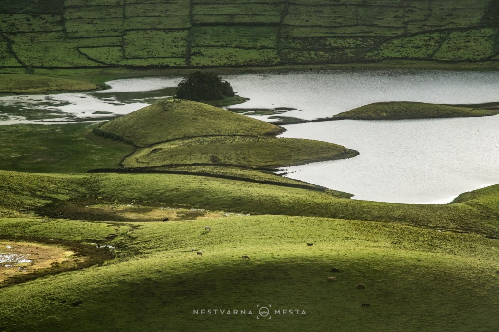
Today, Corvo is home to more cattle than people. Seen from above, Caldeirão resembles Noah’s Ark adrift upon the Atlantic. Its towering crater walls shelter the fertile basin from the wind, while rainwater gathers naturally on the crater floor. Stone walls and hedgerows divide the lush pastures much as they have for generations.
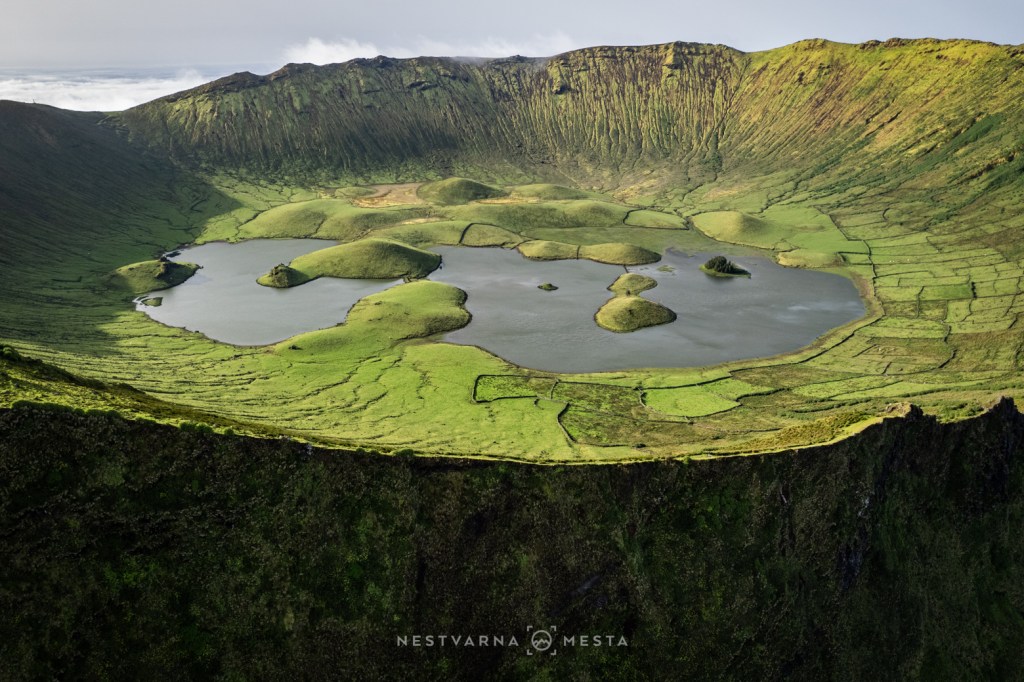
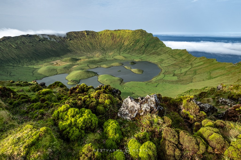
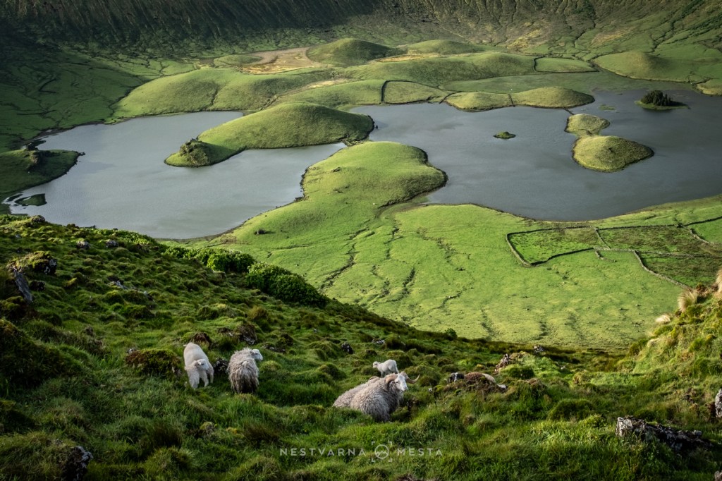
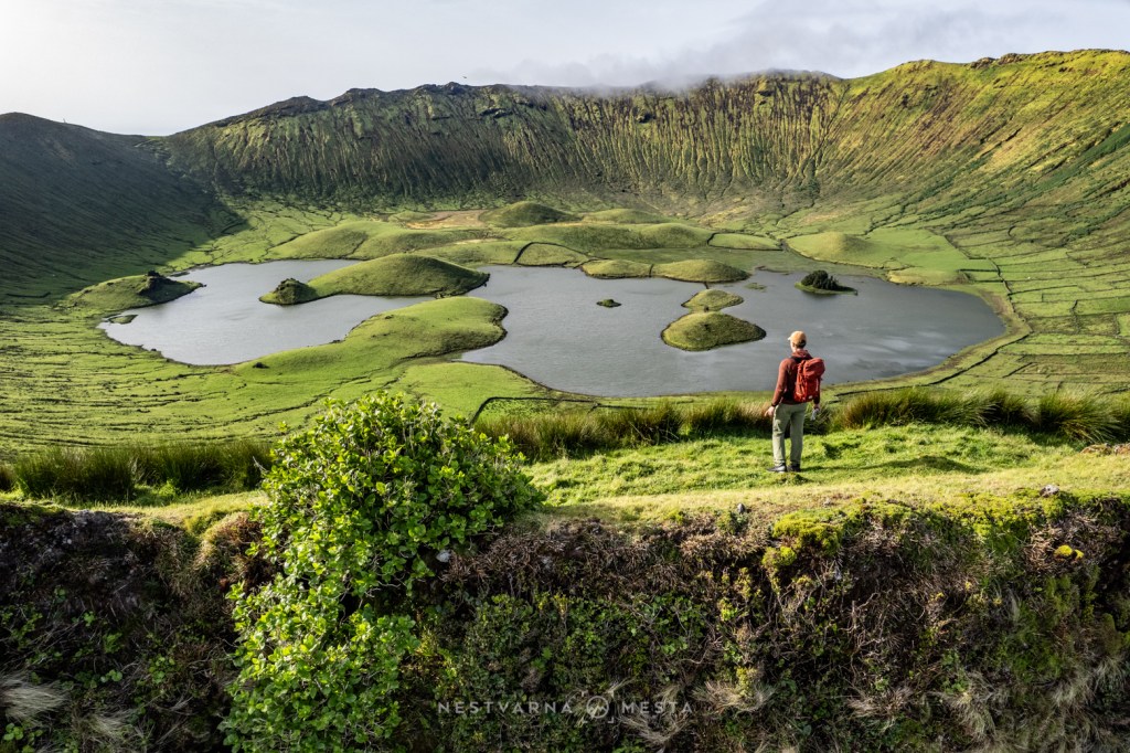
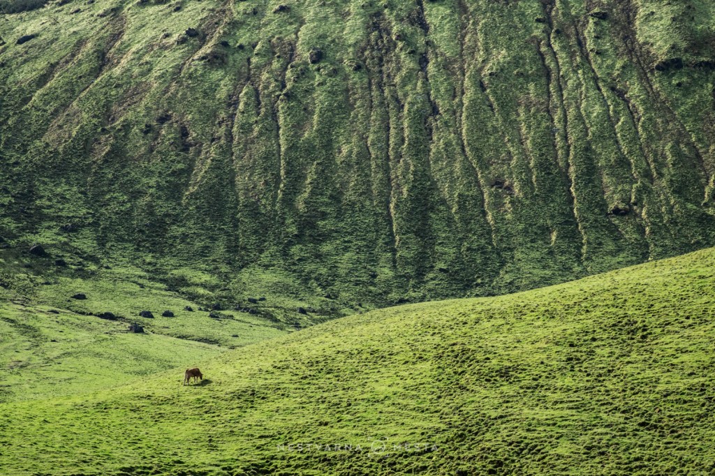
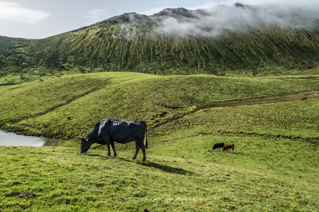
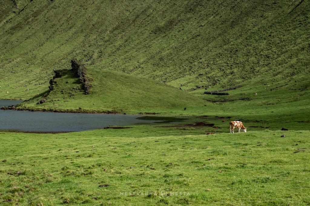
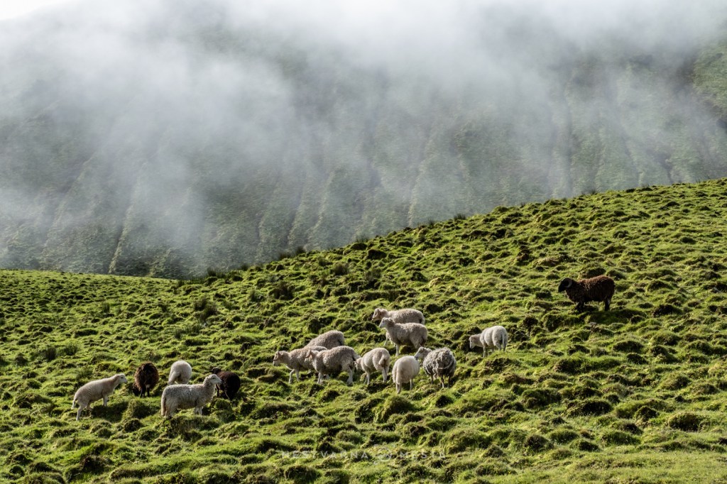
For centuries, Corvo and neighbouring Flores existed on the very edge of the known world. The influence of the Portuguese Crown was barely felt here, and substantial military fortifications were never built. Their isolation made the islands attractive havens for privateers and pirates — corsários—who replenished their supplies of fresh water before lying in wait for merchant ships returning from the Americas.
Far removed from royal protection, local communities often had little choice but to negotiate with these unwelcome visitors. In exchange for food and water, the corsairs usually spared the islanders. There was little to steal from the inhabitants themselves; the true prizes were the treasure-laden merchant ships crossing the Atlantic.
Even today, Corvo remains synonymous with remoteness. Its airstrip was not completed until the 1970s—a remarkably recent chapter in the island’s history.
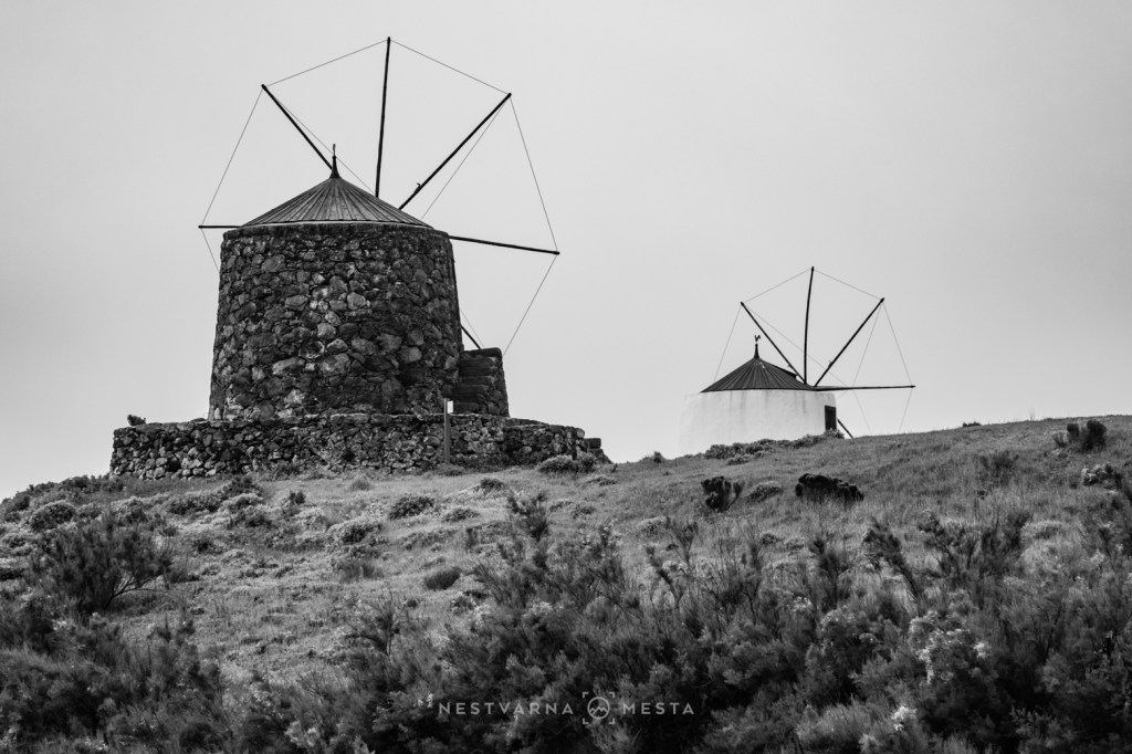
At last, after three unforgettable days and in the company of several new friends from Lisbon, I finally left Corvo — the lonely outpost of the central Atlantic.
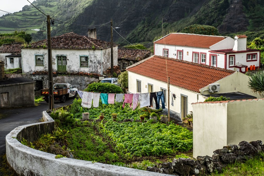
Because my flight had been cancelled the day before, I had already lost the accommodation I had prepaid on Faial. My only concern now was to reach Pico as quickly as possible.
Then came one of those wonderfully unpredictable Azorean moments.
Just before landing, the flight attendant announced that our aircraft would not continue to Faial after all. Instead, because weather conditions there had deteriorated, we would land directly on Pico, where the skies were clear enough for a safe arrival.
The cabin erupted in applause.
For once, the Atlantic had decided to be on our side.
I collected my rental car without delay and set off to make the most of the afternoon. After spending three days imprisoned beneath cloud and mist, every minute of sunshine felt too precious to waste.
Pico – Portugal’s Mountain in the Atlantic.
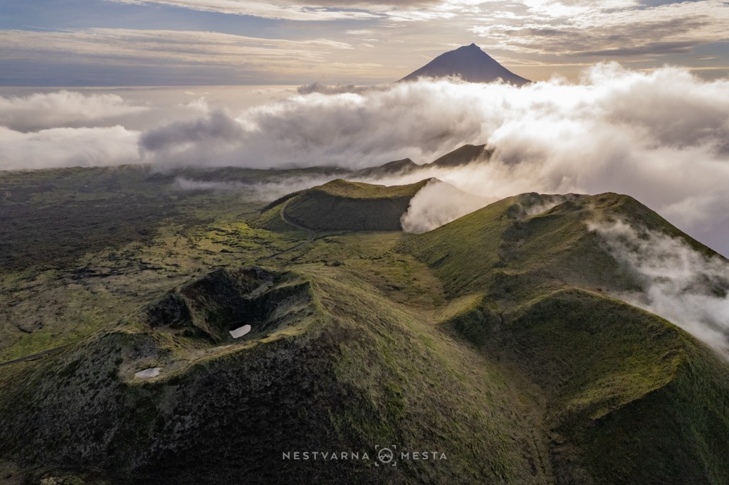
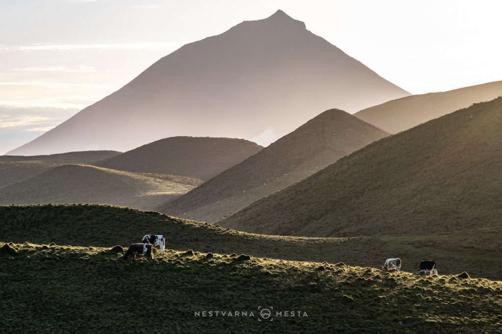
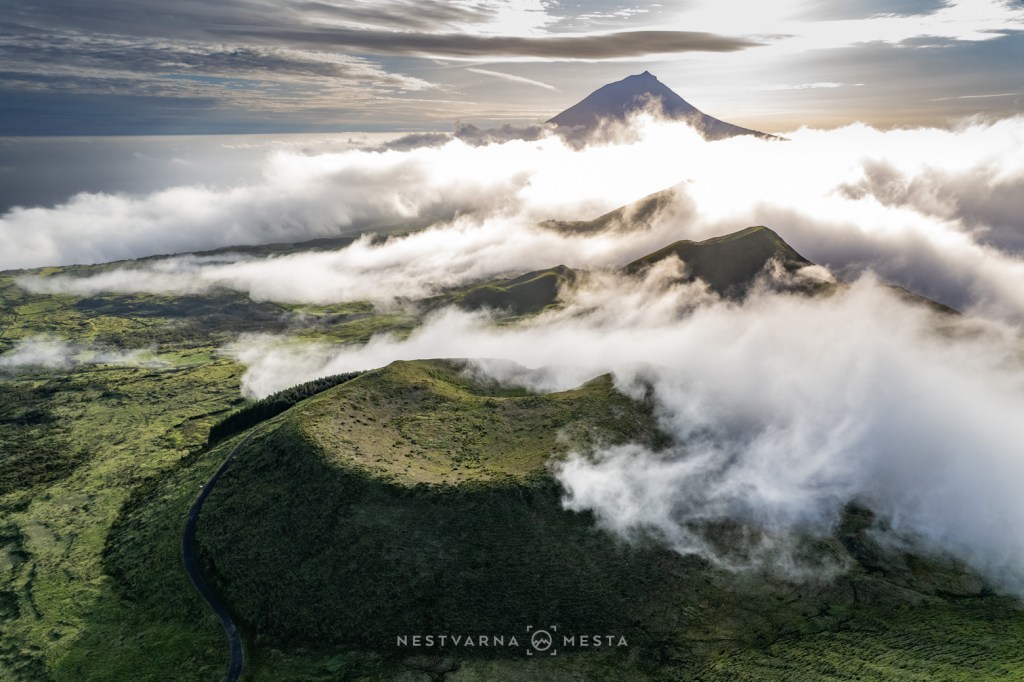
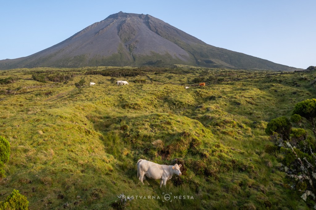
True to its name, Ilha do Pico is defined by a single, overwhelming presence. Rising 2,351 metres above sea level, Montanha do Pico is not only the island’s dominant landmark but also the highest peak in Portugal. Its perfectly shaped volcanic cone commands the horizon and can be seen from the neighbouring islands of Faial and São Jorge on clear days.
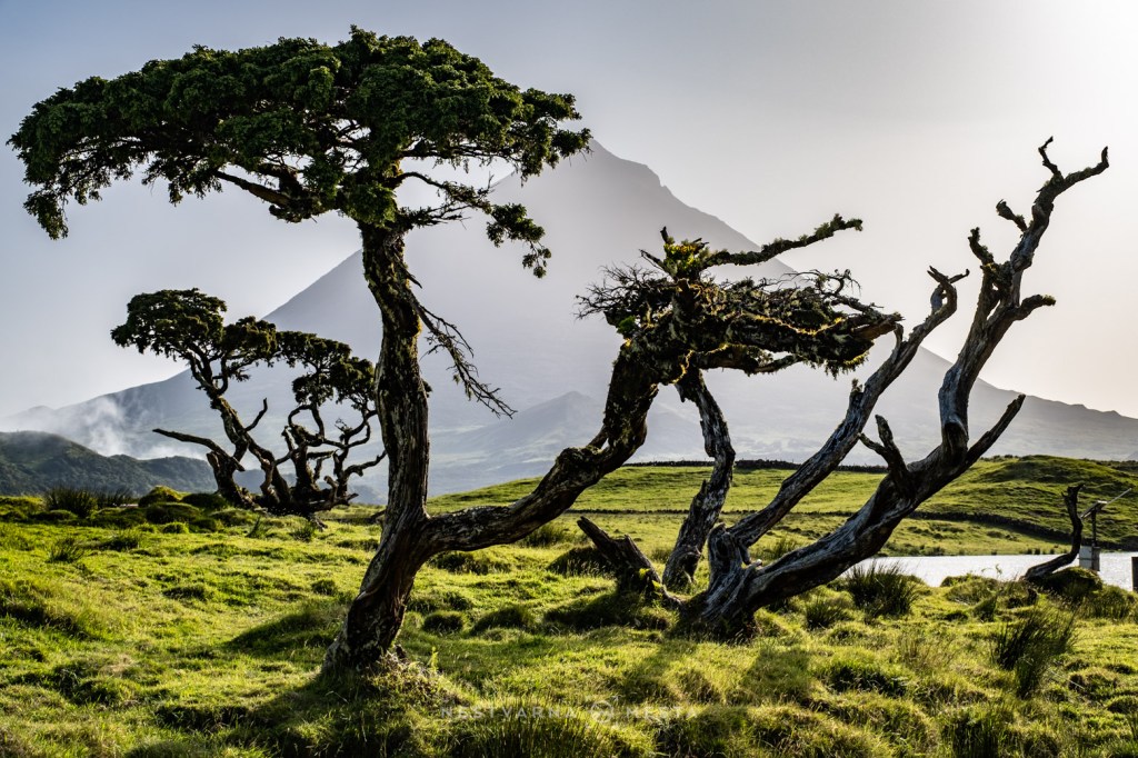
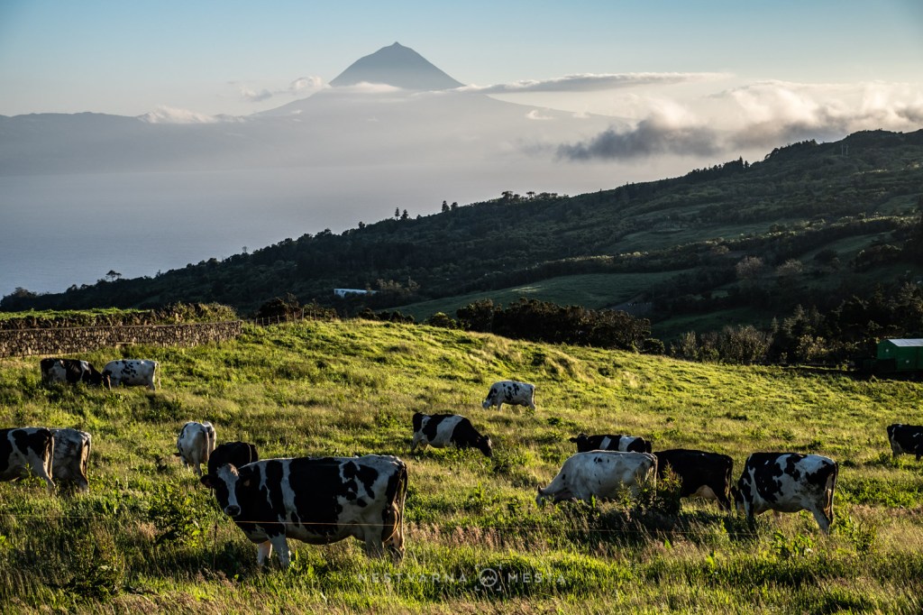
Climbing Pico is no simple undertaking. The mountain is notorious for its rapidly changing weather, while strict regulations govern access to the summit. During my brief stay, I admired the volcano from below, promising myself that one day I would return to stand at its highest point.
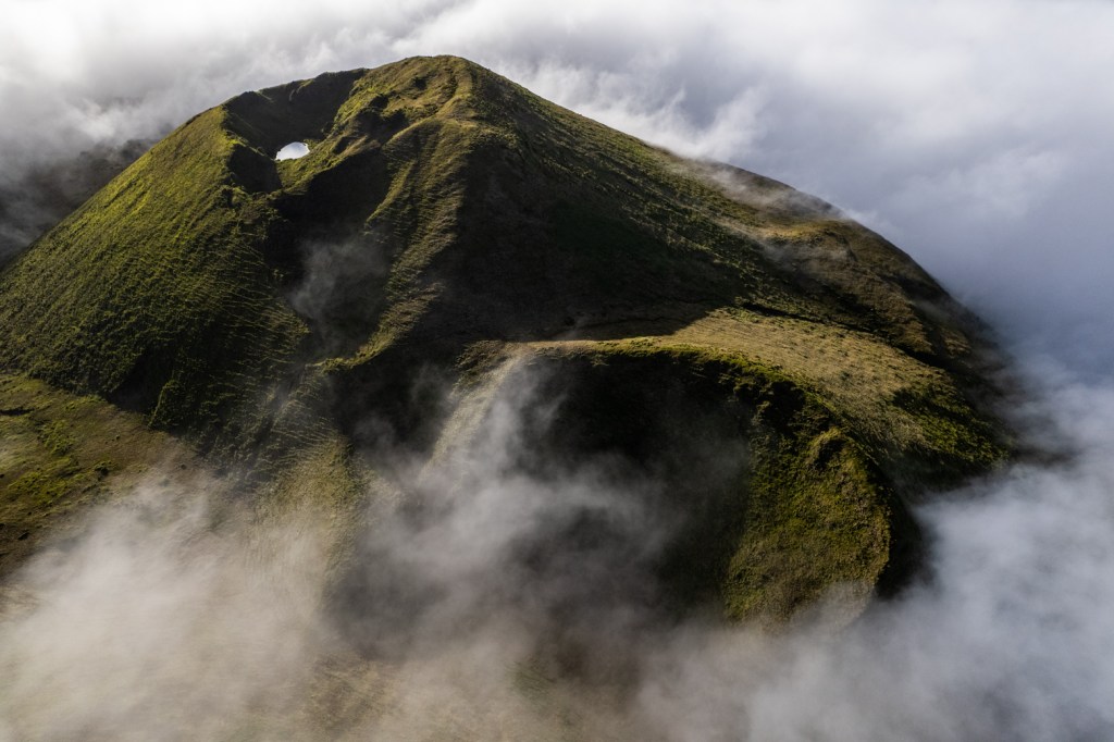
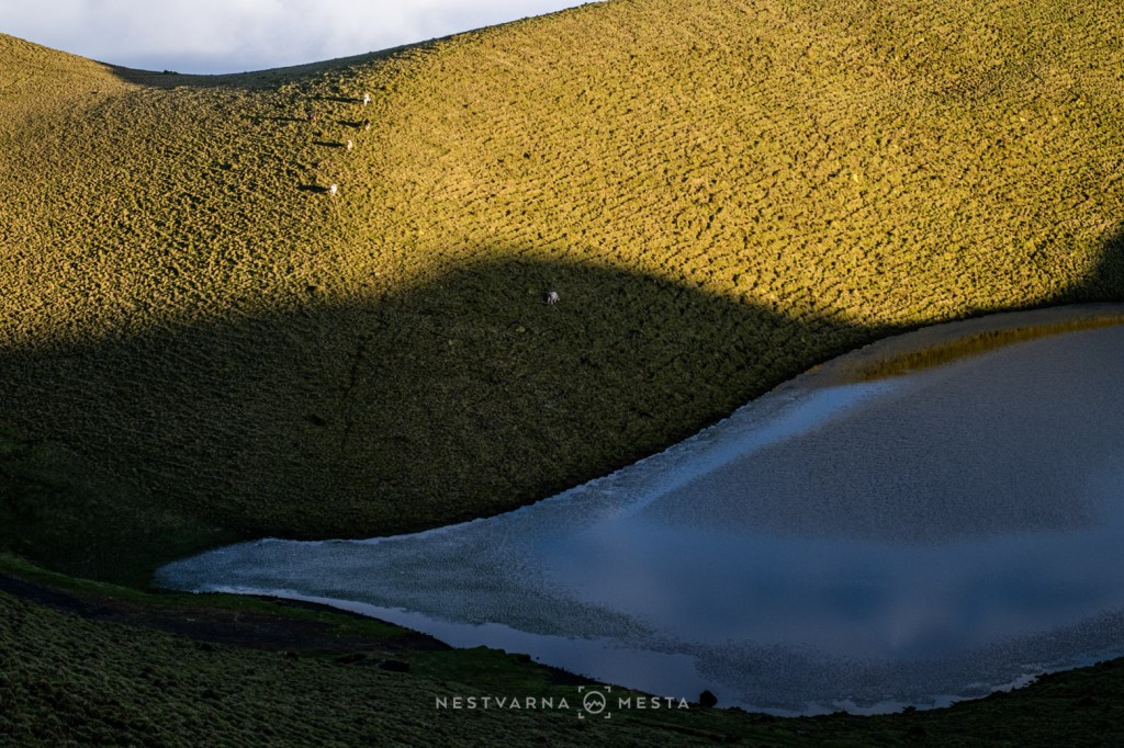
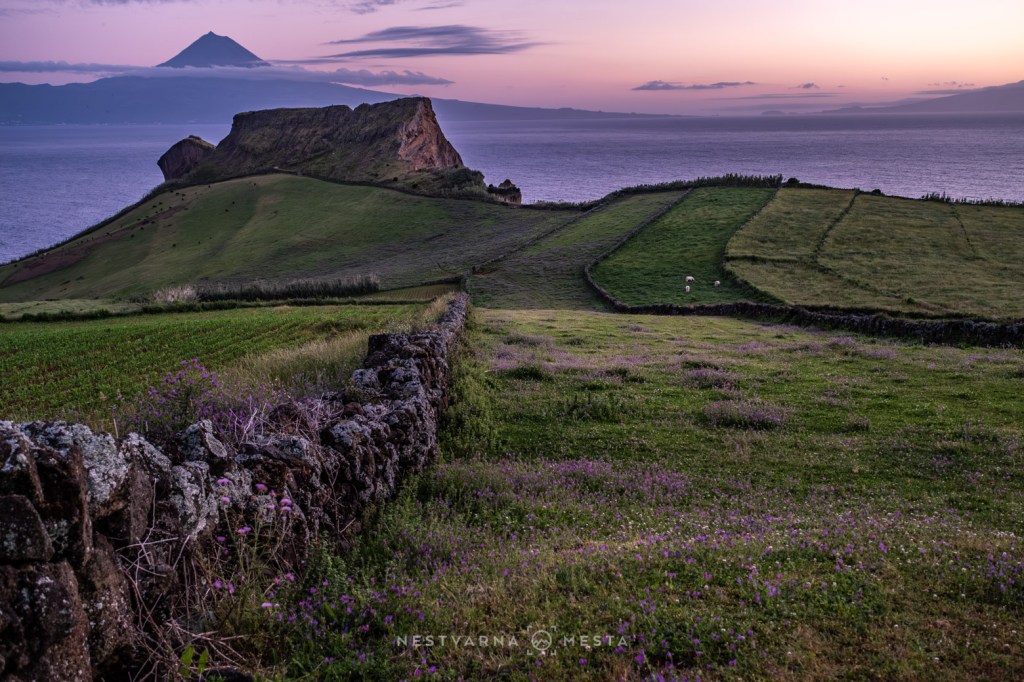
East of the mountain stretches a chain of beautifully preserved volcanic calderas, their ancient craters now filled with tranquil lakes. Below them, the landscape softens into one of the Azores’ most familiar scenes: rolling green pastures enclosed by dozens of low stone walls.
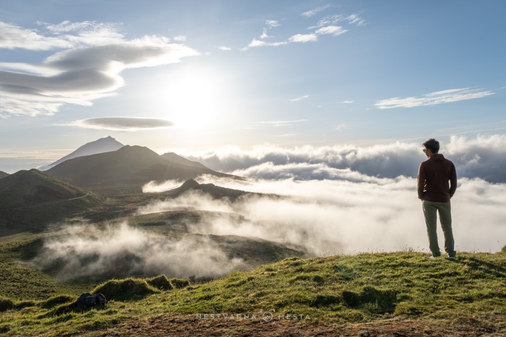
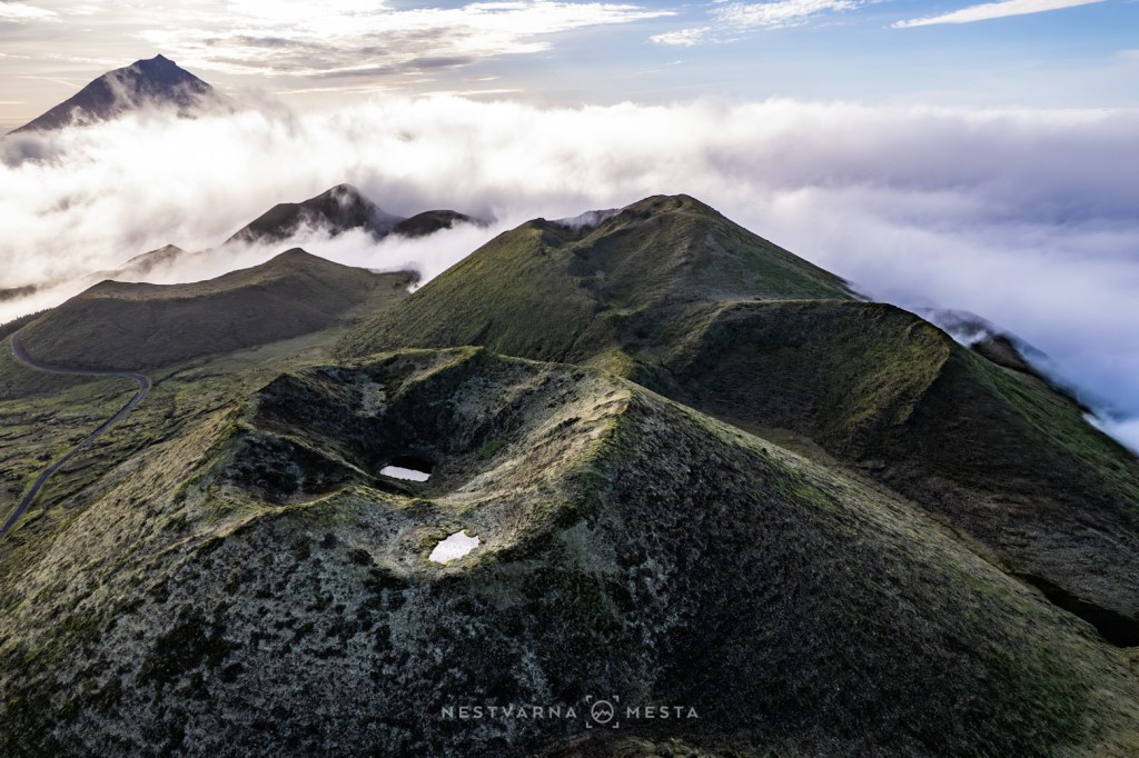
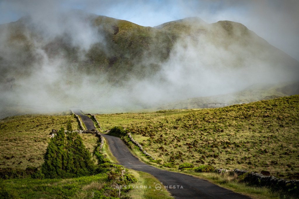
Then, along the western coast, another surprise awaits.
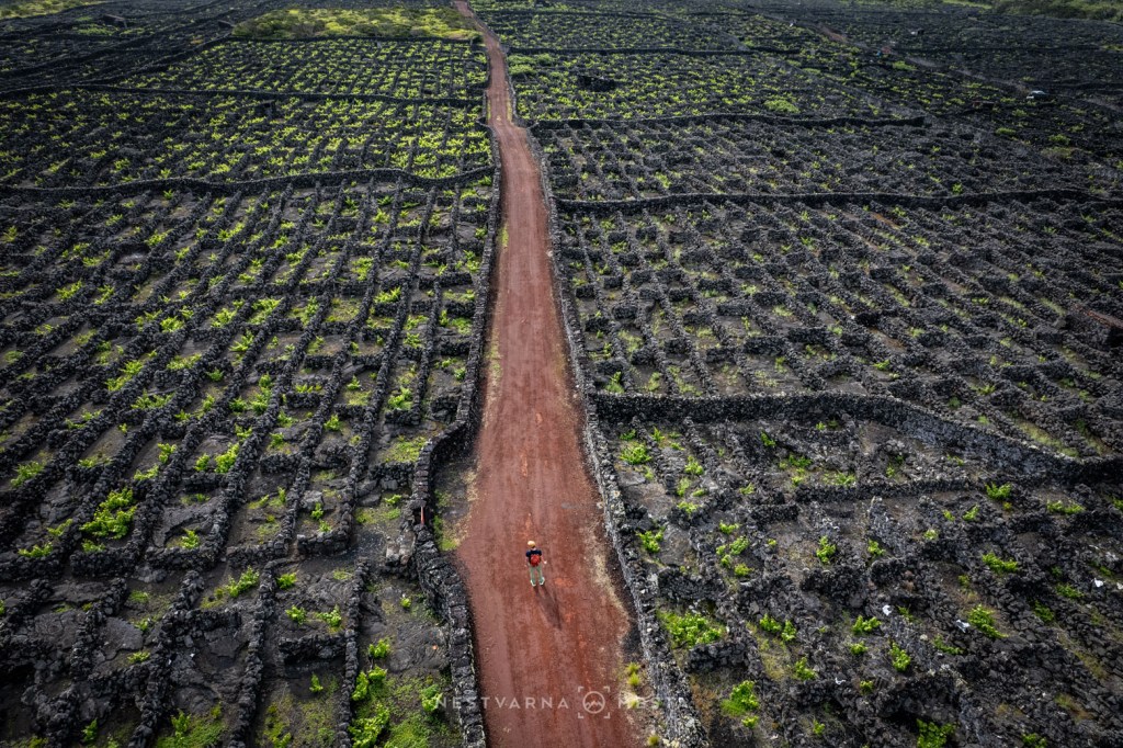
Here, vines grow directly on black volcanic lava.
Known as Vinhas do Pico, these vineyards are the product of centuries of determination and ingenuity. Low walls built from solidified basalt shelter the vines from the relentless Atlantic winds and salt spray, creating one of the world’s most extraordinary wine-growing landscapes. Together with the volcano itself, they have become the defining symbol of Pico.
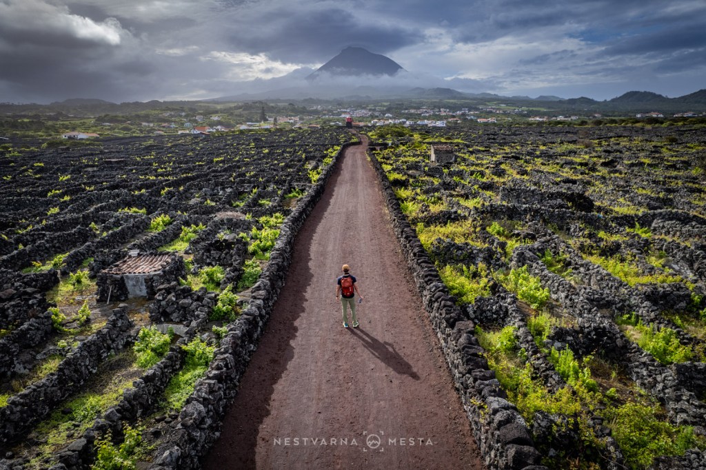
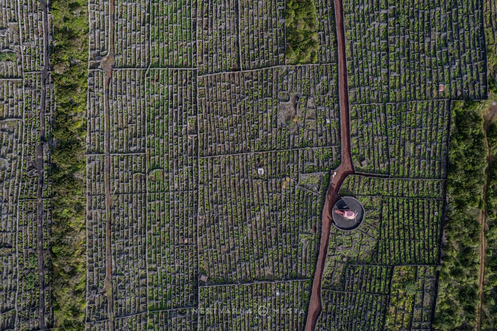
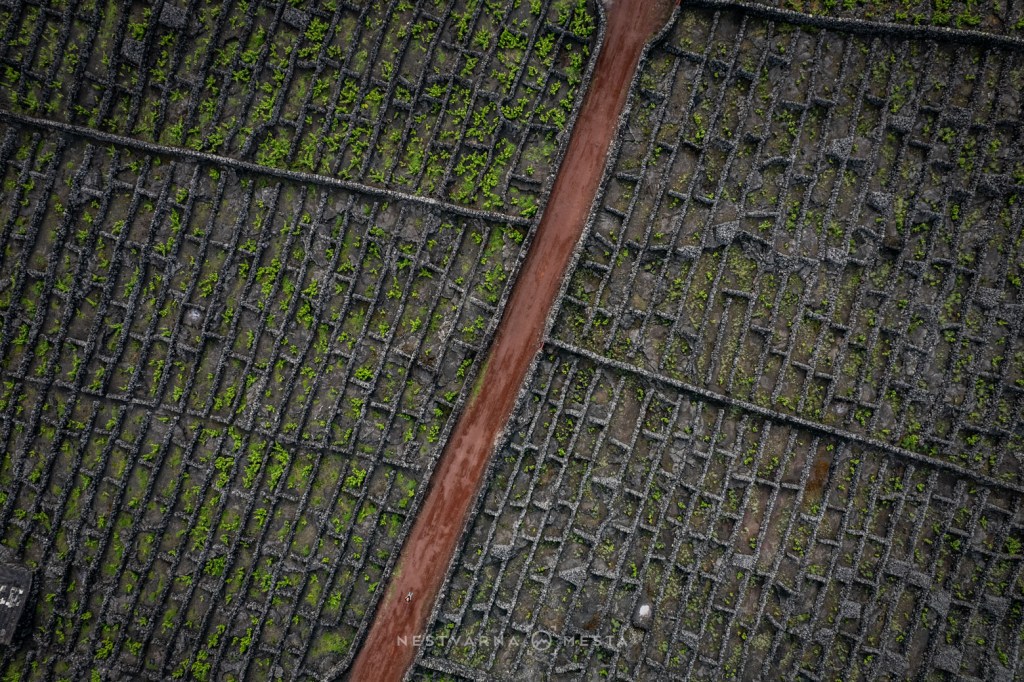
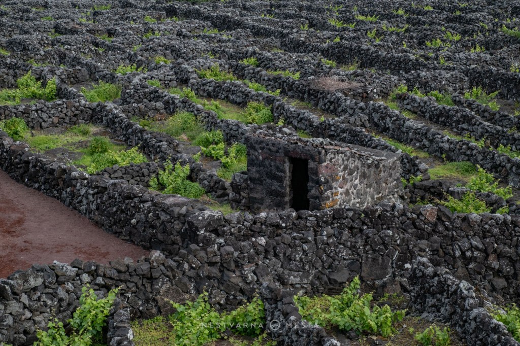
Few islands combine such striking contrasts. Pico is both mountainous and maritime, wild yet welcoming, dramatic yet peaceful. I spent two unforgettable days exploring its landscapes before taking the morning ferry from São Roque to the neighbouring island of São Jorge — the fourth destination on my Azorean journey.
São Jorge – The Island of Fajãs
If Pico belongs to the volcano, São Jorge belongs to the sea.
The island’s spectacular northern coastline is shaped by dozens of fajãs — broad coastal plains lying beneath towering cliffs. These rare landscapes were among the first places settled after the Portuguese reached the Azores.
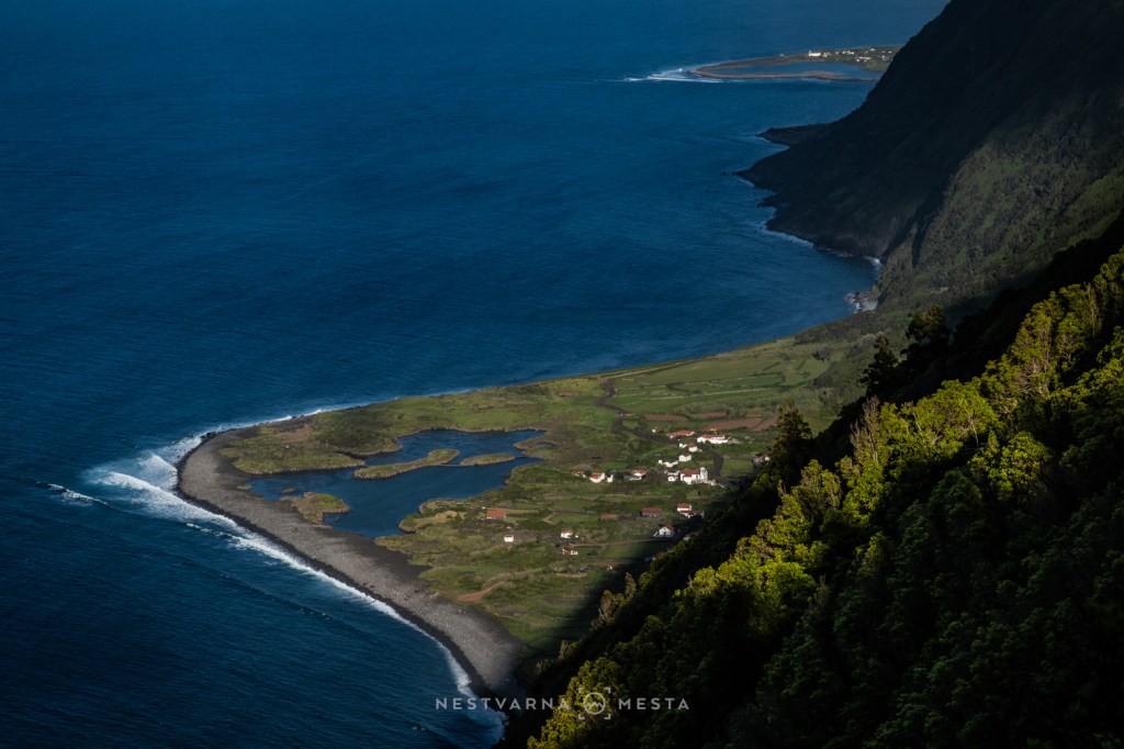
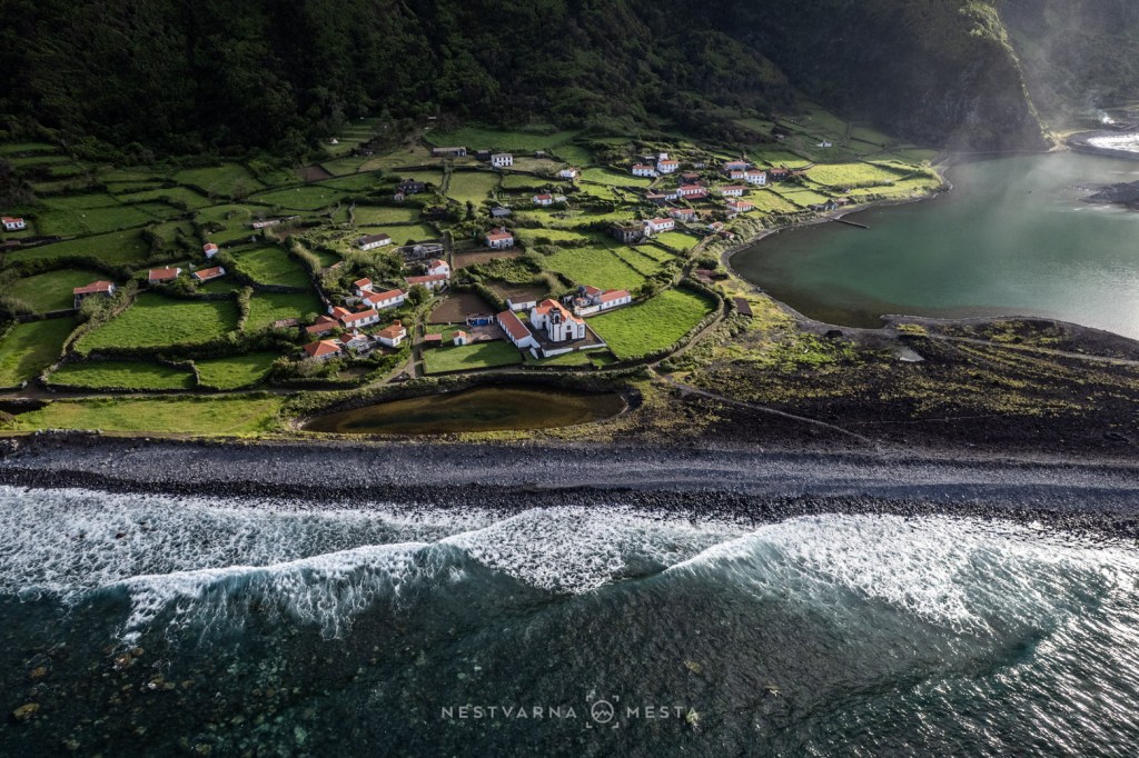
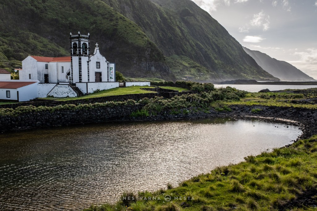
Most are fajãs detríticas, created not by lava but by immense landslides triggered by earthquakes and centuries of erosion. Over time, the ocean sculpted lagoons behind them, producing landscapes unlike anywhere else in Portugal.
Among the most remarkable are Fajã de Além and Fajã da Caldeira de Cristo, isolated hamlets that can still be reached only on foot. Descending towards them along ancient stone paths feels like stepping back in time, recalling the historic mule tracks that once connected remote villages above the Adriatic coast.
The hike from Serra do Topo to Fajã da Caldeira de Cristo, continuing along the coast to Fajã dos Cubres, is widely regarded as one of Portugal’s classic walking routes — and deservedly so.
For decades, Fajã da Caldeira de Cristo gradually disappeared as a permanent settlement. Yet in recent years it has quietly come back to life during the warmer months, attracting hikers, surfers and travellers searching for a slower pace of life.
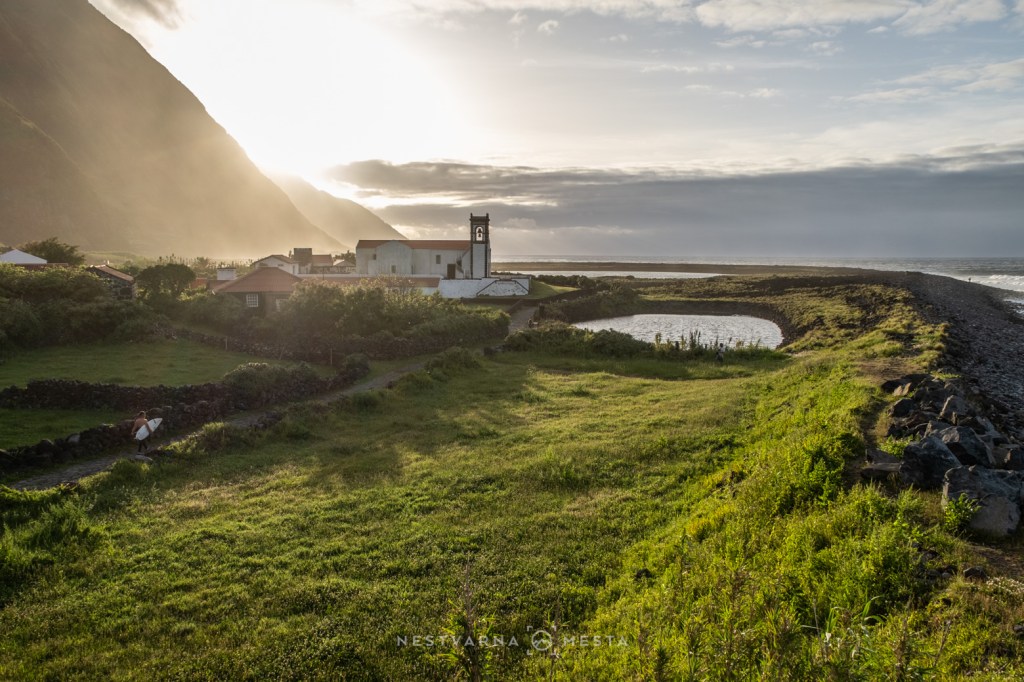
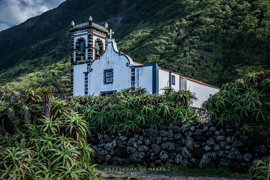
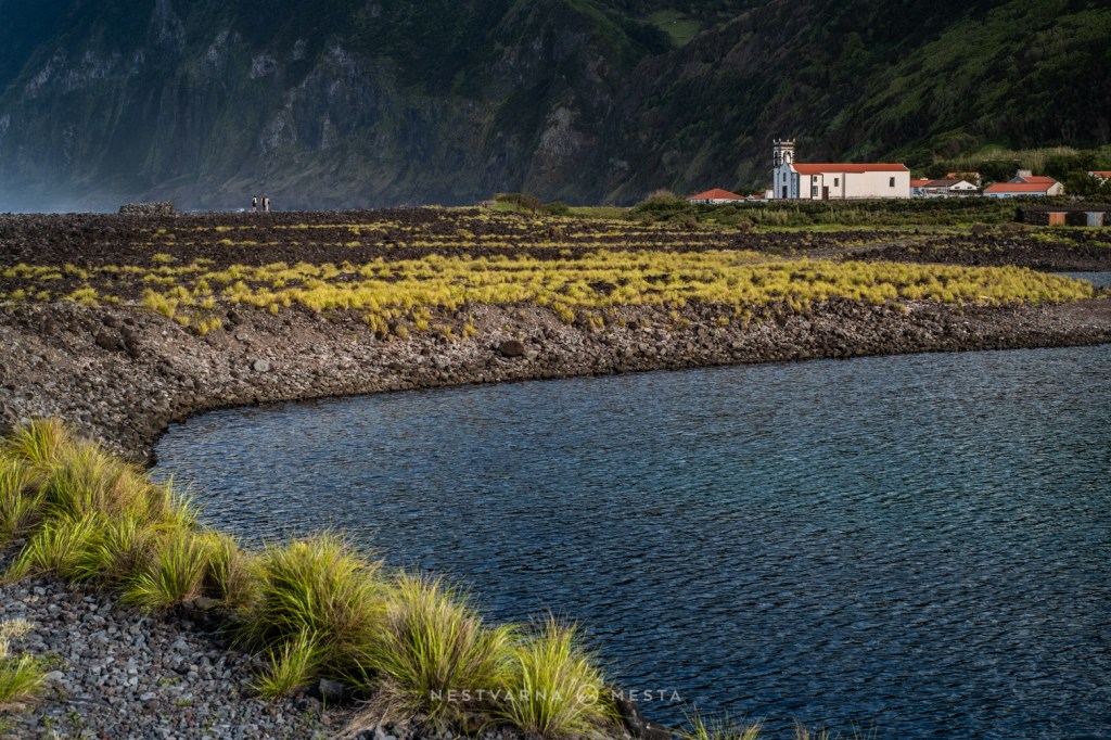
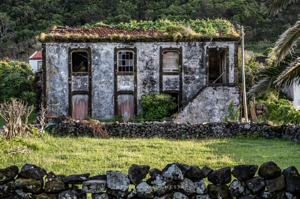
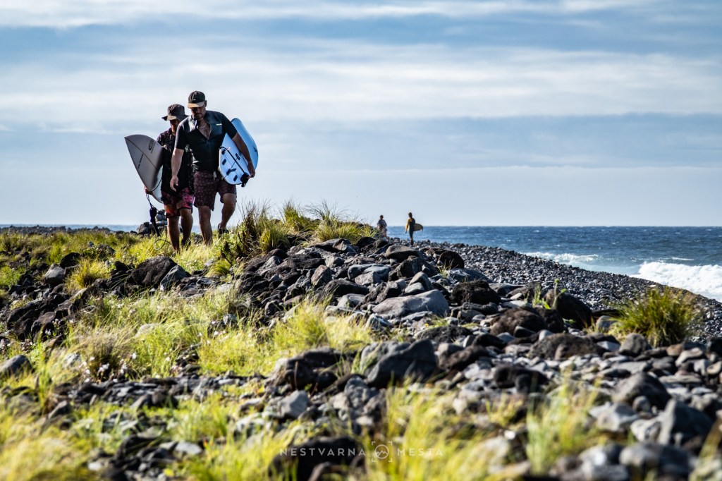
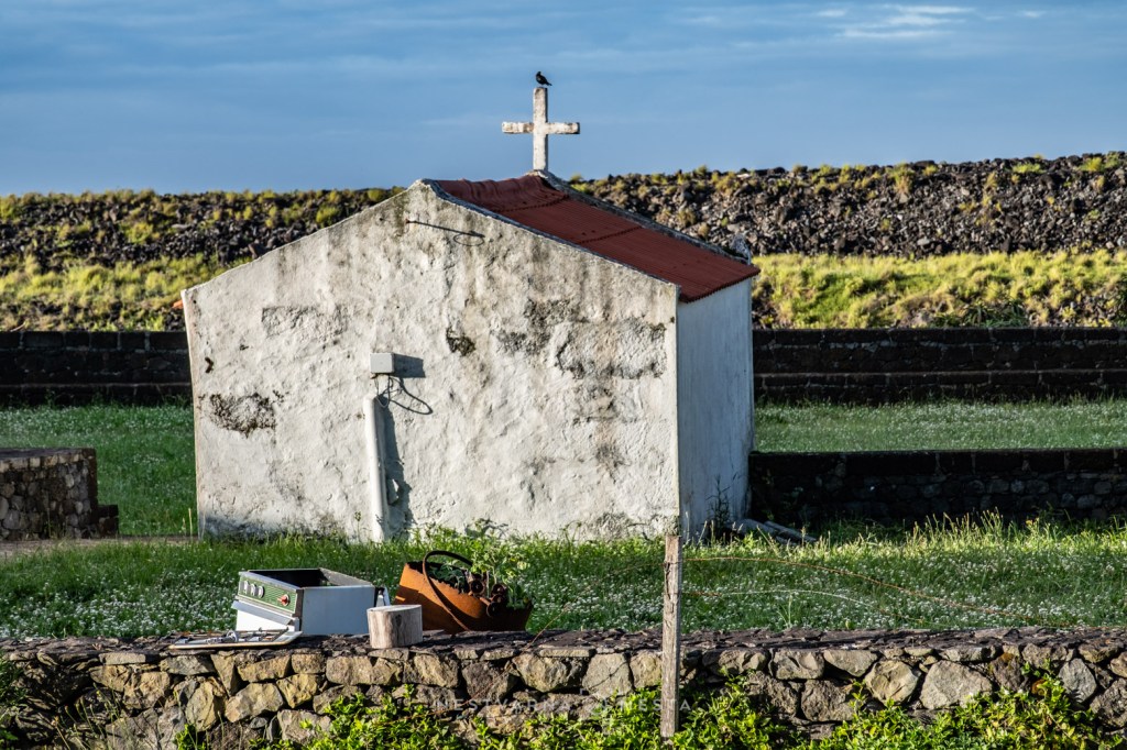
My accommodation overlooked the harbour of Velas on São Jorge’s southern coast, where heavy cloud lingered for most of my stay. Driving across the island’s central plateau meant navigating fog so dense it seemed almost solid.
Then, almost without warning, everything changed.
As I descended towards the northern coast, the clouds vanished, revealing brilliant blue skies and, for the first time since arriving in the Azores, genuine summer warmth.
After hours spent hiking steep volcanic trails, nothing felt more refreshing than plunging into the Atlantic. The natural pools at Fajã do Ouvidor provide one of the safest places to swim on the island, although in early June the water still measured only 18°C.
It was cold enough to take your breath away — but exactly what I needed after a long day on the trail.
Faial – Where Fire Meets the Sea
Faial had the difficult task of being the final island on my twelve-day journey through the Azores.
After Corvo, Flores, Pico and São Jorge, I found myself wondering what Faial could possibly offer that I had not already seen.
The answer lay at Capelinhos.
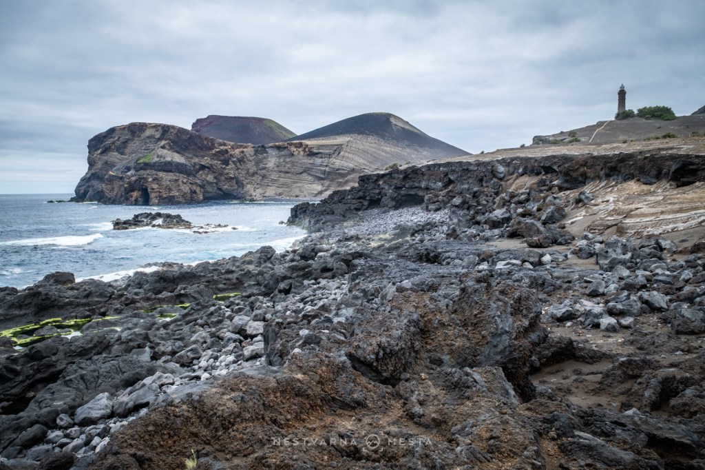
Unlike almost anywhere else in the Azores, this landscape is dry, barren and almost monochrome. Rising directly from the Atlantic shoreline, Capelinhos feels strangely out of place—as though a fragment of Lanzarote had somehow drifted hundreds of kilometres west before coming to rest in the middle of the ocean.
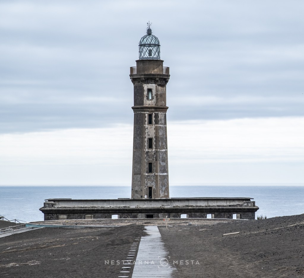
The scene is completed by the island’s abandoned lighthouse, half-buried beneath volcanic ash.
In Portuguese, a lighthouse is called farol, and few symbols capture the spirit of the Azores more completely. Alongside grazing cattle, emerald calderas, dramatic cliffs, fajas, and ancient stone walls, the lighthouse has become part of the archipelago’s identity.
Originally, I had planned to spend two nights on Faial.
Instead, circumstances allowed only a few hours.
My return flight to mainland Portugal was unexpectedly brought forward from the following morning to that very afternoon. Missing it would also have meant missing my connection home to Belgrade.
There was only one option.
I had to leave Faial almost as quickly as I had arrived.
Practical Information
If you are planning to explore the Azores, reserve both your accommodation and rental car at least three months in advance. The ideal season runs from late May until early October, while July and August are by far the busiest months.
Accommodation is often booked on a non-refundable basis, but local car rental companies are generally understanding when flights are delayed or cancelled because of the weather. Whenever possible, it is worth using the same rental company on every island, allowing the security deposit to be transferred from one vehicle to the next and making any necessary reservation changes much easier.
The two largest operators in the Azores are AutAtlantis and Ilha Verde.
Over twelve days I visited five islands, travelled on eight flights, crossed the sea by ferry twice and drove four different rental cars.
The total cost of the journey was approximately €3,000, with most meals prepared independently.
The Azores are certainly not an inexpensive destination.
Out of eight scheduled flights, one was cancelled, another delayed, and a third diverted to a different island.
Here, that is simply part of travelling.
The Atlantic always has the final say.
Journey Overview
Belgrade – Porto – Ponta Delgada – Flores
(Separate tickets booked for the same day. In hindsight, I would strongly recommend spending a night somewhere en route instead.)
Flores – Corvo (flight)
Corvo – Pico (flight diverted from Horta due to weather)
Pico – São Jorge – Horta (Faial) (ferry)
Horta – Ponta Delgada – Lisbon (flight)
Lisbon – Belgrade (flight)
The Journey Continues
This time, I deliberately left São Miguel and Terceira — the Azores’ two largest and most accessible islands— for another visit.
They are easier to reach from mainland Portugal and served by more frequent flights. Inevitably, they also attract many more visitors.
Instead, I chose the islands farther west—the quieter, wilder Azores, scattered deep across the Atlantic.
It was a journey rather than a checklist.
A chance to travel slowly, to accept uncertainty, and to discover places where nature still dictates the rhythm of everyday life.
Looking back, I realise that what stayed with me was not one particular crater, waterfall or mountain.
It was the Atlantic itself.
The wind, waves and the clouds.
And the patience these islands quietly ask of everyone who visits them.
Perhaps that is the true gift of the Azores – the rare opportunity to slow down, surrender your plans to the weather, and remember that, in a world obsessed with schedules and certainty, nature still has the final word.
Nebojša Atanacković, june 2026.

