In Serbian hikers community walking traverse “Divčibare – Ravna Gora – Rajac” over the rolling hills of Maljen and Suvobor belongs to “classics”.
The traverse starts in the holiday settlement Kraljev Sto at the entrance of Divčibare. One-way trail goes all the way to Rajac and is 27km long. It can be however partially accomplished on Ravna Gora (14km) and it also works out pretty well as an out-and-back hike to Mali Rior (17km in total).
There is a gravel road at the north end of the settlement that swings to the east. Passing across Vlasovi (1003m), Čiker (872m), and just below the soft summit of Veliki Maljen (970m) the gravel road reaches Rior.
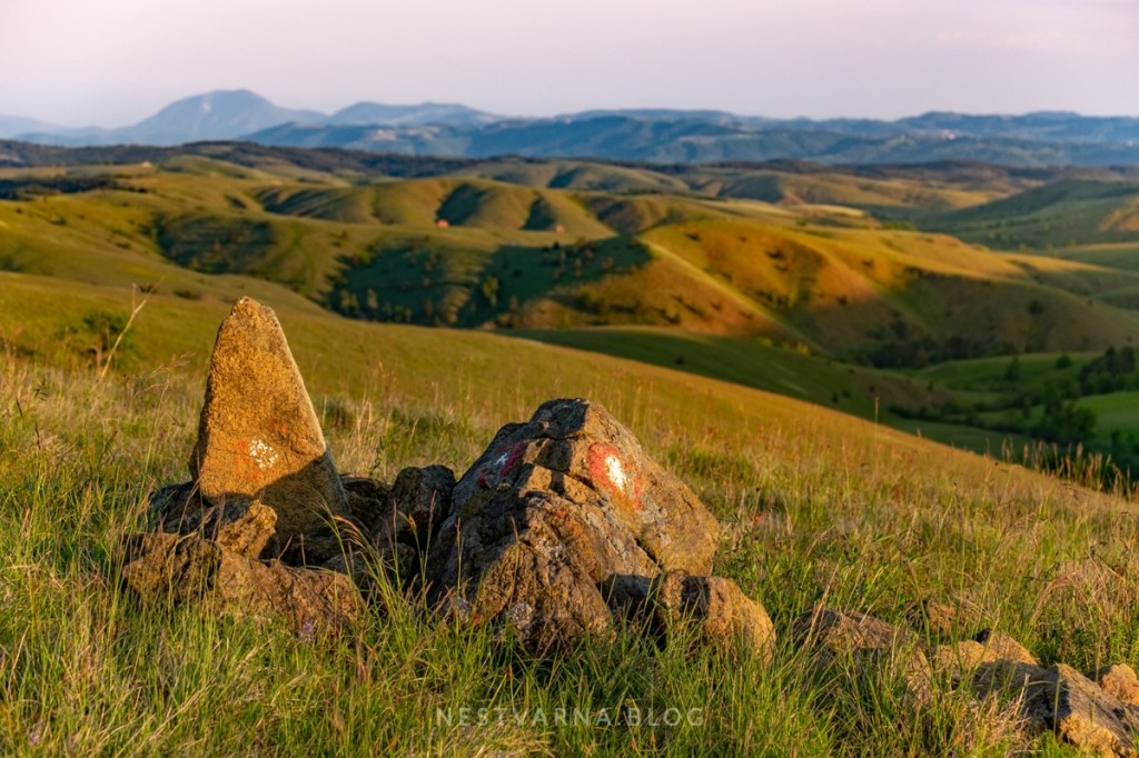
Experienced hikers with navigation skills can avoid big portion of the road by shortening through terrain of pastures and scarce woods (gpx track is included below).
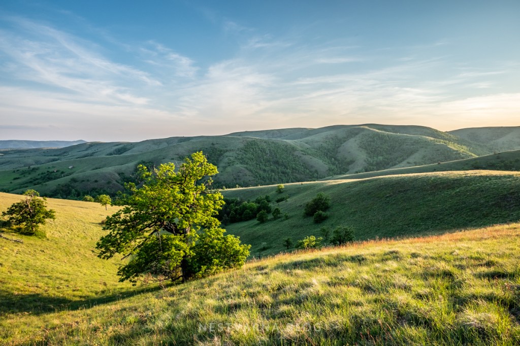
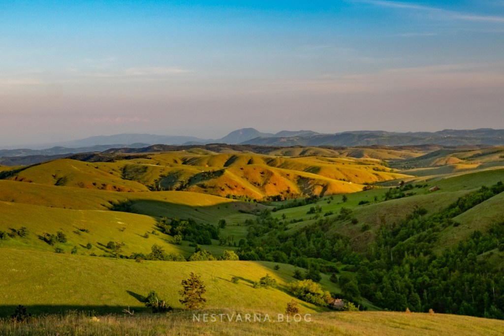
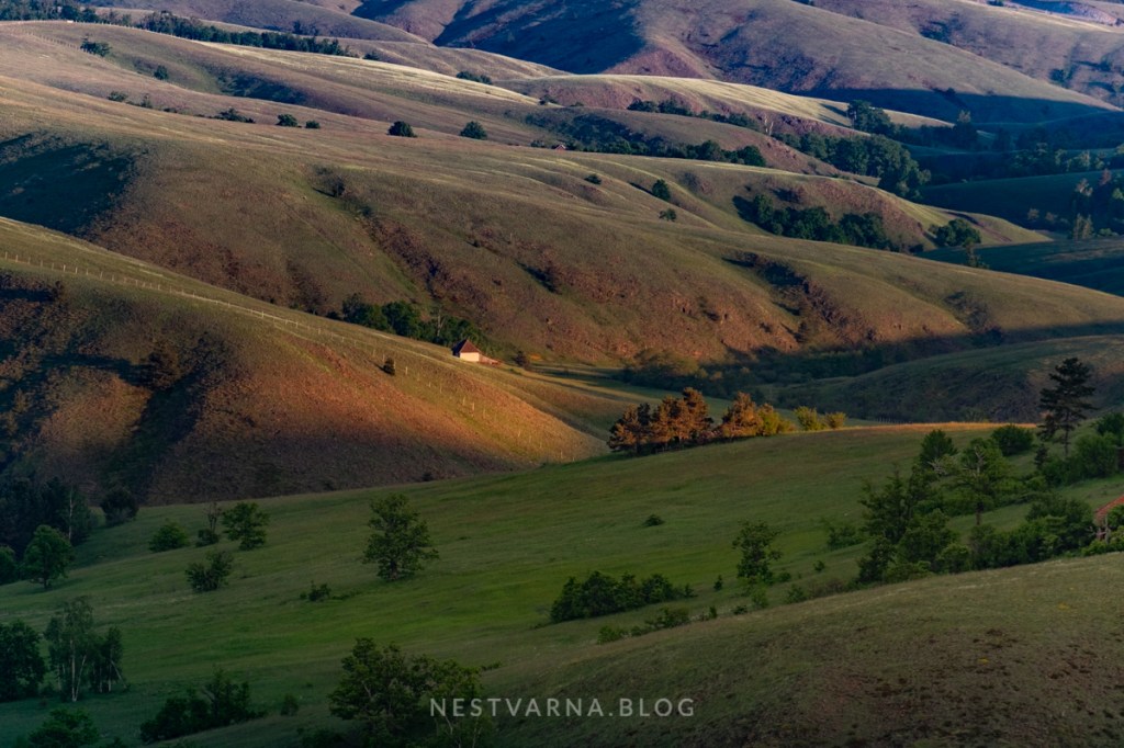
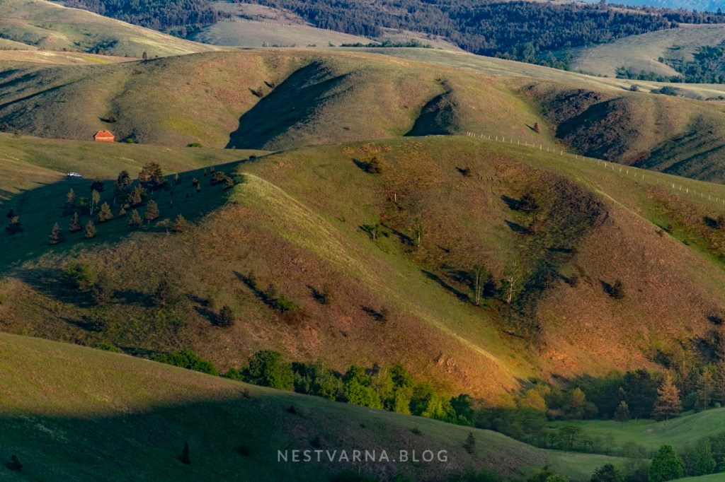
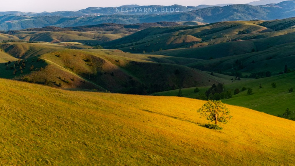
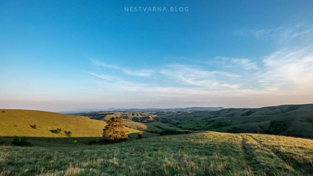
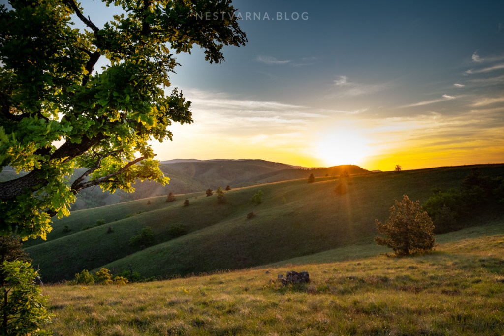
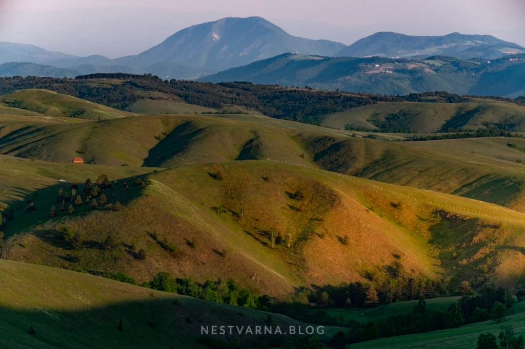
From Rior onwards to Mali Rior (721m) starts the most attractive part of the trail. “The soft hills symphony” is how I call the amazing views over picturesque rolling pastures to the south, with mountain Kablar acting as a guard on horizont.

Grassy road follows the ridge of Rior and Mali Rior before it finally descends to the river of Grab – the frontier between Maljen and Suvobor. After a short gentle ascent road finally reaches Ravna Gora. There is a chapel and (much disputed) Memorial to Serbian royalist movement during WWII on top. From here, asphalt roads lead both to Mionica and Čačak.
Divčibare – Ravna gora one-way is predominantly downhill with only 400m elevation gain in 14km. Starting point is the highest point of the trail at the same time (1040m).
If you depart from Kraljev sto around 9 o’clock, expecting arrival time on Ravna gora is around 15h.
Walking from point A to point B on an independent basis might be tricky with transport logistics. Turning around at Mali Rior (capturing the most attractive part of the traverse) and returning to the starting point is a good alternative. In this case total distance is around 17km with 600m elevation gain.

The route described here is easy for walking. It follows gravel roads most of the time and it is suitable for mountain biking too. There are however plenty of intersections, some without signposts. It is therefore mandatory to be accompanied by a guide, either in human form or in a form a GPS device (trustworthy tracks are attached to this article).
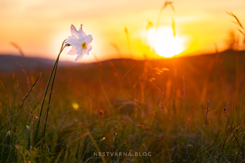
Best period for visit is end of May – when the spring is in full swing and daffodils start to blossom!
It is truly a great photogenic spot, a rare oasis of untouched nature yet relatively close to the capital of Serbia. Very few signs of human activity are visible here, and some of them date one century ago, when the famous Battle of Kolubara in WWI was fought on these hills – and one of the most glorious pages of recent Serbia history was written.
Is this the best trekking experience in the vicinity of Belgrade? Arguably, yes: Maljen is a strong competitor to Zagajička brda in south Banat in the category “Where to go out of town in just couple of hours”. Divčibare is the closest point to Belgrade reaching 1000m altitude.

Flickr:
https://www.flickr.com/gp/jazzm8/o3g17A
Wikiloc:
Kraljev Sto (Divčibare) – Rior and back (16km 600m elevation gain)
Divčibare – Ravna Gora traverse (14km 400m elevation gain)
First track is out-and-back and it does not follow the gravel road in the first part, it shortens through terrain (only for experienced hikers). Second track (traverse) follows the gravel roads all the time. Tracks do not have the very same starting point.
Thanks to Goran Stamenković, inofficial ambassador of the “Triplex confinium of Požega, Valjevo and Mionica” for being my guide on this adventure!
